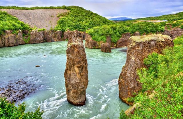
Iceland's best places range from the Golden Circle and South Coast waterfalls to remote Westfjords cliffs and highland hot springs. This guide lists 103 of them by region, with the practical detail you need: distance from Reykjavík, cost, and how long to allow. Every entry links to a full place guide.

How to use this list
Iceland's main sights are spread over a large island, so the list is grouped by region and follows the order you would drive. Each entry gives the basics, and the link goes to a full guide with directions, fees and opening times.
Distances are from Reykjavík unless stated. Many places now charge for parking, usually around ISK 1,000 through the Parka app or at a pay station, so keep a card handy. Check road.is for road conditions and vedur.is for the weather before every drive.
South Iceland and the South Coast
The South Coast is the busiest stretch of the Ring Road and the easiest to reach from Reykjavík. Waterfalls, black sand, glaciers and lagoons are all within a day or two of driving.
- 1. Seljalandsfoss: A 60 m waterfall with a path behind the falling water, about 120 km (1 hour 40 minutes) from Reykjavík. Parking costs around ISK 1,000.
- 2. Gljúfrabúi: A 40 m waterfall tucked inside a narrow, moss-covered canyon, a short walk from Seljalandsfoss and sharing its car park. Allow 20–30 minutes.
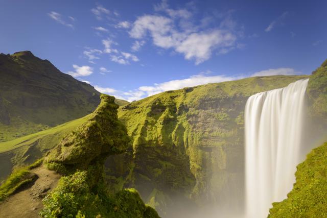
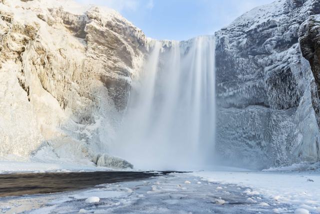
- 3. Skógafoss: A 60 m waterfall beside the village of Skógar, about 150 km (2 hours) from Reykjavík. A 527-step staircase leads to a viewpoint at the top, and parking costs around ISK 1,000.
- 4. Kvernufoss: A 40 m waterfall a short walk from the Skógar Museum car park, and one of the few in Iceland where you can walk behind the water.
- 5. Seljavallalaug: A geothermal pool built into a hillside in 1923, reached by a 20-minute walk. It is free to use, with no lifeguard or regular cleaning, so bathe at your own risk.
- 6. Sólheimajökull: An outlet glacier of Mýrdalsjökull, about 174 km (2 hours 40 minutes) from Reykjavík. The walk to the viewpoint takes 20–30 minutes, and walking on the ice needs a guide.
- 7. Sólheimasandur plane wreck: The rusted hull of a US Navy DC-3 that made an emergency landing on the black sand in 1973. The walk is about 4 km each way across flat, exposed ground, and there is a parking fee.
- 8. Dyrhólaey: A 120 m former island about 5 km west of Vík, with wide coastal views and puffins in summer. The upper viewpoint closes during the nesting season, and access changes with the weather.
- 9. Reynisfjara: A black sand beach with basalt columns and sea stacks, about 180 km from Reykjavík. It is also one of the most dangerous beaches in Iceland because of sudden, powerful waves. Stay well back and check conditions on safetravel.is before you go.
- 10. Vík í Mýrdal: Iceland's southernmost village, with around 750 residents, a black sand beach, a hilltop church, shops and fuel. It is a good overnight stop on a South Coast trip.
- 11. Fjaðrárgljúfur: A winding canyon up to about 100 m deep and 2 km long, about 230 km (3.5 hours) from Reykjavík. Walk the rim trail for 45–90 minutes and follow any closure signs.
- 12. Foss á Síðu: A slim waterfall about 30 m high, dropping over a basalt cliff beside a farm on the Ring Road. A 10–15 minute stop.
- 13. Dverghamrar: Two small cliffs of hexagonal basalt columns beside the Ring Road, protected as a natural monument. Free, with a place to park.
- 14. Stjórnarfoss: A small, wide waterfall near Geirland farm, a few minutes outside Kirkjubæjarklaustur. Fifteen to twenty minutes is enough.
- 15. Fossálar: A small waterfall tumbling over lava cliffs in the Eldhraun lava field, right beside the Ring Road.
- 16. Lómagnúpur: A sheer, freestanding cliff about 688 m high, rising out of the black sands of Skeiðarársandur. It is right on the Ring Road, so most people stop for 10–15 minutes.
- 17. Skaftafell: A hiking area within Vatnajökull National Park, about 330 km from Reykjavík. Entry is free, parking at the visitor centre is charged, and the main trail leads to Svartifoss.
- 18. Svartifoss: A 20 m waterfall framed by dark hexagonal basalt columns. The trail from the Skaftafell visitor centre is about 1.5 km each way and takes 1.5–2 hours there and back.
- 19. Svínafellsjökull: An outlet glacier of Vatnajökull close to Skaftafell. You can view it from the car park and a short path, and walking on the ice is only safe with a guide.
- 20. Hofskirkja: A small turf church built in 1883–84 and often called the last turf church built in Iceland. It stands by the Ring Road. You can walk around it, but the inside is normally closed.
- 21. Fjallsárlón: A glacier lagoon fed by Fjallsjökull, an outlet glacier of Vatnajökull, about 380 km from Reykjavík. Allow 45–90 minutes, longer with a boat tour.
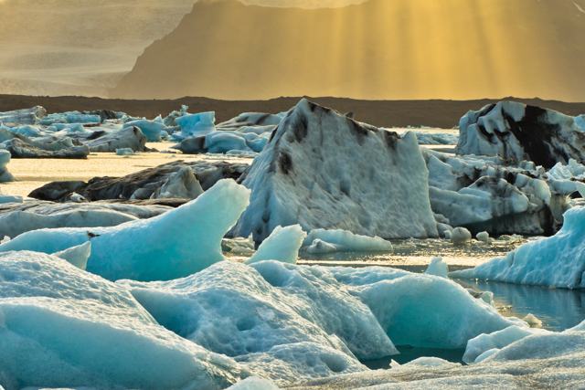
- 22. Jökulsárlón: Icebergs calve from the Breiðamerkurjökull glacier and drift across this lagoon towards the sea. Parking is around ISK 1,110 and also covers Diamond Beach. Allow 1–2 hours.
- 23. Diamond Beach: A black sand beach directly opposite Jökulsárlón, where pieces of ice wash up on the shore. Free to visit, and a 30–45 minute stop.
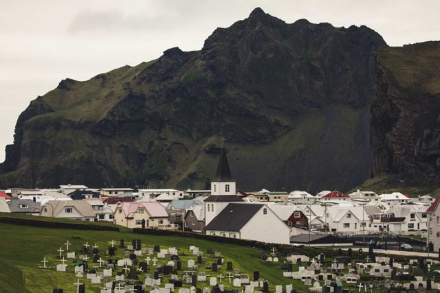
- 24. Westman Islands: A group of volcanic islands off the south coast, reached by a short ferry from Landeyjahöfn or a flight. Come for the town, the 1973 eruption sites and the puffins, and allow at least half a day.
- 25. Reykjadalur: A geothermal river above Hveragerði, reached on a hike of about 3 km each way. Allow 2.5–3.5 hours in total, and parking is paid.
Golden Circle
The Golden Circle is a loop of about 300 km from Reykjavík and works as a day trip. Þingvellir, Geysir and Gullfoss are the three main stops, and there are several good extras nearby. See our extended Golden Circle guide for a fuller route. To see it at your own pace without driving, our Golden Circle private tour from Reykjavík covers Þingvellir, Geysir and Gullfoss with a local guide.
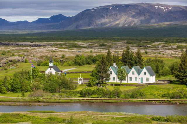
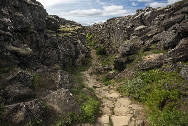
- 26. Þingvellir National Park: A rift valley where the North American and Eurasian plates pull apart, and the site of Iceland's first parliament, founded in 930. It is about 50 km (45 minutes) from Reykjavík and free to enter. Allow 1.5–2 hours.
- 27. Silfra: A water-filled fissure in Þingvellir where you can snorkel or dive between the plates. It needs a booked tour with an entry fee, and a snorkel takes 1–1.5 hours including preparation.
- 28. Öxarárfoss: A 13 m waterfall dropping into the Almannagjá gorge, reached by a short, easy walk from the main car park.
- 29. Geysir: Strokkur erupts every 5–10 minutes, and the original Great Geysir gave its name to geysers worldwide. Entry is free and parking is around ISK 1,000.
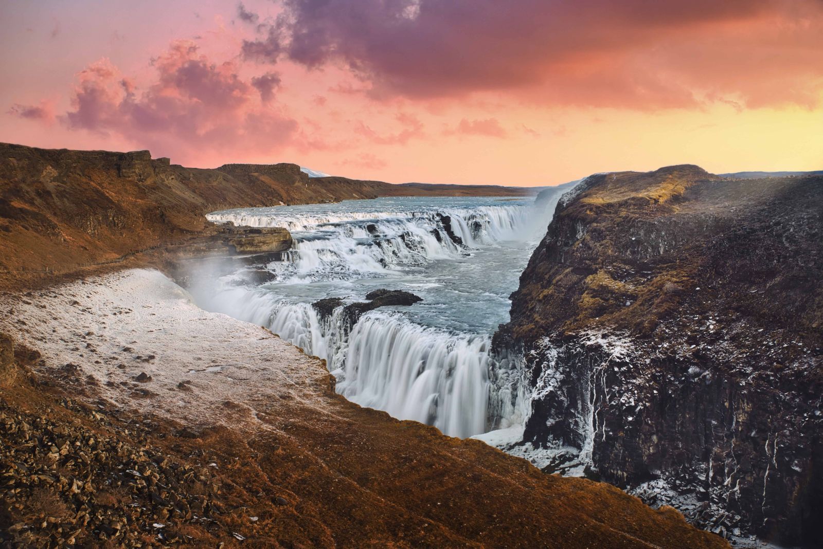
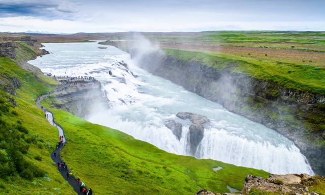
- 30. Gullfoss: A 32 m two-step waterfall on the Hvítá river, about 120 km (1 hour 45 minutes) from Reykjavík. Entry is free and parking is ISK 1,080.
- 31. Faxi: A wide waterfall on the Tungufljót river near Skálholt, with paid parking. A quick 15–20 minute stop.
- 32. Kerið: A volcanic crater about 170 m wide and 55 m deep, with a blue-green lake and reddish walls. There is an entry fee, currently around ISK 700 per adult.
- 33. The Secret Lagoon: A natural geothermal pool at Flúðir, also called Gamla Laugin, meaning the old pool. It costs around ISK 4,500 for adults and is open all year.
- 34. Hrunalaug: Three small stone-lined pools on private farmland near Flúðir. There is an entry fee and each group gets 90 minutes. It can be busy in summer.
- 35. Friðheimar: A family-run tomato farm where you eat lunch inside a working greenhouse heated with geothermal energy. Book ahead.
- 36. Brúarfoss: Often called Iceland's bluest waterfall, on the Brúará river near Laugarvatn. Reach it on a short paid-parking trail or a longer free hike.
East Iceland
East Iceland is a long drive from Reykjavík, so most visitors reach it on a Ring Road trip. The reward is quiet fjords, mountain passes and waterfalls with few crowds.
- 37. Seyðisfjörður: A town of about 700 people at the end of a steep-sided fjord, with wooden buildings from the late 1800s. It is 27 km from Egilsstaðir over the Fjarðarheiði pass and is Iceland's only port for the ferry to the Faroe Islands and Denmark.
- 38. Egilsstaðir: The largest town in East Iceland, on the Lagarfljót river, with fuel, shops, a hospital and a small domestic airport. It is a practical base for a night or two.
- 39. Hengifoss: A 128 m waterfall above Lagarfljót lake. The hike is about 2.5 km each way and takes most people 2–3 hours round trip.
- 40. Litlanesfoss: A waterfall of roughly 30 m in a bowl of tall basalt columns, about 1.5 km up the trail to Hengifoss.
- 41. Stuðlagil Canyon: A canyon of basalt columns and a bright turquoise river in Jökuldalur, about 52 km from Egilsstaðir. The walk to the best viewpoint takes about 45 minutes each way. See our east side vs west side guide.
- 42. Rjúkandi: A two-step waterfall in Jökuldalur, visible from the Ring Road between Egilsstaðir and Mývatn. A 10–20 minute stop.
- 43. Borgarfjörður eystri: A small fishing village on a remote fjord about 70 km from Egilsstaðir, and a base for hiking and puffin watching.
- 44. Fólaldafoss: A waterfall beside the Öxi mountain road (Route 939) above Berufjörður, with a small car park and picnic tables. The road is a summer shortcut, so check conditions.
- 45. Fauskasandur: A black sand beach directly beside Route 1 in the East fjords, about 30 minutes from Djúpivogur. A 15–20 minute stop.
- 46. Stokksnes: A peninsula east of Höfn with views of the jagged Vestrahorn mountain over black sand dunes. It is private land, with an entry fee paid at a café near the gate.
- 47. Höfn: A fishing town known across Iceland for langoustine, which locals call lobster. It is about 460 km from Reykjavík and a good overnight base for the Southeast.
North Iceland
North Iceland has the Diamond Circle, the Mývatn area and the country's whale watching capital. Akureyri is the natural base. Without a car, our Diamond Circle tour from Akureyri takes in Lake Mývatn and Ásbyrgi, and our North Iceland tours have more options.
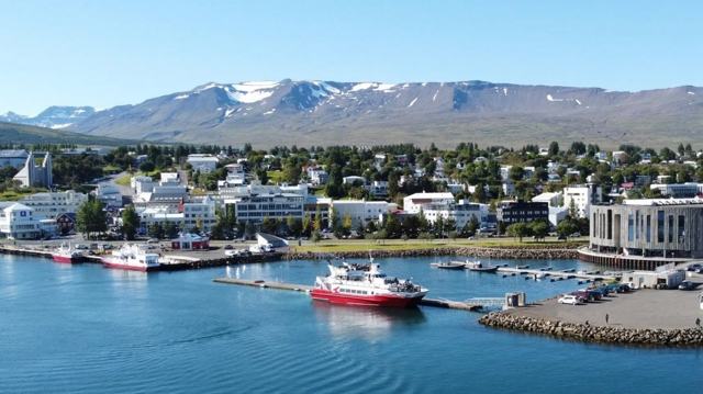
- 48. Akureyri: The capital of the north, at the head of Eyjafjörður. It is about 385 km from Reykjavík, a drive of 4–4.5 hours in summer, or a 45-minute domestic flight.
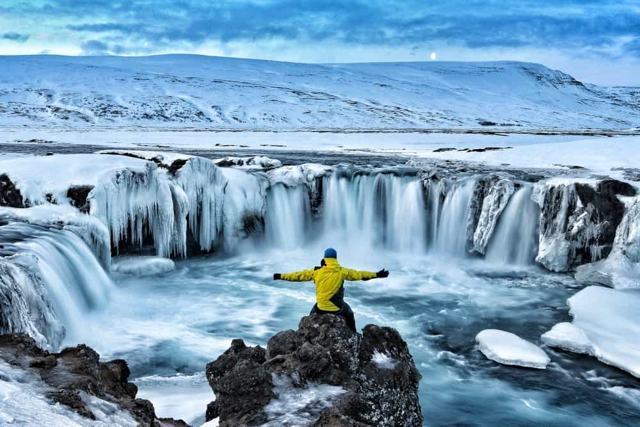
- 49. Goðafoss: A horseshoe-shaped waterfall about 12 m high and 30 m wide, right beside the Ring Road and about 45 minutes from Akureyri. There are viewpoints on both banks.
- 50. Mývatn: A shallow, volcanically formed lake about 100 km (1.5 hours) from Akureyri, surrounded by craters, lava and geothermal areas. The area takes a full day to see properly.
- 51. Dimmuborgir: A field of tall, dark lava pillars and small caves east of Mývatn. The main loop takes about an hour.
- 52. Hverfjall: A tephra crater about 1 km across, formed about 2,500 years ago. The path to the rim takes 10–25 minutes, but the access road is often impassable in winter.
- 53. Námaskarð and Hverir: Boiling mud pools, steam vents and mineral-stained ground between Námafjall and Dalfjall. Free to enter, and 30–45 minutes is enough.
- 54. Krafla: An active volcanic area, best known for the explosion crater Víti and the steaming Leirhnjúkur lava field.
- 55. Grjótagjá: A small lava cave with a geothermal pool inside that glows blue. Swimming is not recommended because the water is often too hot.
- 56. GeoSea: Geothermal sea baths on the cliffs above Húsavík harbour, with infinity-edge pools looking over Skjálfandi Bay. Entry costs around ISK 7,490 for adults.
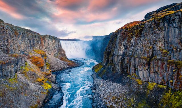
- 57. Dettifoss: A 44 m waterfall on the Jökulsá á Fjöllum river in Vatnajökull National Park, and a highlight of the Diamond Circle.
- 58. Selfoss: A wide, horseshoe-shaped waterfall about 10 m high, a short walk upstream from Dettifoss. The round trip on foot from Dettifoss is about 2.5 km.
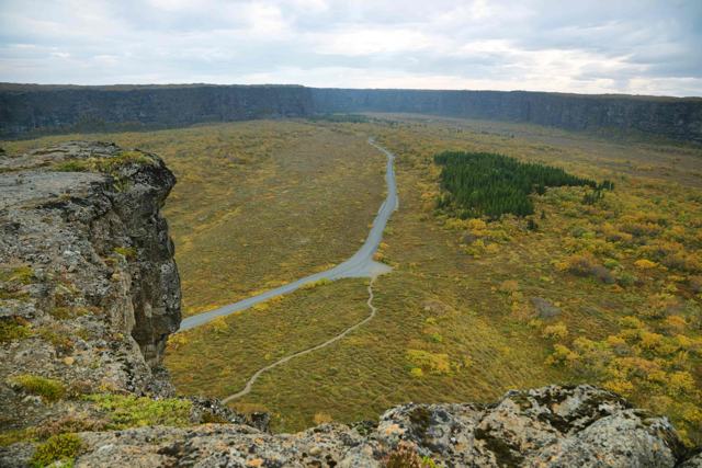
- 59. Ásbyrgi: A horseshoe-shaped canyon in Vatnajökull National Park. Walk in from the car park to the pond at the head of the canyon in 1–2 hours.
- 60. Húsavík: Iceland's whale watching capital, a fishing town of about 2,400 people on Skjálfandi Bay. It is the natural base for the Diamond Circle.
- 61. Siglufjörður: The northernmost town on the Icelandic mainland, with around 1,150 residents, known for its herring history and the Herring Era Museum. It is about an hour from Akureyri through tunnels.
- 62. Hofsós swimming pool: A 25 m outdoor geothermal pool overlooking Skagafjörður and Drangey island. A standard pool entry fee applies.
- 63. Hvítserkur: A 15 m basalt sea stack off the Vatnsnes peninsula, with two holes at its base. View it from the path above the beach.
- 64. Kolugljúfur: A narrow, moss-covered canyon on the Víðidalsá river with a run of waterfalls called Kolufossar. It is about 200 km from Reykjavík.
West Iceland
West Iceland sits close to Reykjavík and is a good choice for a day trip or a first stop on the way to Snæfellsnes.
- 65. Glymur: A 198 m waterfall in Hvalfjörður, about 70 km from Reykjavík. It is reached only on foot, on a moderate to difficult 7 km round trip that takes 3–4 hours and is best from June to September.
- 66. Borgarnes: A town of about 2,000 people on a small peninsula, about 70 km from Reykjavík, with a museum on Iceland's early settlement. It is a natural stop on the way to Snæfellsnes.
- 67. Krauma: A geothermal spa beside Deildartunguhver, Europe's most powerful hot spring. There is an entrance fee, and most people stay 1.5–2 hours.
- 68. Hraunfossar: A series of small waterfalls where water seeps out from beneath the Hallmundarhraun lava field along about a kilometre of riverbank.
- 69. Barnafoss: A narrow, fast waterfall on the Hvítá river just upstream from Hraunfossar. Visit the two together.
- 70. Víðgelmir: Iceland's largest lava cave, near Húsafell. You visit it on a guided tour of about 1.5 hours along a walkway.
- 71. Glanni: A waterfall on the Norðurá river near Bifröst, reached by a short, easy path, with the Paradísarlaut hollow nearby.
Snæfellsnes Peninsula
Snæfellsnes is often called Iceland in miniature, with mountains, lava, beaches, glaciers and fishing villages on one peninsula. Our Snæfellsnes private tour is the easiest way to see it in a day from Reykjavík with your own guide.
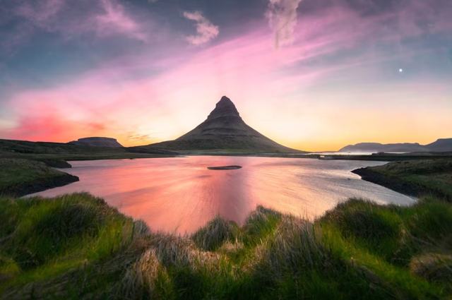
- 72. Kirkjufell: A 463 m cone-shaped mountain beside the small waterfall Kirkjufellsfoss, about 180 km from Reykjavík. Entry is free, and parking is paid.
- 73. Arnarstapi: A small harbour settlement with basalt sea cliffs, the Gatklettur arch and a coastal path to Hellnar. Allow 1–2 hours including the walk.
- 74. Djúpalónssandur: A black pebble beach in Snæfellsjökull National Park with lava formations, the remains of a 1948 shipwreck and four lifting stones once used to test fishermen's strength.
- 75. Lóndrangar: Two basalt sea stacks on the south coast of the peninsula, seen from viewpoints. A 20–30 minute stop.
- 76. Búðir: A tiny hamlet with a black wooden church, a country hotel and the Búðahraun lava field.
- 77. Rauðfeldsgjá: A narrow gorge cut into the mountainside near Arnarstapi. Most visitors spend under 30 minutes here.
- 78. Stykkishólmur: A fishing town of about 1,100 people on the north coast, about 170–175 km from Reykjavík. A few hours is enough.
- 79. Gerðuberg: A wall of regular basalt columns, 7–14 m high, beside Route 54.
- 80. Snæfellsjökull National Park: About 170 square kilometres at the western tip of the peninsula, centred on the glacier-topped volcano Snæfellsjökull. The glacier itself needs a guide and proper equipment.
Westfjords
The Westfjords are remote, with long fjord roads and few crowds. Plan at least two or three nights if you go.
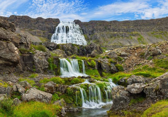
- 81. Dynjandi: A tiered waterfall that fans out as it drops about 100 m over six named stages above Arnarfjörður. It is about 60 km from Ísafjörður, with a small parking charge. Allow 30–60 minutes to walk up.
- 82. Patreksfjörður: The largest town in the southern Westfjords, with about 780 residents. It is the natural base for Látrabjarg, Rauðasandur and Dynjandi.
- 83. Látrabjarg: A 14 km line of sea cliffs at Iceland's westernmost point, over 440 m high at the top. Puffins nest here in summer. Stay back from the edge.
- 84. Rauðisandur: About 10 km of red and golden sand near Látrabjarg. The road in is steep gravel, so allow a full day.
- 85. Ísafjörður: The largest town in the Westfjords, on a narrow sandspit in Skutulsfjörður. It is about 454 km from Reykjavík, a 5–6 hour drive, or a 35-minute domestic flight.
- 86. Garðar BA 64: The rusting hull of a steel ship built in Norway in 1912, beached at Skápadalur near Patreksfjörður.
- 87. Hellulaug: A small natural hot spring by the sea near Vatnsfjörður, a few metres from a roadside car park. It is free and open all year.
Highlands
The highlands are open only in summer and mostly need a 4x4 or a seasonal highland bus. A guided tour is the simplest way in.
- 88. Landmannalaugar: Colourful rhyolite mountains, lava fields and a free natural hot spring in the Fjallabak Nature Reserve. It is reachable only by 4x4 or a seasonal highland bus, and generally open from late June to early September.
- 89. Þórsmörk: A sheltered valley among the glaciers Eyjafjallajökull, Mýrdalsjökull and Tindfjallajökull. The F249 road has river crossings, so most visitors go by 4x4 or highland bus. Open roughly June to September.
- 90. Háifoss: One of Iceland's tallest waterfalls, about 122 m, dropping into a canyon in Þjórsárdalur beside its twin Granni. The last stretch of road needs a 4x4.
Reykjavík
Reykjavík is compact and walkable, and it is the base for most day tours.
- 91. Reykjavík: Iceland's capital, with about 140,000 residents in the city and roughly 250,000 in the wider region. It has a compact centre and works well for a few days before or after a road trip.
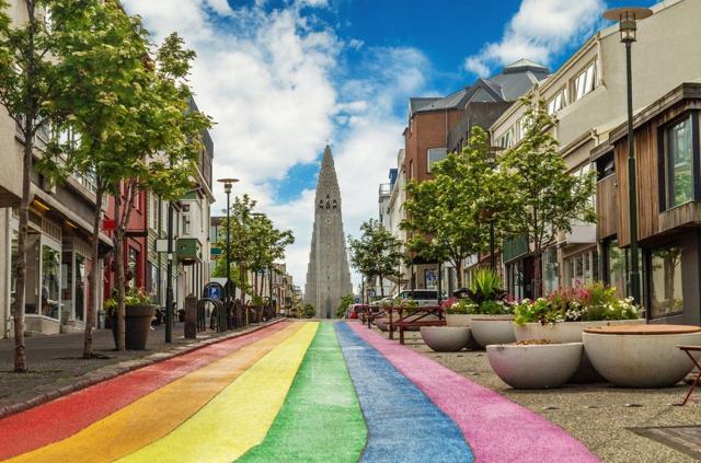
- 92. Hallgrímskirkja: A 74.5 m Lutheran church designed to echo Iceland's basalt columns and glaciers. The church is free to enter, and the tower has an entry fee and the best views over the city.
- 93. Harpa: The concert hall and conference centre on the harbour front. It is free to walk in and look around.
- 94. The Sun Voyager: A stainless steel sculpture on the Sæbraut waterfront, unveiled on 18 August 1990. It is free, always accessible and about ten minutes' walk from Harpa.
- 95. Perlan: A glass-domed museum on Öskjuhlíð hill with the Wonders of Iceland exhibitions, an artificial ice cave, a planetarium and a 360-degree observation deck. Allow 1–2 hours.
Reykjanes Peninsula
The Reykjanes Peninsula is close to Keflavík Airport, and it has seen a series of eruptions since 2021. As of late summer 2026 no eruption is under way, and the last one ended on 5 August 2025. Some areas near Grindavík and the eruption sites can close at short notice, so check safetravel.is and the Icelandic Met Office before you go.
- 96. The Blue Lagoon: A milky-blue geothermal spa about 49 km (50 minutes) from Reykjavík and 21 km from Keflavík Airport. Tickets must be booked in advance and start from around ISK 12,000 for the Comfort package.
- 97. Bridge Between Continents: A small footbridge at Sandvík over a fissure that marks the divide between the Eurasian and North American plates. It takes 15–20 minutes to see.
- 98. Gunnuhver: A geothermal area on the southwestern tip of the peninsula, with boiling mud pools, steam vents and a boardwalk viewing platform.
- 99. Krýsuvík: A small, colourful geothermal area around the Seltún field, with hot springs, mud pools and steam vents on boardwalks. A car park fee applies.
- 100. Brimketill: A natural pool in the lava shore near Grindavík, shaped by the sea. It is not a hot spring and swimming is dangerous.
- 101. Reykjanestá: The rocky southwestern tip of the peninsula, with Iceland's oldest lighthouse, sea cliffs and geothermal steam.
- 102. Fagradalsfjall: A volcanic system that produced eruptions from 2021. There is no entrance fee, but parking near the trailheads is paid, and hiking to the craters depends on current activity.
- 103. Garðskagi: The northwest tip of the peninsula, with two lighthouses: a small one from 1897 and the tallest in Iceland, built in 1944.
How to plan your route
Do not try to see everything. A first trip of a week usually covers Reykjavík, the Golden Circle, the South Coast and one more region. Our how many days in Iceland guide shows what fits, and our itinerary mistakes guide lists the common traps, such as packing too much driving into a day.
If you are new to Iceland, start with our beginner's guide. If you would rather not drive, a Golden Circle tour or South Coast tour from Reykjavík covers the busiest stops with a local guide. To see several regions without planning each night yourself, look at our Ring Road tours, such as the 8 Day Tour Around Iceland.

Safety at Iceland's top locations
Most accidents happen at a few places: waves at Reynisfjara and other black sand beaches, unfenced cliff edges, geothermal ground, and river crossings on highland roads. Read our safety guide and dial 112 in an emergency.
Glaciers, ice caves and highland routes need certified guides or a suitable 4x4. See our volcano guide for how to watch eruptions safely.
Tours to book
If you want a guide to handle the driving, these tours cover many of the places on this list.
- Golden Circle Private Tour from Reykjavík: Þingvellir, Geysir and Gullfoss with your own local guide.
- 2 Day South Coast Private Tour: the South Coast waterfalls and beaches over two days, so you are not rushed.
- 8 Day Tour Around Iceland: a Ring Road trip that links most of the regions above.
Questions people ask
What are the top places to visit in Iceland?
Most first-time visitors start with the Golden Circle (Þingvellir, Geysir, Gullfoss), the South Coast (Seljalandsfoss, Skógafoss, Reynisfjara) and Jökulsárlón. Add Snæfellsnes, the north or the highlands if you have more time.
How many days do I need to see Iceland's top locations?
A week covers Reykjavík, the Golden Circle and the South Coast comfortably, and a Ring Road loop takes 8–10 days or more. Do not try to fit too many stops into one day.
Do I need to pay to visit Iceland's attractions?
Many sights are free to enter, but parking is often charged, around ISK 1,000 at busy places. Some sights such as Kerið, Stokksnes, the lagoons and hot springs charge an entry fee.
Are the highland locations open all year?
No. Landmannalaugar, Þórsmörk and other highland areas are generally open from about June to September, depending on snow. Háifoss is open all year, but the last stretch of road needs a 4x4.