Iceland Travel Guide logo Iceland Travel GuideLOCAL TRAVEL AGENCY IN ICELAND My trip Talk to a local
Dettifoss waterfall

Diamond CircleWaterfallFree entryOpen all year

See it on one of our Ring Road tours

DETTIFOSS IN SHORT

Dettifoss is a waterfall about 45 metres high and 100 metres wide on the Jökulsá á Fjöllum river in North Iceland, inside Vatnajökull National Park and on the Diamond Circle route. It is free to visit, about 2 hours' drive from Akureyri and about 30–40 minutes from Mývatn, and most people spend 45–90 minutes there. The paved west side (Route 862) is the usual approach; the gravel east side (Route 864) opens only in summer.

ON THIS PAGE
Quick factsGetting thereViewpointsBest time to visitSafety tipsFacilitiesMapNearbyWhere to stayFAQ

About Dettifoss

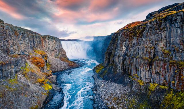
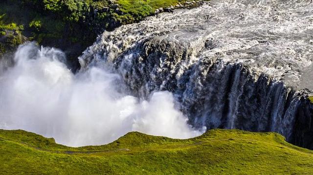
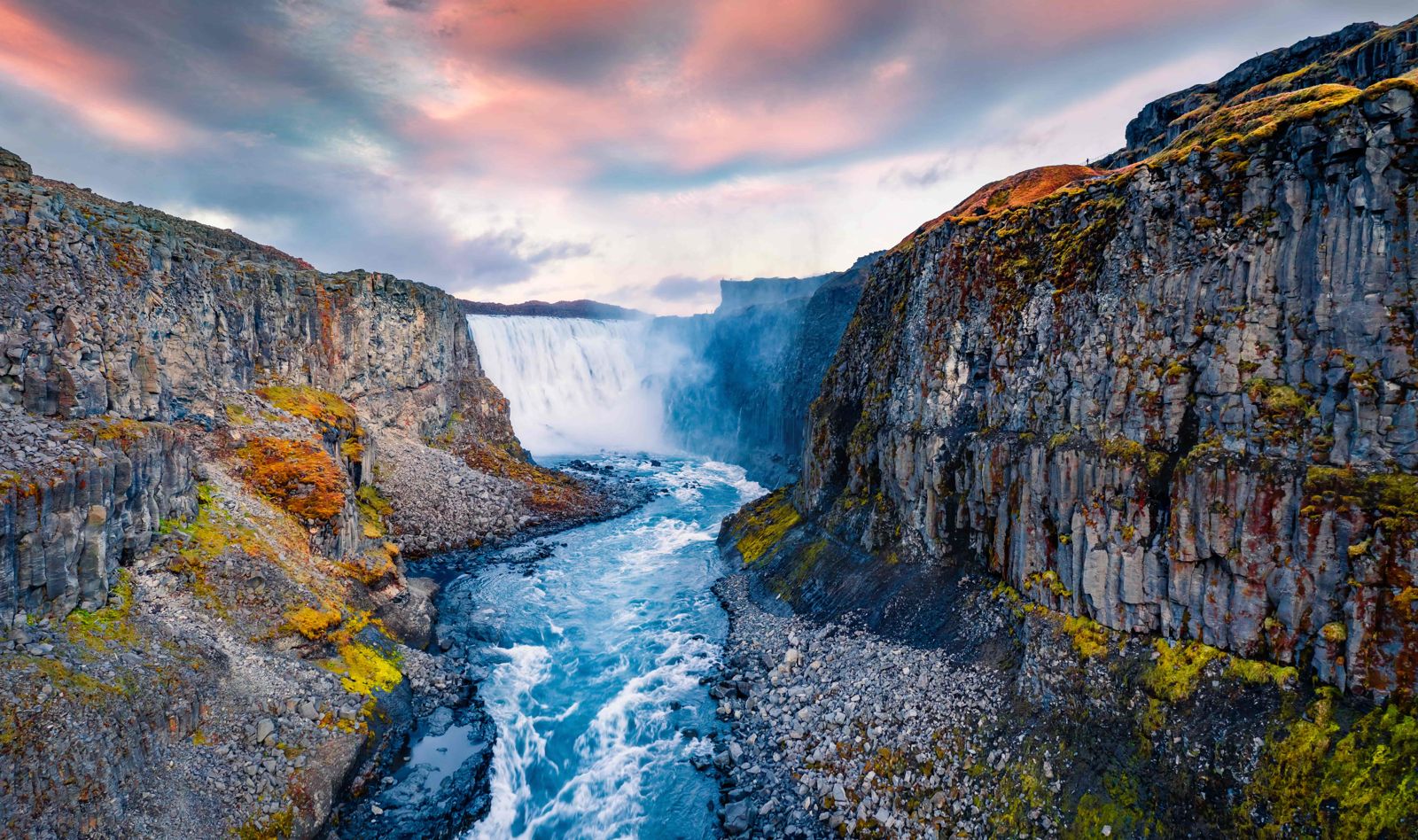
Dettifoss is often called the most powerful waterfall in Europe, with an average flow of around 200 cubic metres per second. The Jökulsá á Fjöllum, a glacial river that starts under Vatnajökull, drops about 45 metres over a ledge some 100 metres wide into the Jökulsárgljúfur canyon. The water is grey with glacial silt, and the spray cloud is often visible from the car park.

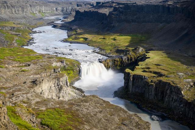
There are viewpoints on both banks, reached by different roads, and they do not connect at the falls. The west side has the paved road, the larger car park and a path that takes you close to the edge, often in the spray. The east side is reached by gravel road, gives a fuller view of the whole falls from above, and is close to Hafragilsfoss further down the canyon. A few hundred metres upstream is Selfoss, a wide, lower waterfall about 10 metres high, which is an easy add-on from the west side.

Dettifoss sits on the Diamond Circle, a loop that also takes in Goðafoss, Mývatn, Ásbyrgi and Húsavík. It is about 530 km from Reykjavík, so it is not a day trip from the capital: visit it on a North Iceland or Ring Road trip, or on a day tour from Akureyri or Mývatn. A long trail of about 34 km follows the canyon from Dettifoss to Ásbyrgi, for experienced hikers with camping gear.

Quick facts

HeightAbout 45 m
WidthAbout 100 m
Average flowAbout 200 m³/s, higher in summer
RiverJökulsá á Fjöllum, fed by Vatnajökull
RegionNorth Iceland, Vatnajökull National Park
From ReykjavíkAbout 530 km, around 6–7 hours by car
From AkureyriAbout 2 hours by car
EntryFree
ParkingFree
Time needed45–90 minutes, more if you also walk to Selfoss
RoadWest side: Route 862, paved, not serviced in winter from January to early April. East side: Route 864, gravel, closed in winter, usually opens around the end of May
ProtectedPart of Vatnajökull National Park

How to get to Dettifoss

On a guided tourThe easy way is our small-group Diamond Circle Tour from Akureyri, a day of about 9 hours by minibus with an English-speaking guide that stops at Dettifoss and Selfoss, Goðafoss, the Mývatn geothermal area, Hljóðaklettar, Ásbyrgi and Húsavík. The guide drives the northern roads and chooses the timing, so you don't have to judge winter road conditions yourself. From June to October there is also a Diamond Circle tour from Akureyri or Mývatn that ends at the GeoSea sea baths in Húsavík, and Dettifoss is a stop on day 5 of our 6-Day Ring Road Tour in Summer.
By carFrom the Ring Road east of Mývatn, turn north onto Route 862 for the west side. It is paved all the way to the car park, but it is not cleared in winter from January to early April. For the east side, turn onto Route 864, a gravel road between the Ring Road and Route 85; it is slower and closed in winter. The two sides do not connect at the falls, so choose one in advance.
By public transportThere is no regular public bus to Dettifoss, so a tour or a rental car is the practical choice.
ParkingFree car parks on both sides. From the west car park it is a walk of about 1 km each way to the main viewpoint, over rocky ground; the east side walk is shorter.

Check umferdin.is for road status and vedur.is for the weather before you drive Route 862 or 864, especially from October to May. In winter, a guided tour is the safer way to visit.

Viewpoints and walks at Dettifoss

Both sides have marked paths from the car park to the canyon rim. Allow more time than the distance suggests, because the ground is rocky and uneven.

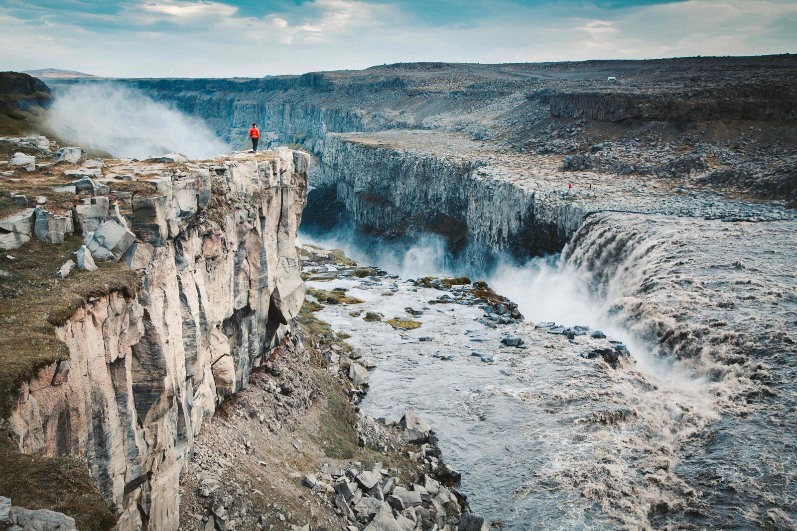
West side viewpointsA marked path of about 1 km leads from the car park to a viewing platform facing the falls, with steps down to a lower viewpoint closer to the water. You get the whole width of the waterfall and a lot of spray.
SelfossA path continues upstream along the canyon to Selfoss, a lower, wider waterfall on the same river. It adds about 1 km each way and is worth the extra half hour.
East sideFrom the Route 864 car park a shorter, rougher path over boulders leads right to the edge of the falls. There are no platforms here, so keep well back from the brink.
HafragilsfossThe third waterfall in the canyon lies about 2 km downstream. It is seen from a viewpoint above the gorge, with a signed car park off Route 864 on the east side.

In winter the paths and steps are covered in snow and ice. Bring ice cleats or light crampons, and turn back if the path is not clear.

Best time to visit Dettifoss

Summer (June–August)Highest flow and long daylight. Both roads are normally open, so this is the only time you can easily see both sides. Midday can be busy at the west car park.
Autumn (September–October)Quieter, with good light and both roads usually still open into autumn. Snow can arrive early in the north, so check conditions.
Winter (November–March)The east road is closed, and the west road is not serviced from January to early April, so it can be blocked by snow. Paths are icy. A guided tour or a careful visit in a suitable car in good weather is the way to go.
Spring (April–May)The west road is cleared again from early April, and the east road usually opens around the end of May. Paths can be muddy as the snow melts.

Opening of Route 864 depends on snow and ground conditions each year.

Safety and practical tips

  • Wear a waterproof jacket. The spray soaks the west-side viewpoints on most days.
  • Stay behind the ropes and away from the edge; the rock is wet and slippery and there are few barriers.
  • Check umferdin.is and vedur.is before driving Route 862 or 864, particularly from October to May.
  • If you can only visit one side, choose the paved west side, and add the short walk to Selfoss.
  • Wear proper shoes with good grip; the path from the west car park is rocky.
  • Combine Dettifoss with Ásbyrgi, Húsavík and Mývatn on a full Diamond Circle day.

Facilities and accessibility

Basic toilets at the car parks. There is no café or shop at the falls; the nearest services are around Mývatn, Húsavík and Ásbyrgi.

On the map

Open in Google Maps →

Nearby places worth a stop

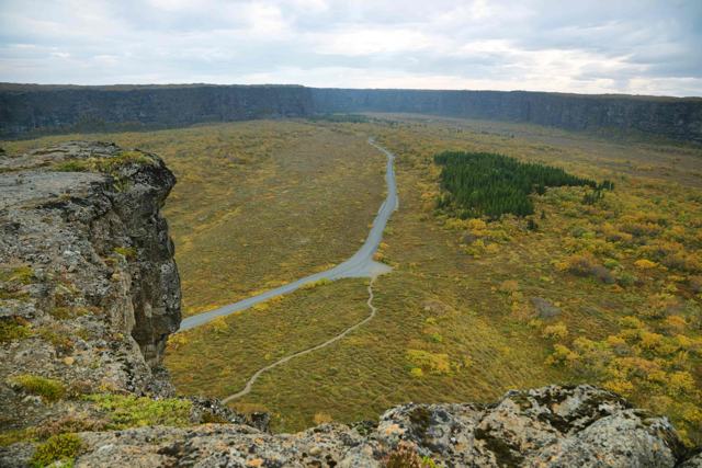
HafragilsfossHafragilsfossSmaller waterfall further down the same canyonÁsbyrgiÁsbyrgiHorseshoe-shaped canyon on the Diamond CircleMývatnLake MývatnVolcanic lake with pseudocraters and birdlife
DimmuborgirLava towers and caves near Mývatn
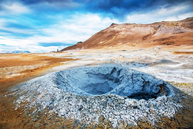
Námaskarð and HveraröndNámaskarð & HveraröndGeothermal mud pools and steam vents

Where to stay near Dettifoss

Most visitors stay around Mývatn, Húsavík or Akureyri, all within about an hour or two of Dettifoss. Hotels in North Iceland can be added to your trip in our trip planner, or let a guided Ring Road tour handle the hotels and the driving.

Dettifoss FAQ

Is Dettifoss free to visit?

Yes. There is no entry fee and parking is free on both sides.

Which side of Dettifoss is better, east or west?

The west side (Route 862) is paved, has the larger car park and brings you close to the falls. The east side (Route 864) is gravel, summer only, and has a fuller view of the whole falls from above.

How high is Dettifoss?

About 45 metres high and 100 metres wide, with an average flow of around 200 cubic metres per second.

Can you visit Dettifoss in winter?

Sometimes. The east road closes for winter, and the west road is not serviced from January to early April, so access depends on snow. A guided tour from Akureyri is the safer option.

How far is Dettifoss from Akureyri and Reykjavík?

About 2 hours by car from Akureyri and about 530 km, or 6–7 hours, from Reykjavík.

How long do you need at Dettifoss?

45–90 minutes, including the walk from the car park. Allow a little more if you also walk to Selfoss.

Can you do a day trip to Dettifoss from Akureyri?

Yes. Our Diamond Circle Tour from Akureyri takes about 9 hours and also visits Goðafoss, Mývatn, Ásbyrgi and Húsavík.

See Dettifoss with a local

Tours and trips that include Dettifoss, booked directly with a local travel agency in Iceland.
Diamond Circle Tour with Lake Myvatn & Asbyrgi Canyon from AkureyriDAY TOURDiamond Circle Tour with Lake Myvatn & Asbyrgi Canyon from AkureyriFrom 39,900 ISK per personDiamond Circle & Geo SeaDAY TOURDiamond Circle & Geo SeaFrom 38,900 ISK per person6 Day Iceland Ring Road Tour in SummerMULTI-DAY6 Day Iceland Ring Road Tour in SummerFrom 277,119 ISK per personDiamond CircleSHORE EXCURSIONDiamond CircleFrom 24,990 ISK per person8 Day Iceland Summer TourPACKAGE8 Day Iceland Summer TourFrom 346,126 ISK per person
More places in North IcelandWaterfalls in Iceland