GLYMUR IN SHORTGlymur is a 198-metre waterfall in Hvalfjörður, West Iceland, and one of Iceland's tallest. It is about 70 km (around 1 hour) from Reykjavík, free to visit, and reached only on foot by a moderate to difficult 7 km round-trip hike that takes 3–4 hours, best done from June to September.
About Glymur
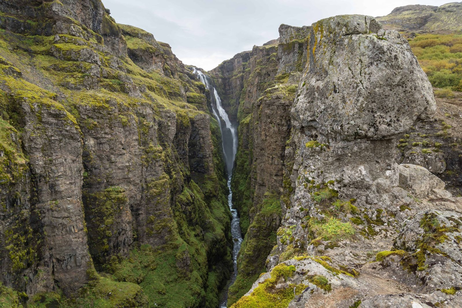
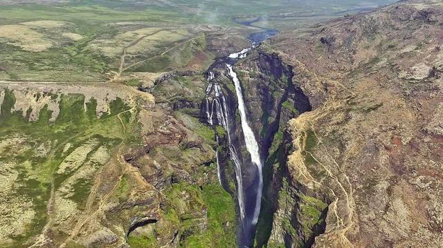
Glymur drops 198 metres into a narrow, mossy canyon fed by the Botnsá river, which flows from the lake Hvalvatn. It was long considered Iceland's tallest waterfall until Morsárfoss, by Vatnajökull in Skaftafell, was measured as taller in 2011, so Glymur is now Iceland's second-highest waterfall. Unlike most of Iceland's famous waterfalls, Glymur cannot be seen from a car park. You have to walk to it, and the hike is as much the point of the visit as the waterfall itself.
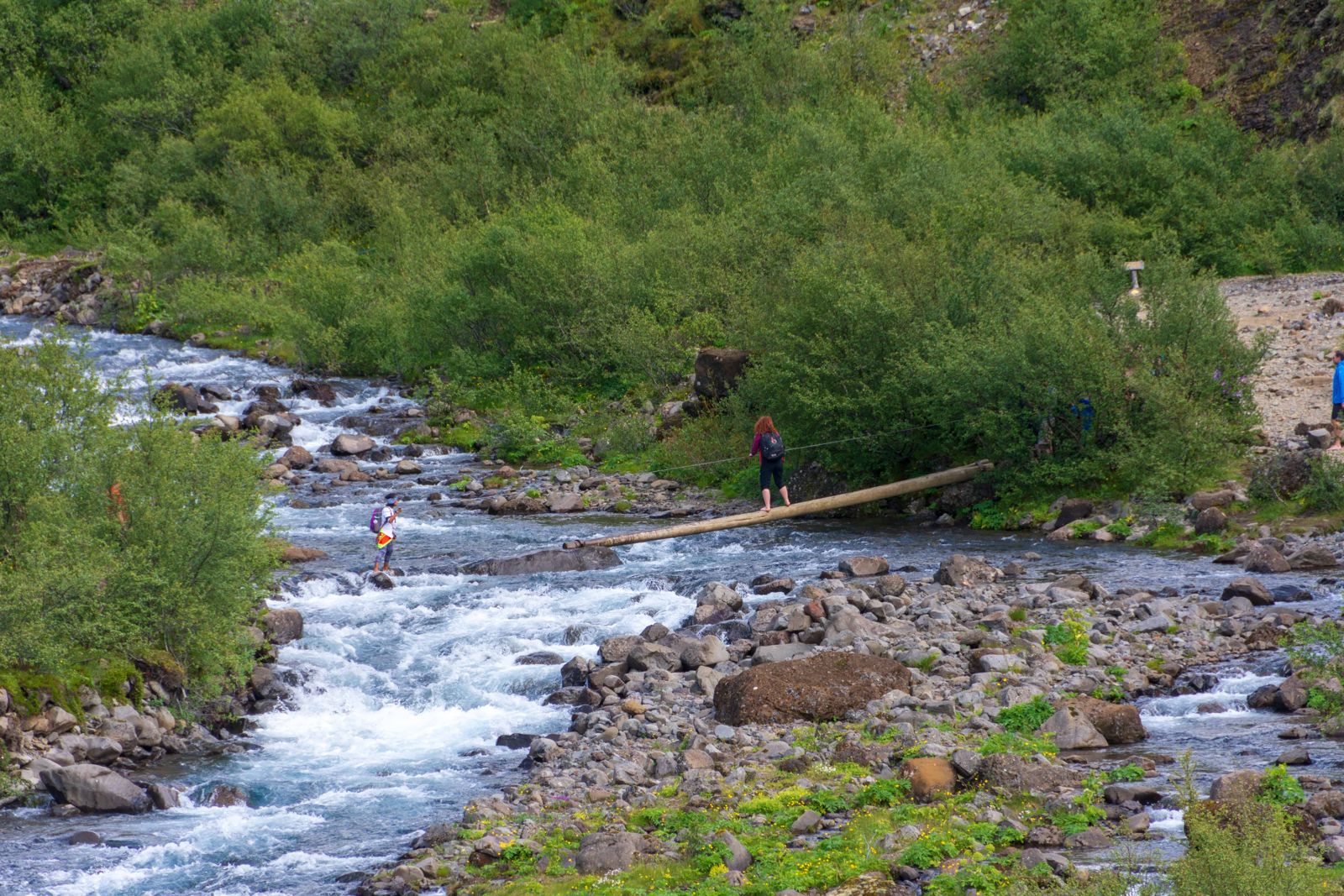
The waterfall sits at the head of Botnsdalur, a green valley at the innermost end of Hvalfjörður. The trail climbs through a canyon, crosses the river (often on a log with a rope handhold in summer), passes through a short lava cave, and follows narrow paths along steep slopes with views down into the gorge. It is a proper hike on a rocky, unpaved path, not a short walk, and it needs sturdy footwear and reasonable fitness.
Glymur is a favourite with locals because it is less than an hour from Reykjavík and still feels wild. Few guided tours go here, so most people come by rental car and do the hike on their own.
Quick facts
HeightAbout 198 m
RiverBotnsá, flowing from the lake Hvalvatn
RegionWest Iceland, Hvalfjörður
From ReykjavíkAbout 70 km, around 1 hour by car
EntryFree
ParkingFree, no facilities at the car park
Trail lengthAbout 7 km round trip
Time needed3–4 hours for the hike
DifficultyModerate to difficult, with a river crossing and steep sections
Iceland's former tallest waterfall
Glymur held the title of Iceland's tallest waterfall for decades, until Morsárfoss in Vatnajökull National Park was measured as taller in 2011 after a glacier retreated and exposed it. Its name comes from the Icelandic word for a deep, rumbling sound, a fitting description of the roar that carries up the canyon on the approach.
How to get to Glymur
By carFrom Reykjavík, drive north on Route 1 through Mosfellsbær towards Akranes and Borgarnes. Just before the Hvalfjörður tunnel, turn right onto Route 47, the old road around the fjord. Follow it to the innermost point of the fjord, where signs for Glymur and Botnsdalur point inland to the east. A wide gravel road leads the last few kilometres to the car park.
By public transportThere is no public bus to the Glymur trailhead, so a rental car or a tour that includes the hike is the practical option.
Hiking thereThe trail starts at the Botnsdalur car park. Two route options loop around the canyon; many hikers go up one side and down the other. A river crossing partway up needs care, especially with the seasonal log bridge in place only in summer.
With the Golden Circle or West IcelandRoute 47 runs about 60 km around Hvalfjörður and passes several smaller waterfalls, so it is a scenic alternative to the tunnel. Glymur lies west of Þingvellir National Park, about an hour's drive away, so it can be added to a Golden Circle day or a trip up the west coast if you leave enough time for the hike.
In winter and early spring the log crossing is often removed and the paths can be icy, so the hike becomes considerably harder and more dangerous. Late spring meltwater can also raise the river. Most people hike Glymur between June and September.
Step-by-step guide to the Glymur hike
The full loop is a little over 7 km and takes most people 3 to 4 hours. Locals recommend going up the south side of the canyon, which has the best views of the waterfall, and coming down the north side.
Step 1: Botnsdalur valleyFrom the car park the trail is flat at first, crossing old lava and low birch scrub on the valley floor, with wide views up the valley. Follow the signs and markers for Glymur.
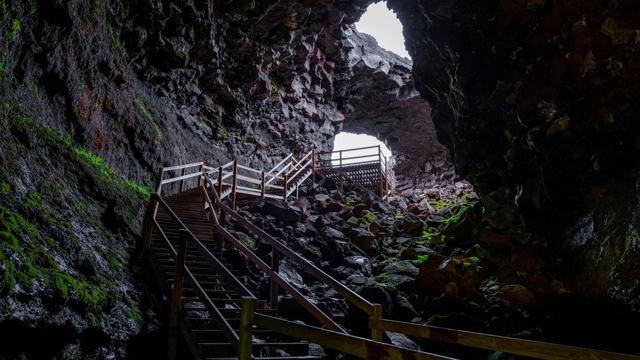
Step 2: Þvottahellir, the washing caveThe path drops through Þvottahellir, a short lava cave that opens onto the bank of the Botnsá. It is a few steps of scrambling, and it can hold ice outside summer.
Step 3: The log across the riverYou cross the Botnsá on a tree log with a rope stretched above it as a handhold. Take it slowly, one person at a time. The log is only in place in the summer months.
Step 4: The climb on the south sideAfter the river the trail gets steeper and follows the canyon rim. Ropes are fixed on the steepest parts. Several viewpoints look straight into the gorge and across to the waterfall.
Step 5: Above the waterfallThe last stretch brings you high above Glymur, with a view down the whole of Botnsdalur and out to Hvalfjörður. This is where most people stop for a break.
Step 6: Back down the north sideTo make a loop you wade the river above the falls, where it is wide and shallow but cold, and walk down the north side. This descent is much gentler and rejoins the main trail to the car park. If the water is high, go back the way you came.
Do not go close to the canyon edge for a photo. The ground is loose and the drop is sheer.
Best time to visit Glymur
Summer (June–September)The trail is at its easiest, with the log bridge in place for the river crossing and the least ice on the paths. This is when most visitors hike Glymur.
Winter and shoulder seasonThe hike becomes far more demanding, with ice on narrow ledges and the log crossing usually removed. Only experienced hikers with the right gear should attempt it, and many choose to skip the hike at this time.
Check conditions before you go, since river levels and ice can change the difficulty from week to week.
Safety and practical tips
- Wear proper hiking boots. The trail has loose rock, mud and a river crossing.
- Bring trekking poles if you have them, especially for the steeper descents.
- The river crossing can be cold and slippery. Take your time and use the rope where provided.
- Start early. The hike takes 3–4 hours and the light in Iceland changes fast.
- There is no phone signal in parts of the canyon, so tell someone your plan.
- This is not a hike for young children or anyone unsteady on uneven ground.
- Pack water, snacks and an extra layer. There is nothing for sale anywhere near the trailhead.
Facilities and accessibility
No toilets, café or shop at the trailhead or along the trail. The nearest services are in Akranes or Borgarnes.
Nearby places worth a stop
Where to stay near Glymur
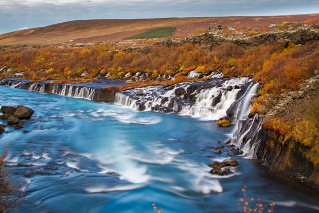
Most people visit Glymur as a day trip from Reykjavík, and it combines well with Krauma, Borgarnes and Hraunfossar if you want a full day in West Iceland. For those exploring further, Akranes and Borgarnes have hotels and guesthouses within easy driving distance, and there is accommodation along Hvalfjörður itself.
Glymur FAQ
How long is the Glymur hike?
About 7 km round trip, taking 3–4 hours depending on which loop you take and your pace.
Is Glymur free to visit?
Yes, there is no entrance fee and parking is free.
Can you see Glymur without hiking?
No. There is no viewpoint reachable by car; the waterfall is only visible from the trail.
Is the Glymur hike difficult?
It is moderate to difficult, with a river crossing, steep sections and narrow paths, so it needs proper footwear and some fitness.
When is the best time to hike Glymur?
From June to September, when the seasonal log bridge is in place and paths are mostly free of ice.
How far is Glymur from Reykjavík?
About 70 km, around 1 hour by car to the trailhead.
Which way should I hike the Glymur loop?
Locals go up the south side, across the log and along the canyon rim for the best views, and come down the gentler north side after wading the river above the falls.
 Iceland Travel GuideLOCAL TRAVEL AGENCY IN ICELAND
My trip
Talk to a local