Iceland Travel GuideLOCAL TRAVEL AGENCY IN ICELAND
My trip
Talk to a local
Iceland Travel GuideLOCAL TRAVEL AGENCY IN ICELAND
My trip
Talk to a local
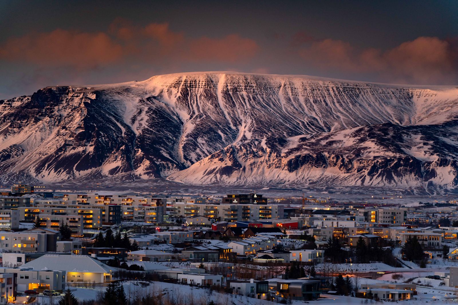
Esja is a volcanic mountain range across the bay from Reykjavík, about 10 km from the city in a straight line, with its highest point at 914 m. The popular hike to the large rock Steinn is about 6–7 km return, takes most people 2–4 hours, is free, and starts at a car park in Kollafjörður beside Route 1.
Esja is not one mountain but a range of basalt and tuff, formed in the Pleistocene, with the western part around 3.2 million years old and the eastern part around 1.8 million. The highest point, Hábunga, is 914 m. Two well-known summits are Þverfellshorn (780 m) and Kerhólakambur (851 m). It is the closest proper hiking mountain to Reykjavík and the backdrop to the city skyline.
Almost everyone walks the marked path to Steinn, a big rock that is the usual turning point. The path is steep in places but needs no technical skill in good summer conditions. Beyond Steinn the climb to Þverfellshorn is steeper and more exposed, with handrails on the final section, and the route on to Hábunga crosses a rocky plateau with no signs or clear path, so it is only for experienced hikers.
Locals call the mountain Esjan, which simply means 'the Esja', and it is their favourite everyday hike. On a fine evening you share the path with people from Reykjavík walking or running up after work, which also means there is always someone to ask if you are unsure of the way. Most people hike without a guide, because the main routes are clear.
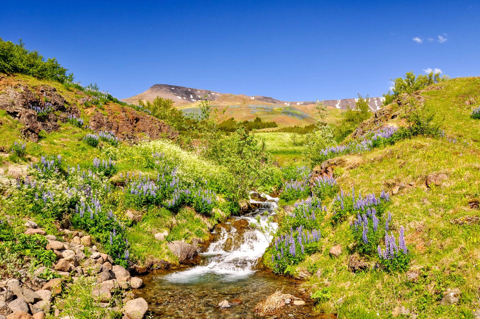
The mountain has changed little since the volcanic activity here ended, apart from the work of Ice Age glaciers that carved its flat-topped shape. In summer the lower slopes are covered in lupin and wildflowers, and there is plenty of birdlife along the trail, so keep a camera to hand.
The paths are well marked, and signboards at the start show how difficult each route is, which makes it easy to pick one that suits you. If you are new to hiking, choose the simple route and leave the steeper summits to experienced walkers.
The hiking season is summer. Esja looks its best from the city when it is capped with snow, but hiking it when it is snow-covered is not recommended unless you have winter experience and equipment. Ice, rain and thick fog are all common, and the weather can turn at any time, so check the forecast and wear sturdy boots whatever the season.
Know your own limits. Turning back at Steinn is what most people do, and the view over Reykjavík and Faxaflói bay from there is already wide.
Check the weather and avalanche information on vedur.is and safetravel.is before any winter hike, and turn back if conditions look uncertain.
There is a large car park and toilets at the trailhead. Right below the slopes, Esjustofa has a café-restaurant where you can sit down after the hike; opening hours vary by season.
Esja is so close to the capital that most people stay in Reykjavík, with its wide choice of hotels, guesthouses and a campsite, and come out for half a day. Mosfellsbær, on the way, is closer still and has simpler places to stay on the edge of the city. Esja also works as a first or last stop if you are driving the Ring Road.
The popular route to Steinn takes most people 2–4 hours return, depending on fitness, breaks and conditions.
The route to Steinn is achievable for a reasonably fit person in good summer conditions, but proper footwear matters and the path is steep in places. The route to the summit is harder.
Yes, Strætó bus route 57 runs from Reykjavík towards the trailhead in about 30 minutes.
Only with proper winter gear and after checking the forecast and avalanche conditions; there have been fatal avalanches on the mountain in past winters.
The highest point, Hábunga, is 914 m. The popular summit Þverfellshorn is 780 m.
No. Most people hike without a guide, as the route to Steinn is clear and well used. A guide makes sense for winter ascents or the routes beyond Þverfellshorn.
Both. Esja is the name, and Esjan is the same word with the Icelandic definite article, 'the Esja', which is how locals usually say it.
Drive about 20 minutes north on Route 1 through Mosfellsbær to the car park in Kollafjörður, or take bus 57 from Mjódd.
Tours and trips that include Esja, booked directly with a local travel agency in Iceland.