Iceland Travel Guide logo Iceland Travel GuideLOCAL TRAVEL AGENCY IN ICELAND My trip Talk to a local

Fagradalsfjall volcano

ReykjanesVolcanoFree entryCheck status before visiting
FAGRADALSFJALL IN SHORT

Fagradalsfjall is a volcanic system on the Reykjanes Peninsula, about 45 minutes from Reykjavík, that produced repeated eruptions between 2021 and 2024. There is no entrance fee, but parking near the trailheads is paid, and whether you can hike to the craters depends on current activity, so check before you go.

ON THIS PAGE
Quick factsHistoryGetting thereEruptionsHikingBest time to visitSafety tipsFacilitiesMapNearbyWhere to stayFAQ

About Fagradalsfjall

Fagradalsfjall itself is an older table mountain, but the name is now used for the wider volcanic system that woke up in March 2021 after being dormant for roughly 6,000 years. It was also the first eruption anywhere on the Reykjanes Peninsula in almost 800 years. That first eruption drew hundreds of thousands of hikers to see fresh lava up close, and it was followed by two more at Fagradalsfjall in 2022 and 2023. Since December 2023 the eruptions have moved a few kilometres west, closer to the town of Grindavík and the Svartsengi power plant.

Because the system is still active, the landscape changes from year to year: new lava fields, new craters, sometimes new fissures near Sundhnúksgígar to the northwest. Trails, parking areas and access rules are adjusted by the authorities as needed, and can close on short notice if seismic activity picks up or gas levels rise.

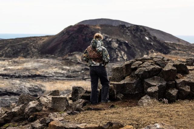
The system is made up of old cones, lava fields and eruptive fissures, known together as a fissure swarm, in the southern part of the peninsula. It is rare to be able to walk this close to a recent eruption site, and that is what still brings people here: you can stand on a ridge and look down on craters and black lava that did not exist a few years ago.

Quick facts

TypeFissure and shield volcano system, part of the Reykjanes volcanic belt
MountainTuya (table mountain) formed under ice; highest point Langhóll, 385 m
RegionReykjanes Peninsula, Southwest Iceland
First 2021 eruption began19 March 2021
Recent activityEruptions at Fagradalsfjall in 2021, 2022 and 2023; since December 2023 the eruptions have been at Sundhnúksgígar near Grindavík
From ReykjavíkAbout 45 minutes by car to the main parking areas near Grindavík
EntryFree
ParkingCar parks P1 and P2 on Route 427; ISK 1,000 for 24 hours, paid through Parka
HikingFrom about 2 km one way (Nátthagi) to 18–20 km round trip (Meradalir)
AccessDepends on current activity; can be closed or restricted with little notice

A table mountain born under ice

Fagradalsfjall is a tuya, or table mountain: a volcano with a flat top and steep sides, a little like a table. A tuya forms when lava erupts up through a thick ice sheet or glacier, and this one dates from the last ice age. Tuyas are uncommon worldwide, because they only form where volcanoes were active under glaciers, as in Iceland. The highest point, Langhóll, is 385 metres above sea level, and the mountain's earthy brown and grey slopes blend in with the ridges around it.

Iceland sits on the boundary between the North American and Eurasian plates, which are slowly pulling apart, and the Reykjanes Peninsula is where that boundary comes ashore. Fagradalsfjall lies between the Svartsengi and Krýsuvík volcanic systems and is sometimes counted as a branch of Krýsuvík. Before 2021 the peninsula had been quiet for a long time: its last eruptions ended around 1240.

How to get to Fagradalsfjall

On a guided tourLocal operators run hiking and viewing tours whenever access allows, with guides who know the current trails and safe viewpoints. This is the easiest way to see the site without worrying about changing regulations.
By carFrom Reykjavík, take Route 41 (Reykjanesbraut) towards Keflavík, turn south on Route 43 to Grindavík, then east on Route 427 (Suðurstrandarvegur) to the signposted car parks P1 and P2. Route 43 has been cut by lava and closed at times. The other way in is Route 42 past Kleifarvatn to Route 427, then west. Roads and parking have changed with each eruption, so check umferdin.is before setting off.
ParkingUse only the official, signposted car parks. Fees are paid through the Parka app. Parking anywhere else, including road verges, can get you towed and blocks emergency access.

Because this is an active eruption site, always check safetravel.is and the Icelandic Meteorological Office (vedur.is) before travelling, and follow instructions from on-site staff or rangers. Trails and access points named here may no longer be open by the time you visit.

Geological activity, earthquakes and the eruptions

The eruptions at Fagradalsfjall were slow and steady, not explosive. Lava welled out of cracks in the ground with very little ash, which is why people could hike so close to them.

The earthquake swarm, February 2021On 24 February 2021 a strong swarm of earthquakes began on the peninsula. More than 40,000 quakes were recorded over about four weeks as magma pushed its way up towards the surface, and people in Grindavík and the nearby towns lost a good deal of sleep.
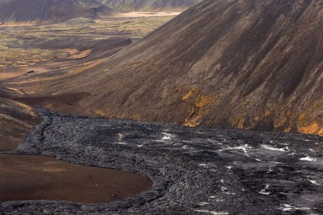
19 March 2021: GeldingadalirThe eruption started on the evening of 19 March 2021 in the Geldingadalir valley, from a fissure about 500–700 metres long. At first the lava covered less than one square kilometre, with small fountains here and there and no ash to speak of, so the hazard stayed local. It went on for six months, until September 2021, and built the main crater and lava field you see from the trails today.
August 2022: MeradalirA second, shorter eruption opened on 3 August 2022 in the Meradalir valley, just north-east of the 2021 crater. It lasted about three weeks.
July 2023: Litli-HrúturThe third eruption began on 10 July 2023 beside the hill Litli-Hrútur, further to the north-east, and ended in early August. It is the hardest of the three sites to reach on foot.
Since December 2023: SundhnúksgígarLater eruptions moved to the Sundhnúkur crater row north of Grindavík, which belongs to the neighbouring Svartsengi system. These have been bigger, faster fissure eruptions close to the town, the power plant and the Blue Lagoon, and they are the reason access rules in the area change so often.

Hiking routes and parking at Fagradalsfjall

These are the marked routes listed by Visit Reykjanes, all starting from the two car parks on Route 427. Routes are re-marked when conditions change, so read the signs at the trailhead.

Car parks P1 and P2P1 (Geldingadalir) and P2 (Stóri-Leirdalur) are both beside Route 427, east of Grindavík. Each costs ISK 1,000 for 24 hours, paid online through Parka. The car parks are monitored by cameras.
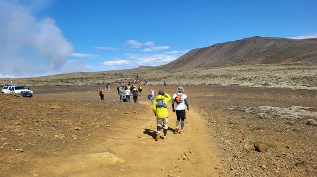
Path A: the 2021–2023 eruption sitesThe main route up onto Fagradalsfjall, 6–8 km one way depending on how far you go. Visit Reykjanes gives 2–2.5 hours for the walk.
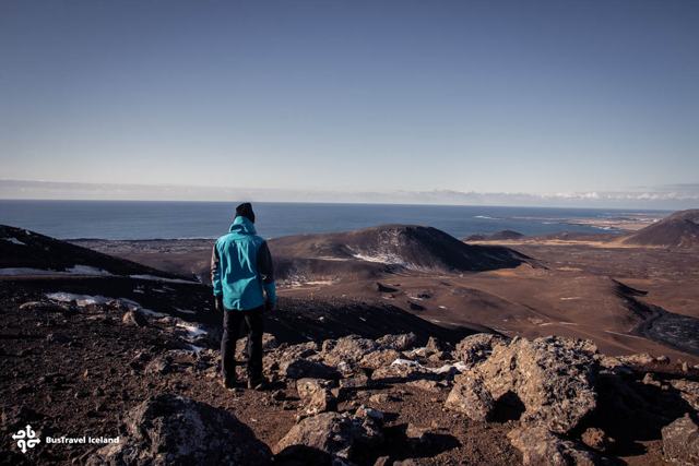
Path C: LangihryggurAbout 4 km one way along the Langihryggur ridge, with views over the lava from the 2021, 2022 and 2023 eruptions.
Path E: MeradalirThe long one: 18–20 km round trip and 5–6 hours, to the area of the July 2023 eruption. For fit, well-equipped hikers only.
Nátthagi: the short optionAbout 2 km one way on easier ground to the lava that flowed down into the Nátthagi valley. A sensible choice with children or limited time.
Path B: view towards Sundhnúksgígar4.7 km one way to the first viewing point (B1) and 6.1 km to the second (B2), looking over the newer craters and lava north of Grindavík.

The ground is rough, loose and exposed to wind on every route. Allow more time than the distance suggests, and turn back if fog comes in: the trails are hard to follow in poor visibility.

Best time to visit Fagradalsfjall

SummerLong daylight makes hiking easier and safer if trails are open, but this is also when demand and crowding are highest if there is visible activity.
WinterShorter days, wind and ice make the walk harder and access is more likely to be limited. Only attempt it with proper winter gear and if officially open.

Safety and practical tips

  • Never walk on the lava. It looks solid but can hide hollow, red-hot sections underneath, even long after an eruption ends.
  • Check gas readings before you go. Sulphur dioxide from the site can be dangerous, especially for anyone with respiratory conditions, and can pool in low ground with little wind.
  • Follow the marked path and any ropes or signs. Rangers close routes for real safety reasons, not to be difficult.
  • Bring proper hiking boots, a headtorch if walking in low light, and warm, windproof layers even in summer.
  • If there is an active eruption, keep well back from the recommended viewing distance and be ready to leave quickly if told to.
  • Conditions can change within hours. Check safetravel.is on the day, not the week before.

Facilities and accessibility

There are no permanent facilities at the site itself. Toilets, fuel and food are available in Grindavík when the town is open to visitors; check current status before relying on it.

On the map

Open in Google Maps →

Nearby places worth a stop

GrindavíkGrindavíkFishing town affected by the eruptions, access varies
Svartsengi geothermal areaPower plant and the area around the Blue Lagoon
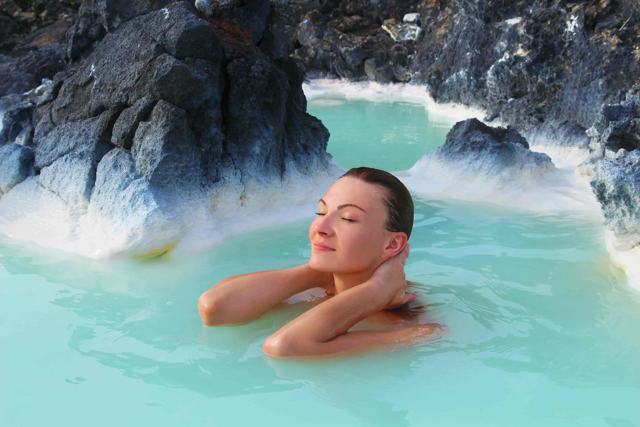
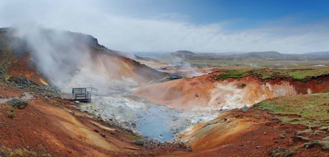
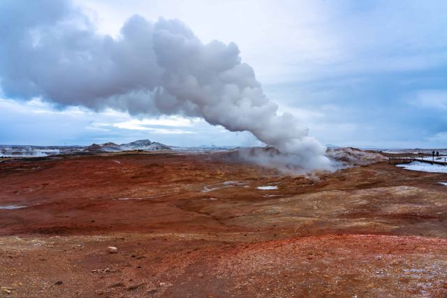
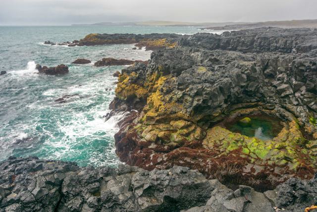
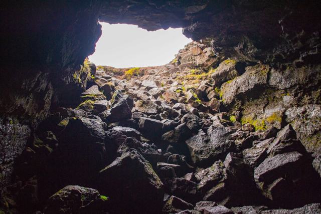
Blue LagoonBlue LagoonGeothermal spa, closures possible during activityKrýsuvíkKrýsuvíkHot springs and mud pots on Route 42GunnuhverGunnuhverSteaming geothermal area near the tip of the peninsulaBrimketillBrimketillLava rock pool on the coast west of GrindavíkLeiðarendiLeiðarendiLava tube cave off Route 42
Garðskagi lighthouseNorthern tip of the peninsula

Where to stay near Fagradalsfjall

Most visitors base themselves in Reykjavík or Keflavík and drive out for the day, since the eruption site itself has no accommodation and Grindavík's status can change.

Fagradalsfjall FAQ

Is Fagradalsfjall erupting right now?

Activity has been on and off since 2021, with several eruptions through 2023 and 2024. Check safetravel.is or the Icelandic Meteorological Office for the current status before planning a visit.

Can I still hike to see the lava?

Sometimes, when the area is officially open and safe. Trails, closures and parking areas are managed by local authorities and change with the activity, so check right before you go.

How far is Fagradalsfjall from Reykjavík?

About 45 minutes by car to the main parking areas near Grindavík, when they are open.

Is it safe to visit?

It can be, when access is officially open and you follow the marked routes and any instructions on site. During active eruptions or high gas readings, the area is closed for good reason.

Do I need a guide?

Not always, but a local guide is worth it for the safety knowledge and up-to-date route information, especially if you are unfamiliar with volcanic terrain.

What type of volcano is Fagradalsfjall?

The mountain is a tuya, a flat-topped table mountain formed when lava erupted under an ice sheet during the last ice age. The recent eruptions came from fissures in the valleys beside it.

When did Fagradalsfjall erupt?

On 19 March 2021 in Geldingadalir, for six months, then again in August 2022 in Meradalir and in July 2023 at Litli-Hrútur. Eruptions since December 2023 have been at Sundhnúksgígar, closer to Grindavík.

See Fagradalsfjall with a local

Tours and trips that include Fagradalsfjall, booked directly with a local travel agency in Iceland.
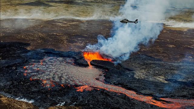
Volcano Helicopter TourDAY TOURVolcano Helicopter TourFrom 73,500 ISK per personVolcano Tour in IcelandDAY TOURVolcano Tour in IcelandFrom 15,990 ISK per personVolcano Tour & the Blue LagoonDAY TOURVolcano Tour & the Blue LagoonFrom 32,990 ISK per personVolcano Tour & Reykjanes SightseeingDAY TOURVolcano Tour & Reykjanes SightseeingFrom 15,990 ISK per personVolcano Tour & Sky LagoonDAY TOURVolcano Tour & Sky LagoonFrom 32,999 ISK per personVolcano Tour: Grindavík Volcano Village & the Blue LagoonDAY TOURVolcano Tour: Grindavík Volcano Village & the Blue LagoonFrom 36,499 ISK per person
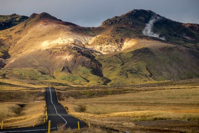
More places in Reykjanes