Iceland Travel GuideLOCAL TRAVEL AGENCY IN ICELAND
My trip
Talk to a local
Iceland Travel GuideLOCAL TRAVEL AGENCY IN ICELAND
My trip
Talk to a local
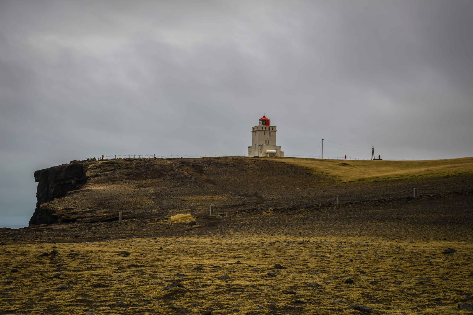
Dyrhólaey is a 120-metre-high former island, now a peninsula, on the South Coast just west of Vík: about 6 km away in a straight line, but around 20 km and 20 minutes by road. It is roughly 180 km (around 2.5 hours) from Reykjavík. It is free to visit, but the upper viewpoint closes during the puffin nesting season and access changes with the weather.
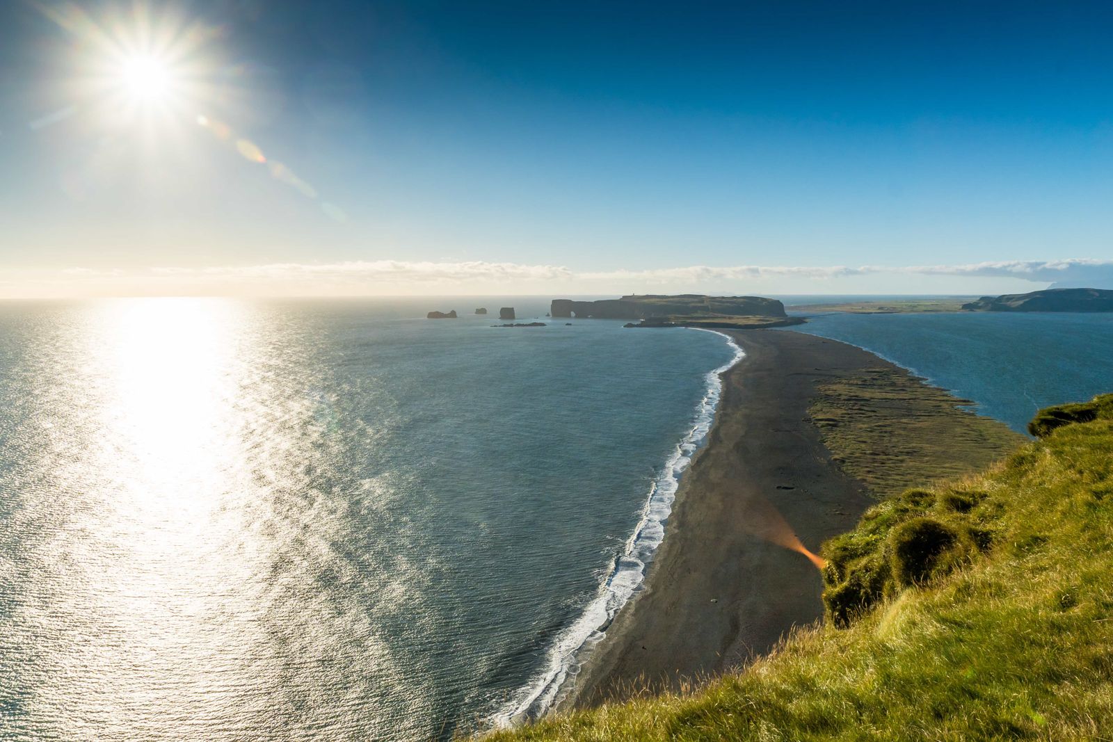
Dyrhólaey means "door hole island" or "door hill island", after the large arch cut through the rock by the sea, big enough for a boat to pass through in calm weather. The headland rises 120 metres above the coast and gives wide views over the black sand beaches on either side, the glacier Mýrdalsjökull inland, and the sea stacks of Reynisdrangar to the east.
The area has two main viewpoints: a lower one near the arch, reachable by a short walk, and a higher one by the lighthouse at the top of the headland. Dyrhólaey is also one of the best places on the South Coast to see puffins in summer, which is exactly why parts of it close for a few weeks each year to protect nesting birds.
Dyrhólaey is a nature reserve because of its importance as a seabird colony, especially for puffins and other cliff-nesting species. To give the birds space to nest undisturbed, the upper part of the headland is typically closed to visitors for a few weeks in spring, with dates set each year depending on when the birds arrive. Outside that window, the site is generally accessible, though always check current signs and closures on arrival, since access can also change with weather and safety conditions.
The road to the upper viewpoint is steep, narrow and unpaved, and is sometimes closed entirely in winter or high wind. Check conditions on umferdin.is before heading up, and be ready to view from the lower area if the top is closed.
Dyrhólaey has a lower part and a higher part, each with its own car park and its own arches. The walk between them is about 1.3 km each way, uphill and often very windy.
From the upper part you stand about 120 metres above the sea with an open view in every direction. Bring a camera, and a firm grip on it in the wind.
No café or shop on site. There are toilets by the lower car park in summer. All other services are in Vík, about 20 minutes away by car.
Vík í Mýrdal, about 20 minutes away by car, has the closest range of hotels and guesthouses, and is a common overnight stop for anyone exploring the South Coast.
A hotel we know and book close by: Black Beach Suites. See all places to stay.
Yes, there is no entrance fee, though parking is paid via the Parka app.
Puffins nest here from about late April to mid-August. The upper viewpoint is usually closed or limited to daytime hours for some weeks in May and June to protect them while nesting; check current signage.
To protect nesting seabirds during breeding season, and occasionally due to high winds or ice on the access road.
About 20 km and 20 minutes by car, west on Route 1 and then Road 218. In a straight line it is only about 6 km, which is why the two look so close on a map.
Usually yes in summer with a normal car, but the road is steep, narrow gravel and can close in bad weather or winter.
Road 218, which turns off Route 1 west of Vík, before the Reynisfjara turn-off if you are coming from Reykjavík.
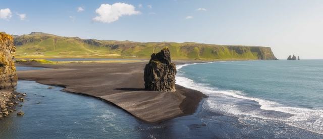
Arnardrangur, a rock stack in the surf below the lower part of Dyrhólaey, named after the eagles that once nested on it.
Tours and trips that include Dyrhólaey, booked directly with a local travel agency in Iceland.