Iceland Travel Guide logo Iceland Travel GuideLOCAL TRAVEL AGENCY IN ICELAND My trip Talk to a local
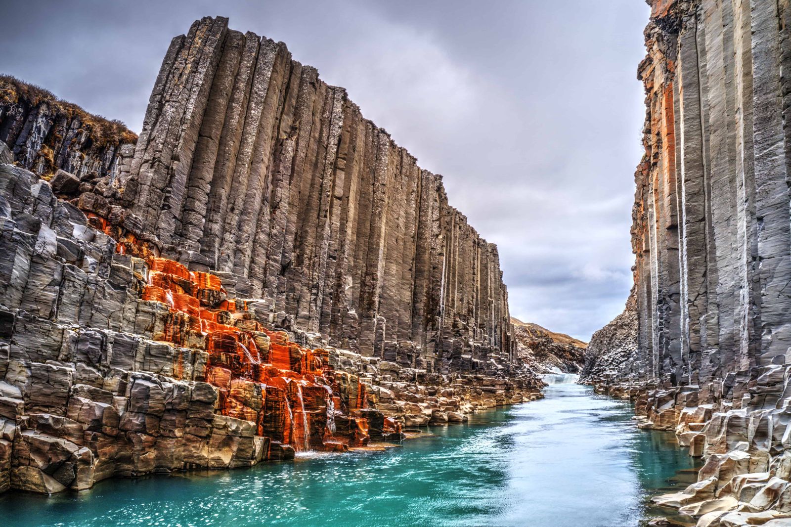
Stuðlagil canyon

East IcelandCanyonParking feeSummer easiest

See it on one of our Ring Road tours

STUÐLAGIL CANYON IN SHORT

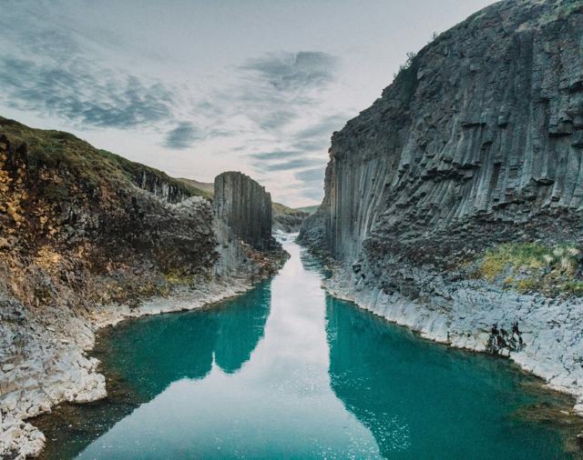
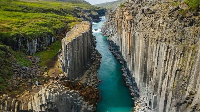
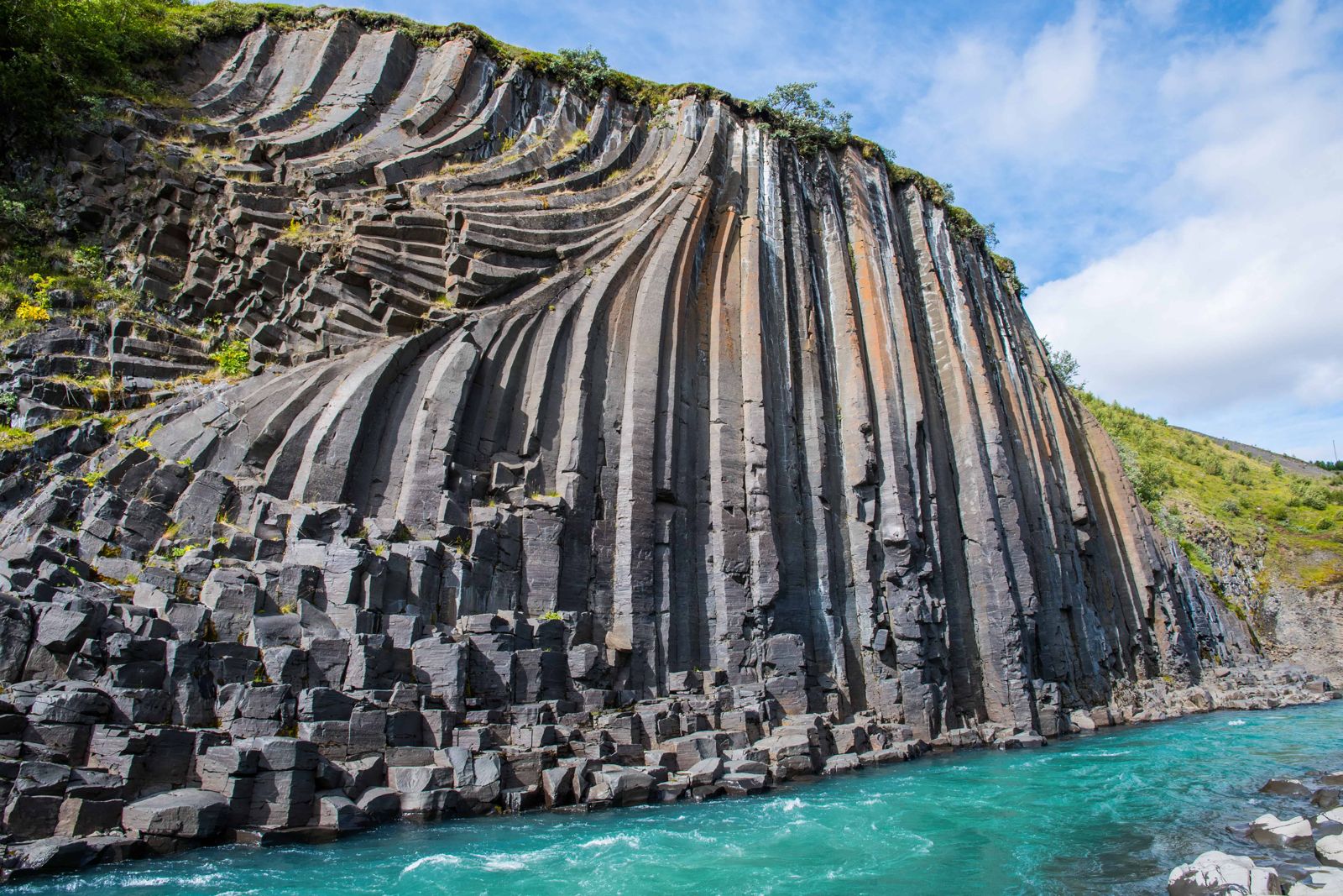
Stuðlagil is a canyon of basalt columns and a blue-green river in the Jökuldalur valley in East Iceland, about 70 km (a little over an hour) from Egilsstaðir and roughly 600 km (7–8 hours) from Reykjavík. There is no entrance fee, but parking costs about ISK 1,000. There are two ways to see it: a short walk to viewing platforms on the west side at Grund, or a hike of 5–10 km return on the east side from Klaustursel, which takes you down among the columns.

ON THIS PAGE
Quick factsHistoryGetting thereRoutesColumnsBest time to visitSafety tipsFacilitiesMapNearbyWhere to stayFAQ

About Stuðlagil Canyon

Stuðlagil sits on the Jökla (Jökulsá á Dal) river in the upper part of Jökuldalur, cutting through walls of tightly packed hexagonal basalt columns. The canyon was mostly hidden under fast, glacial-grey floodwater until the Kárahnjúkar hydropower project diverted much of the river in the late 2000s. The water level dropped and far more of the columns came into view than anyone had seen before. The water that remains carries less glacial silt and runs blue-green for much of the year.

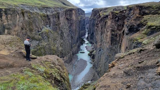
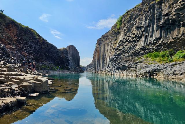
There are two ways to see it, on opposite banks, and they give very different experiences. The classic photograph most people have seen is usually taken from the east side, at the base of the canyon after a longer hike. The west side gives a quicker, higher view down into the gorge.

The colour is not guaranteed. When the Hálslón reservoir upstream is full, usually from some time in August into October, overflow water is released into the Jökla and the river turns grey-brown again. Spring meltwater can do the same. Late June and July are the safest bet for clear, blue-green water.

Quick facts

GPS65.1635, -15.3070 (the canyon)
RiverJökla (Jökulsá á Dal)
RegionEast Iceland, upper Jökuldalur valley
From ReykjavíkAbout 600 km, around 7–8 hours by car
From EgilsstaðirAbout 52 km on the Ring Road to the Road 923 turn-off, then 14–19 km of gravel: around 70 km and a little over 1 hour
From MývatnAbout 1.5 hours by car
EntryNo entrance fee. Parking is about ISK 1,000 per car, paid in the Parka app
ParkingGrund farm (west side); Klaustursel by the Jökla bridge and a second car park by Stuðlafoss (east side)
West side walkAbout 250 m on a path and stairs to the viewing platforms; allow 20–30 minutes
East side hikeAbout 10 km return from the bridge, or about 5 km return from the second car park (45–60 minutes each way)
ToiletsAt Grund (paid); none on the east side

A canyon uncovered by a dam

The Jökla was once one of the mightiest glacial rivers in Iceland and is still the longest river in the east. For most of modern memory this stretch ran high, fast and grey with sediment, hiding the basalt columns beneath it, and it split the valley into an east and a west side with few places to cross. When the Kárahnjúkar hydropower scheme diverted much of the river's flow in 2007–2009, the water level in the ravine dropped by about 7–8 metres, and columns that had rarely, if ever, been seen came into view. Local farmers reportedly knew the rock was there, but almost no visitors had seen it. The dam was controversial, but without it the canyon would still be under water.

Photographs of the newly visible canyon began circulating within a few years, and Stuðlagil went from an obscure local spot to one of the most photographed places in East Iceland in a short space of time, which is also why the hiking paths and car parks are relatively new and still developing.

How to get to Stuðlagil Canyon

By carStuðlagil lies between Egilsstaðir and Mývatn. From Egilsstaðir, drive the Ring Road (Route 1) west for about 52 km. At Skjöldólfsstaðir, turn south onto gravel Road 923 into Jökuldalur. For the east side hike, stop at the farm Klaustursel after about 14 km. For the west side platforms, carry on to the farm Grund, about 19 km from the Ring Road. The two sides are on opposite banks, so decide which one you want before you set off.
On a guided tourDay tours from Egilsstaðir and multi-day Ring Road or East Iceland itineraries often include Stuðlagil, which is a practical option if you would rather not drive the gravel road yourself.
By public transportThere is no scheduled bus service to the canyon. A rental car or organised tour from Egilsstaðir is the realistic way to get there.
ParkingParking is charged at about ISK 1,000 per car and paid in the Parka app. In July and August the car parks fill up, so come early in the morning or in the evening.

Road 923 is gravel. It is kept open all year and a normal car can manage it in summer, but drive slowly, and check umferdin.is and vedur.is before setting out in poor weather or outside summer.

How to get to Stuðlagil: the two hiking routes

There are only two ways to reach the canyon, one on each bank. Both start from Road 923.

Route 1: Grund, the west side viewpointDrive about 19 km along Road 923 to the farm Grund and park. A path and stairs lead about 250 metres down to viewing platforms above the canyon. It is short, but the slope is high and steep, so the climb back up takes some effort, and it is slippery in winter. You look down on the columns from above and cannot reach the river on this side. Allow 20–30 minutes.
Route 2: Klaustursel, the east side hikeDrive about 14 km along Road 923 to the farm Klaustursel and park by the bridge over the Jökla. Cross the bridge and follow the track upstream along the east bank. It is about 5 km each way from the bridge, on easy, mostly level ground, so allow three hours or more for the return trip.
The shorter start: the second car parkYou can drive over the bridge and about 2 km further along a rough dirt track to a second car park by Stuðlafoss. From there it is about 2.5 km each way, 45–60 minutes. The track is rutted and a car with good ground clearance is advised. If in doubt, park at the bridge and walk.
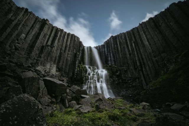
Stuðlafoss on the wayThe east side trail passes Stuðlafoss, a waterfall that drops over its own wall of basalt columns. It is right beside the path and worth a few minutes in either direction.
Down to the riverAt the canyon on the east side you can climb down among the columns to the water's edge. This takes some care and sure feet: the rocks are wet and very slippery. Never go into the river. The Jökla is a glacial river, close to freezing, with a strong current, and entering it is forbidden.

Geese nest along the river. From 1 May to 10 June, keep strictly to the marked trail.

The hexagonal basalt columns at Stuðlagil

The name says what it is: stuðlar are basalt columns and gil is a ravine. The columns form by a process called columnar jointing. When a thick flow of basalt lava cools slowly, it shrinks and cracks, and the cracks spread through the rock in a regular pattern that leaves columns, often with six sides.

What you see today is the result of a process that began long before anyone set foot in Iceland. The river then did the rest, cutting down through the lava and exposing the columns in cross-section. Stuðlagil has one of the largest displays of basalt columns in the country, which is why photographers travel across Iceland to see it.

Best time to visit Stuðlagil Canyon

Summer (June–August)The easiest season, with the paths clear and the longest daylight. In early July the sun is up for around 20 hours. The water is most reliably blue-green in late June and July; from about August the reservoir can overflow and turn the river grey-brown.
Autumn (September–October)Quieter, with autumn colours in the valley, but the river is often grey-brown while the reservoir overflows. The columns are still worth the trip.
Winter and springRoad 923 stays open but can be icy, daylight is short, and the east side hike is much harder in snow and ice. The stairs at Grund can be slippery. Spring meltwater often colours the river.

Safety and practical tips

  • Decide in advance which side you want: east for the close-up view from the canyon floor, west for the quick look from above. Doing both means driving back down the valley and around.
  • Wear proper hiking boots. The east side trail is uneven and sometimes muddy, and the slope at Grund is steep.
  • Do not go into the river, and take great care on the wet rocks if you climb down among the columns.
  • Bring water and check the weather. There is no shelter on either trail.
  • Pay for parking in the Parka app, and come early or late in the day in high summer.
  • For blue-green water, aim for late June or July. Later in summer the river can turn grey-brown.
  • Combine the visit with other East Iceland stops nearby, as Stuðlagil alone does not fill a full day.

Facilities and accessibility

Grund has a car park and toilets, which are charged for. There is no shelter on either trail, and the nearest town with full services is Egilsstaðir.

On the map

Open in Google Maps →

Nearby places worth a stop

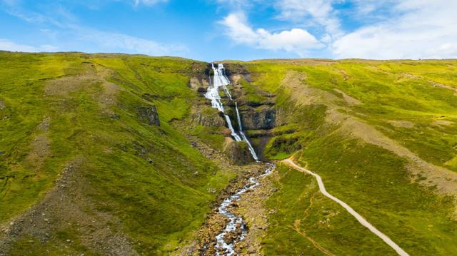
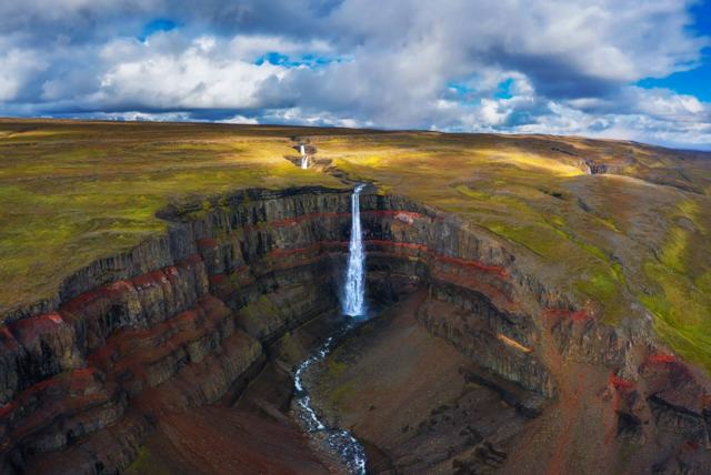
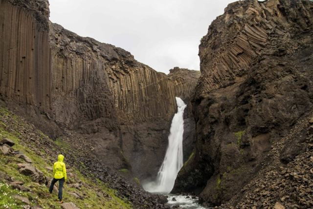
StuðlafossStuðlafossBasalt column waterfall on the east side trailRjúkandiRjúkandiTwo-step waterfall beside the Ring Road in JökuldalurEgilsstaðirEgilsstaðirThe nearest town, a little over an hour awayHengifossHengifossTall waterfall with striped rock layers, in the same regionLitlanesfossLitlanesfossBasalt column waterfall on the way to Hengifoss
Borgarfjörður eystriPuffin colony and coastal village further north

Where to stay near Stuðlagil Canyon

Egilsstaðir has the main range of hotels and guesthouses in East Iceland and makes the most convenient base for visiting Stuðlagil.

Stuðlagil Canyon FAQ

Is Stuðlagil free to visit?

There is no entrance fee, but parking costs about ISK 1,000 per car, paid through the Parka app.

Which side should I choose, east or west?

The east side (Klaustursel) gives the close view from the canyon floor that most photos show, after a longer hike. The west side (Grund) is a short walk to platforms that look down from above.

How long is the hike to Stuðlagil?

On the east side it is about 10 km return from the bridge at Klaustursel, or about 5 km return from the second car park by Stuðlafoss. On the west side it is only about 250 metres from the car park at Grund, but steep.

How far is Stuðlagil from Egilsstaðir?

About 70 km: 52 km on the Ring Road, then 14–19 km on gravel Road 923. Allow a little over an hour.

Why is the water blue-green here?

A hydropower project diverted much of the glacial river in the late 2000s, lowering the flow and letting the remaining water run clearer.

When is the water blue?

Usually from early summer until some time in August. When the reservoir upstream overflows, typically August to October, and during spring melt, the river turns grey-brown.

Is Stuðlagil suitable for a day trip from Reykjavík?

Not really. It is about 600 km away, so it is usually visited as part of a multi-day trip through East Iceland rather than a day trip from the capital.

See Stuðlagil Canyon with a local

Tours and trips that include Stuðlagil Canyon, booked directly with a local travel agency in Iceland.
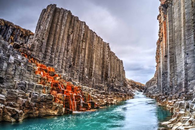
Stuðlagil Canyon Tour from SeyðisfjörðurDAY TOURStuðlagil Canyon Tour from SeyðisfjörðurFrom 26,990 ISK per personStuðlagil Canyon, Karahnjukar Dam & Laugavallalaug Hot SpringDAY TOURStuðlagil Canyon, Karahnjukar Dam & Laugavallalaug Hot SpringFrom 50,710 ISK per personStuðlagil Canyon Hiking TourDAY TOURStuðlagil Canyon Hiking TourFrom 50,000 ISK per personStuðlagil Canyon & VökSHORE EXCURSIONStuðlagil Canyon & VökFrom 49,900 ISK per personStuðlagil Canyon Private TourSHORE EXCURSIONStuðlagil Canyon Private TourFrom 290,000 ISK per groupStuðlagil Canyon Private Jeep TourPRIVATEStuðlagil Canyon Private Jeep TourFrom 199,900 ISK per group
More places in East Iceland