Iceland Travel Guide logo Iceland Travel GuideLOCAL TRAVEL AGENCY IN ICELAND My trip Talk to a local

Þórsmörk: the Valley of Thor

HighlandsNature reserveFree entrySummer access only
ÞÓRSMÖRK IN SHORT

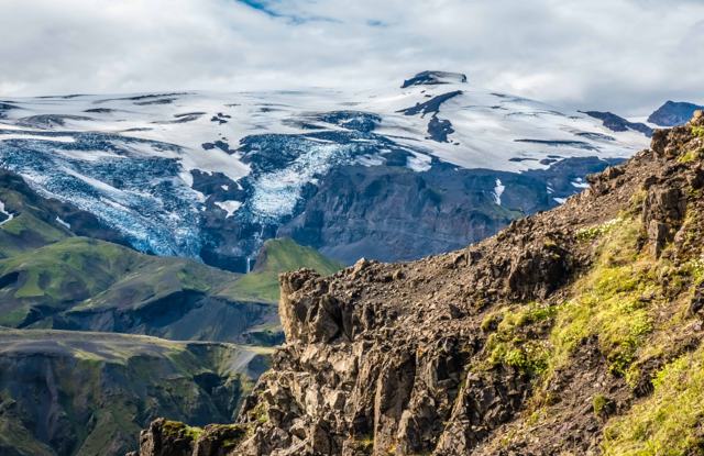
Þórsmörk ("Thor's Forest") is a sheltered valley in the South Iceland highlands, surrounded by the glaciers Eyjafjallajökull, Mýrdalsjökull and Tindfjallajökull. It is about 150 km from Reykjavík but only reachable by 4x4 on the F249 mountain road, which crosses the Krossá river, or by a seasonal highland bus. It is free to enter, open roughly June to September, and most visitors come for a day hike or to start a multi-day trek.

ON THIS PAGE
Quick factsHistoryGetting thereHikingCamping & hutsBest time to visitSafety tipsFacilitiesMapNearbyWhere to stayFAQ

About Þórsmörk

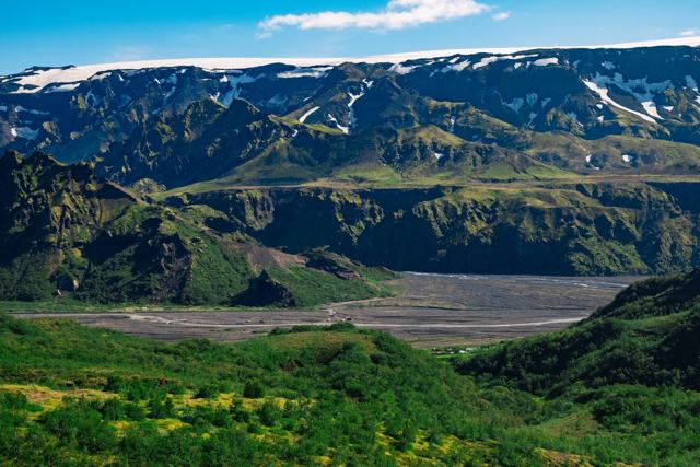
Þórsmörk sits lower and more sheltered than most of the highlands around it, which lets birch woodland, moss and wildflowers grow in a landscape otherwise dominated by black sand, lava and ice. Three glaciers frame the valley, and the meeting of rivers, canyons and volcanic rock makes it one of the most scenic parts of inland Iceland.

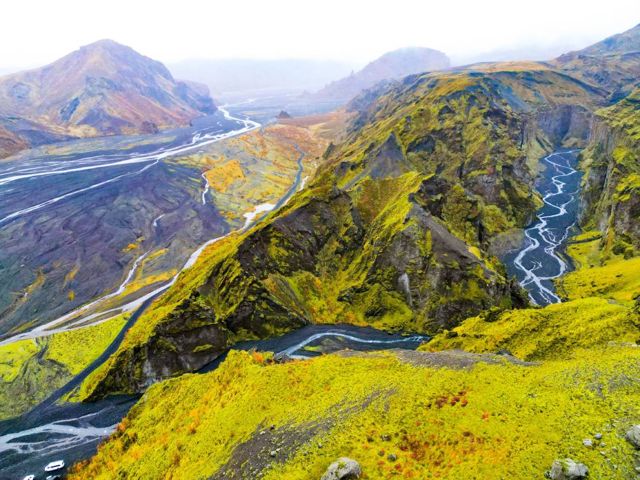
Glacial rivers braid across the valley floor and shift their channels from week to week, so the view is never quite the same twice. The largest is the Krossá, which splits the area in two: Þórsmörk proper on the north side, and Goðaland with the Básar area on the south side.

The valley is best known as the finishing point of the Laugavegur trail from Landmannalaugar and the starting point of the Fimmvörðuháls route over the pass between Eyjafjallajökull and Mýrdalsjökull to Skógar. Even without a multi-day hike, there are shorter walks around Þórsmörk itself, from easy valley strolls to steeper climbs up ridges like Valahnúkur for panoramic views.

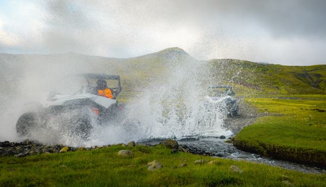
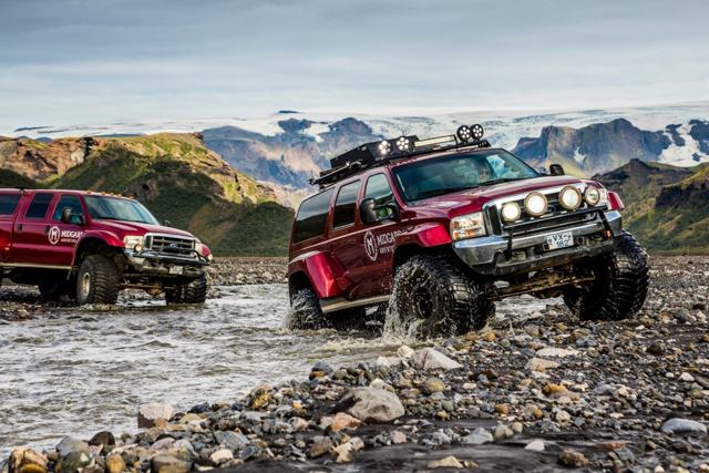
Getting there is part of the experience: the F249 road crosses the Krossá river, which changes course and depth with the weather and glacial melt, so it is genuinely unsuitable for ordinary rental cars.

Quick facts

RegionSouth Iceland highlands, between three glaciers
From ReykjavíkAbout 150 km, around 3–4 hours including the mountain road
Access roadF249, includes crossing the Krossá river
Vehicle neededModified 4x4 only; standard rental cars are not permitted or able to cross the river
EntryFree
SeasonRoad and huts generally open June to September
Hiking trailsLaugavegur (from Landmannalaugar) and Fimmvörðuháls (to/from Skógar)
Time neededA day trip is possible, but many stay overnight to hike further
ProtectedPart of a nature reserve; camp only in designated areas

Named for the god of thunder

Þórsmörk means "Thor's forest" or "Thor's woods", after the Norse god associated with strength and storms, a fitting name for a green refuge surrounded by three of Iceland's most active glacial volcanoes. Despite the setting, the valley itself has largely escaped the worst of eruptions and floods over the centuries, which is part of why birch woodland has been able to survive here while much of lowland Iceland lost its tree cover long ago.

Today it is a base for hikers tackling the Laugavegur and Fimmvörðuháls trails, and a well-known day-trip destination for those who want a taste of the highlands without a multi-day hike.

How to get to Þórsmörk

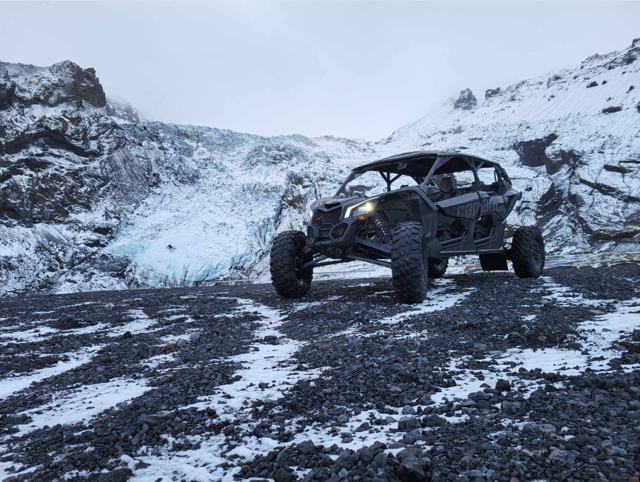
On a guided tourSuper-jeep day tours from Reykjavík or the South Coast handle the river crossing safely and often combine Þórsmörk with short hikes and viewpoints.
By the highland busA seasonal 4x4 bus service runs into Þórsmörk from around Hvolsvöllur, Seljalandsfoss and the Krossá car park roughly from June to September. This is the standard way in for hikers without their own super-jeep.
By carOnly a properly equipped, modified 4x4 should attempt the F249 and the Krossá crossing. Water depth changes daily; do not attempt it in an ordinary rental car, even one marketed as 4x4.
On footHikers arrive via the Laugavegur trail from Landmannalaugar (about 3–4 days) or the shorter, steeper Fimmvörðuháls route from Skógar (a long single day or overnight).

The Krossá river crossing is the main hazard on this route and has caught out many rental cars. If in doubt, park at the Krossá car park and take the highland bus for the final stretch.

Hiking trails in Þórsmörk

There is a walk here for every level, from a flat riverside stroll to two of Iceland's best-known long-distance routes. Trails are marked, but conditions change quickly, so ask the hut wardens about rivers and weather before you set off.

Valahnúkur: the panorama pointThe classic short hike. Valahnúkur is a hill about 460 m high between Langidalur and Húsadalur, and the marked path reaches the top in roughly 30–45 minutes from either side. The view is a full circle: the Krossá and Markarfljót river plains, Eyjafjallajökull, Mýrdalsjökull and Tindfjallajökull. A loop over the top and back along the valley is about 4 km and takes around 1.5 hours.
Along the KrossáThe easiest walk in the valley follows the river through birch woods between Húsadalur and Langidalur. It is nearly flat, has open views of the glacial river and the mountains on the far side, and suits anyone who wants a gentle hour outdoors.
Básar and GoðalandOn the south side of the Krossá, well-kept paths wind through sheltered birch woodland around the Básar huts, past small ravines and along the river. It is a good area for short walks and the starting point for the climb towards Fimmvörðuháls.
Tindfjöll circleA longer day walk of about 9 km and 4–5 hours from Langidalur, climbing above the woods to ridges with views over the whole valley. Some sections are narrow and steep, so it is for sure-footed walkers in good weather.
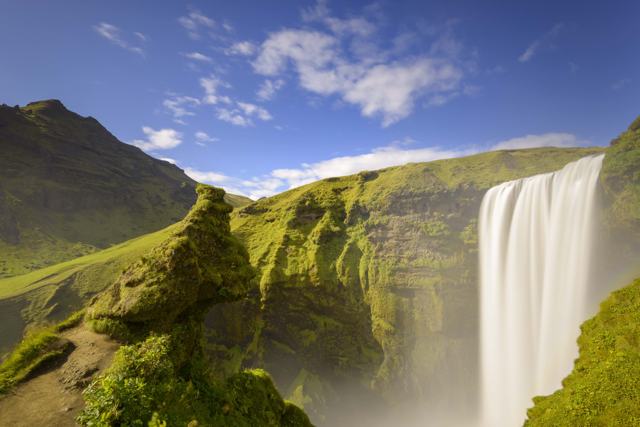
Fimmvörðuháls: the fire and ice trekA demanding trail of about 25 km between Skógar, by Skógafoss, and Þórsmörk, crossing the pass between Eyjafjallajökull and Mýrdalsjökull. It passes the lava and the two craters left by the 2010 eruption and takes around 10 hours, or two days with a night in a hut. Snow lies on the pass well into summer.
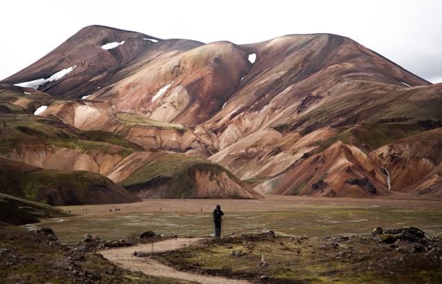
Laugavegur: the classic multi-day trailAbout 55 km from Landmannalaugar to Þórsmörk, usually walked in 3–4 days. It runs from colourful rhyolite mountains and hot springs, across black sand and rivers you have to wade, and ends in the birch woods of Þórsmörk.

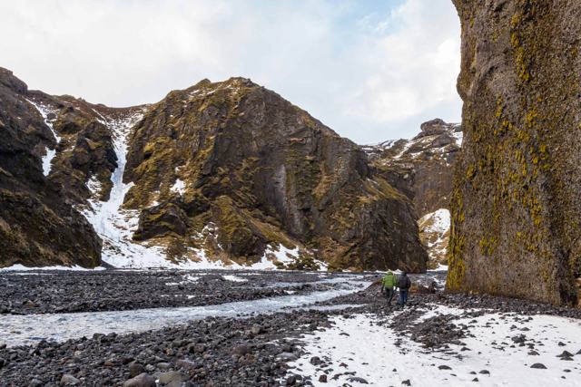
Stakkholtsgjá, a narrow canyon with a waterfall at its end, is a short stop on the F249 on the way in. The walk into it takes about 1.5 hours there and back.

Camping, huts and where to base yourself

Staying overnight is the best way to see Þórsmörk, because day visitors leave by late afternoon and the valley goes quiet.

HúsadalurOn the north side of the valley, with cabins, dormitory beds, a campsite and a restaurant. The highland buses stop here, and it is the end point for many Laugavegur hikers.
LangidalurA mountain hut and campsite by the Krossá, at the foot of Valahnúkur. Simple bunk accommodation, a shared kitchen and a small shop in summer.
BásarHuts and a large campsite in the woods of Goðaland, on the south side of the Krossá. Vehicles reach it without fording the Krossá itself, though the road still crosses several other rivers. It is the natural base for Fimmvörðuháls.

Campsites have toilets and basic washing facilities, and the huts have bunks and shared kitchens. Bring a sleeping bag for the huts. Wild camping is not allowed in the nature reserve, so use the marked campsites.

Walkers cross the Krossá on movable footbridges, which are shifted when the river changes course. Never try to wade it.

Best time to visit Þórsmörk

Summer (June–August)The only season with reliable road access, the highland bus running, huts open and the widest range of hiking options.
WinterThe area is largely inaccessible except with specialist super-jeep operators; hiking trails are closed and huts unstaffed.

Exact opening and closing dates depend on snowmelt and river conditions each year, so check current status before planning a visit outside peak summer.

Safety and practical tips

  • Do not drive the F249 or cross the Krossá in a standard car; use the highland bus or a super-jeep tour instead.
  • Weather changes fast in the highlands; bring warm, waterproof layers even in summer.
  • If hiking the Laugavegur or Fimmvörðuháls trails, book huts or campsites in advance in peak season.
  • Rivers and trails can be closed on short notice after heavy rain; check safetravel.is before setting out.
  • Bring cash or a card for any hut fees, as facilities are limited.
  • If you only have a few hours, walk up Valahnúkur. It gives the widest view for the least effort.
  • Stay overnight if you can. Evenings and early mornings are the quietest and often the clearest.
  • Stay on marked paths. The birch woods and moss here grow slowly and damage easily.

Facilities and accessibility

Volcano Huts and other operators run huts, a restaurant and basic shop in Þórsmörk in summer, along with campsites at Húsadalur, Langidalur and Básar. There is no fuel station in the valley itself, and the last shops and fuel are in Hvolsvöllur.

On the map

Open in Google Maps →

Nearby places worth a stop

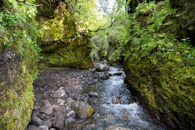
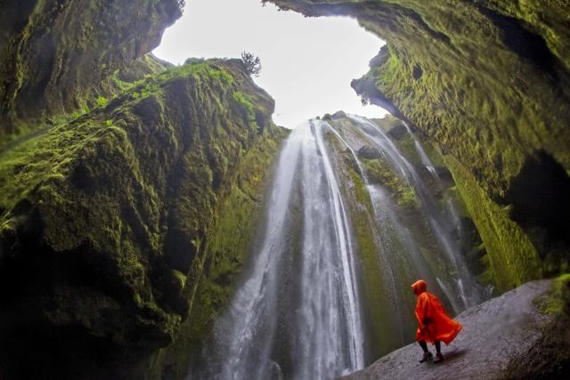
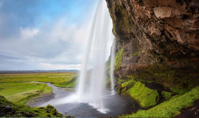
SeljalandsfossSeljalandsfossWaterfall you can walk behind, on the way inSkógafossSkógafossThe other end of the Fimmvörðuháls trailEyjafjallajökullEyjafjallajökullOne of the glaciers surrounding the valleyLandmannalaugarLandmannalaugarStart of the Laugavegur trailStakkholtsgjáStakkholtsgjáNarrow canyon beside the F249NauthúsagilNauthúsagilRavine with a waterfall, near the start of the road inGljúfrabúiGljúfrabúiWaterfall inside a cleft, next to Seljalandsfoss
EinhyrningurThe “unicorn” mountain north of the Markarfljót

Where to stay near Þórsmörk

Most visitors base themselves along the South Coast, around Hvolsvöllur or Seljalandsfoss, and take a tour or bus in for the day. Hikers doing multi-day treks stay in Þórsmörk's mountain huts or campsites, and anyone who wants a quiet evening in the valley can book a cabin, a bunk or a tent pitch at Húsadalur, Langidalur or Básar.

Þórsmörk FAQ

Can I drive to Þórsmörk in a normal rental car?

No. The F249 crosses the Krossá river, which is unsuitable for ordinary vehicles, including most rental 4x4s. Use the highland bus or a super-jeep tour instead.

When is Þórsmörk open?

Roughly June to September, depending on snow and river conditions each year.

Is Þórsmörk part of the Laugavegur trail?

Yes, it is the finishing point of the popular multi-day Laugavegur trail from Landmannalaugar.

Do I need to be an experienced hiker to visit?

No. Short, easy walks around the valley floor are possible for most visitors; the longer multi-day trails require more preparation and fitness.

Is there phone signal in Þórsmörk?

Coverage is patchy in the highlands, so do not rely on your phone for navigation or emergencies.

What are the best hikes in Þórsmörk?

For a short visit, Valahnúkur (about 1.5 hours) and the walk along the Krossá. For a full day, the Tindfjöll circle. The long routes are Fimmvörðuháls (about 25 km) to Skógar and the Laugavegur trail (about 55 km) from Landmannalaugar.

Can you camp in Þórsmörk?

Yes, at the campsites in Húsadalur, Langidalur and Básar. There are also huts and cabins. Wild camping is not allowed.

What does Þórsmörk mean?

Thor's forest or Thor's woods. It is often called the Valley of Thor, after the Norse god of thunder.

See Þórsmörk with a local

Tours and trips that include Þórsmörk, booked directly with a local travel agency in Iceland.
Thorsmork Super Jeep Tour from HellaDAY TOURThorsmork Super Jeep Tour from HellaFrom 39,990 ISK per personThorsmork Buggy TourDAY TOURThorsmork Buggy TourFrom 34,990 ISK per personThorsmork Buggy TourDAY TOURThorsmork Buggy TourFrom 89,990 ISK per personÞórsmörk Private TourPRIVATEÞórsmörk Private TourFrom 225,000 ISK per groupThorsmork HikeDAY TOURThorsmork HikeFrom 42,000 ISK per personThorsmork Super Jeep TourDAY TOURThorsmork Super Jeep TourFrom 39,000 ISK per person
More places in Highlands