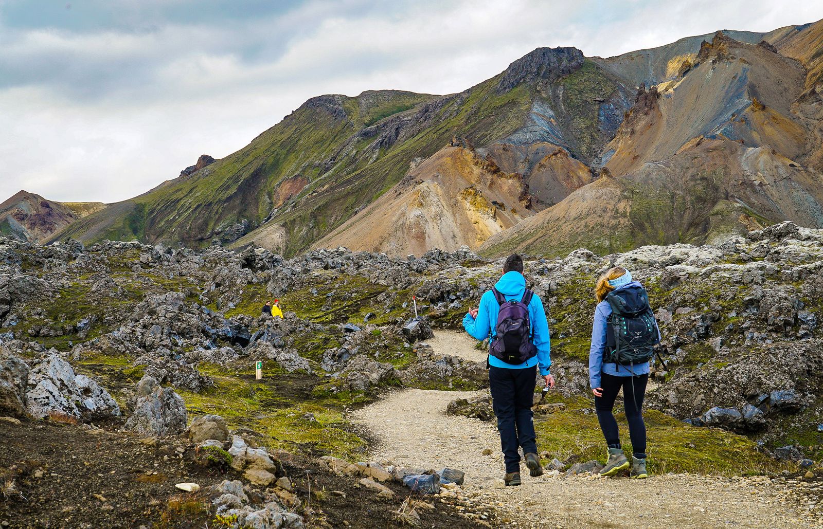
Landmannalaugar is the best base for hiking in Iceland's southern highlands. From the campsite you can walk short loops through lava and coloured rhyolite hills in an hour or two, climb Bláhnúkur or Brennisteinsalda in half a day, or start the four-day Laugavegur trek to Þórsmörk. The hiking season runs from late June to mid-September, and in summer you need to book parking or come by bus or tour.
Where is Landmannalaugar?
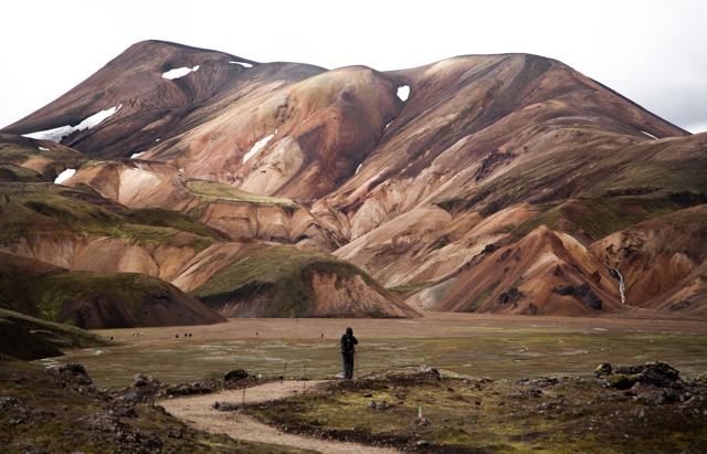
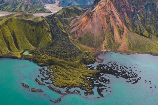
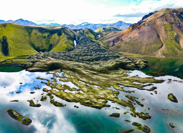
Landmannalaugar sits at about 550 metres above sea level in the Fjallabak Nature Reserve, north of Mýrdalsjökull and east of the volcano Hekla. The campsite and hut lie at the edge of Laugahraun, a lava field from an eruption in around 1477. Natural hot springs run out from under the lava, and anyone can bathe in them.
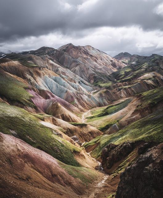
What makes the hiking special is the rock. Most Icelandic mountains are dark basalt, but here the hills are rhyolite, streaked with pink, red, yellow, green and grey. Add black obsidian, steaming vents and snow patches, and even a short walk feels varied. Our Landmannalaugar place guide has more on the area itself.
Best day hikes from Landmannalaugar
All of these start at or near the campsite and are marked. Times are for a steady pace with stops for photos.
- Laugahraun lava loop (1–2 hours, easy). A short circuit through the obsidian lava field just above the campsite. A good first walk on arrival day.
- Grænagil loop (1.5–2 hours, easy). Around 3.5 km with little climbing. It follows the green-tinged Grænagil canyon and circles back through the lava. The best choice for families and beginners.
- Brennisteinsalda (2.5–3 hours, moderate). About 8 km return through Laugahraun and past steaming vents to the 855-metre summit of the 'sulphur wave', one of the most colourful hills in Iceland. The top gives a wide view over the valley and the start of the Laugavegur.
- Bláhnúkur (3–4 hours, moderate to hard). The 'blue peak' rises to 945 metres, and the round trip is about 7 km with roughly 340 metres of climbing. Some parts are steep and loose. On a clear day you can see five glaciers from the top.
- Bláhnúkur and Brennisteinsalda combined (4–5 hours). Most fit walkers join the two into one loop: up Bláhnúkur, down its south side, and back over Brennisteinsalda.
- Suðurnámur (3.5–4 hours, moderate). A ridge walk on the other side of the valley, with a different view back over the colourful hills and fewer people.
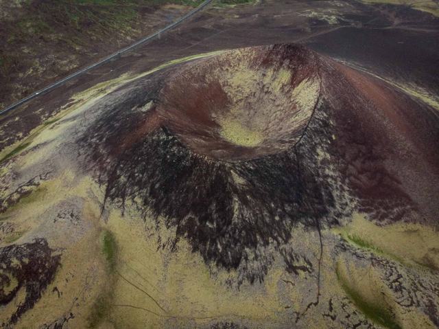
- Ljótipollur (about 4 hours, moderate). The 'ugly puddle' is actually a red crater with a bright blue lake. The walk heads north past lava and cones. You can also reach it by car on the F208 north of the campsite.
The Laugavegur trail to Þórsmörk
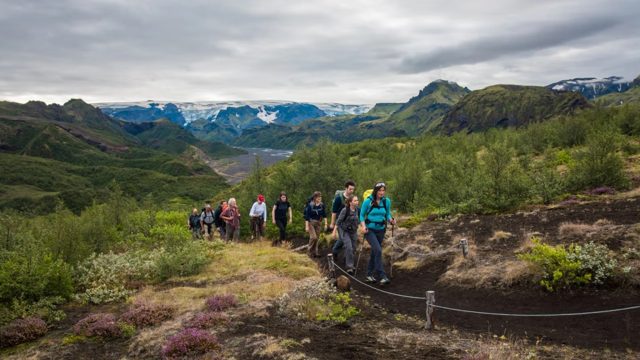
The Laugavegur is Iceland's most famous trek. It runs about 55 km from Landmannalaugar south to Þórsmörk, past obsidian fields, geothermal areas, lakes, black sand deserts and finally birch woods. Most people take four days and hike north to south.
The usual stages are Landmannalaugar to Hrafntinnusker (12 km), Hrafntinnusker to Álftavatn (12 km), Álftavatn to Emstrur/Botnar (about 15–16 km) and Emstrur to Þórsmörk (about 15 km). The first day holds most of the climbing and the highest point, around 1,050 metres at Hrafntinnusker, where snow and fog can linger even in July. There are several unbridged rivers to wade on the later stages, so bring river shoes and cross with others.
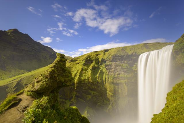
Huts along the route are run by Ferðafélag Íslands and book up months ahead for July and August. They only take bookings north to south. If you want to keep going, the Fimmvörðuháls pass continues from Þórsmörk over to Skógar and Skógafoss. If you would rather not arrange huts and food yourself, our guided Laugavegur & Fimmvörðuháls Trek is a six-day trip with mountain huts, meals and luggage transfers between huts; check the latest Fimmvörðuháls conditions before you book. See our Fimmvörðuháls guide and our guide to hiking in Þórsmörk.
Hellismannaleið: a quieter multi-day trek
If the Laugavegur is full or you want fewer people, the Hellismannaleið is a good alternative. It runs about 55 km west from Landmannalaugar to Rjúpnavellir near Hekla, usually in three days. The stages are Landmannalaugar to Landmannahellir (about 16.5 km), Landmannahellir to Áfangagil (17–18 km) and Áfangagil to Rjúpnavellir (about 21 km), with huts at each stop.
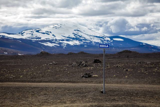
The name comes from the cave at Landmannahellir, used for centuries to shelter people and horses. Expect lava, sand plains, lakes and views of Hekla, but fewer facilities than on the Laugavegur. Some hikers link it with the Laugavegur for a longer walk.
When to go
The hiking season is from late June to mid-September. The FÍ hut at Landmannalaugar opens roughly from 20 June to 15 September, with a warden on site. The northern road in, the F208 from Sigalda, has opened on average in early June in recent years, but other highland roads can stay closed until late June or early July after a snowy winter.
July and August give the most reliable trail conditions and the longest days. Early season can mean snow on the higher paths and wet, muddy ground. September brings autumn colours and fewer people, but colder nights and a higher chance of storms. Read our month guides for July, August and September.
In winter the area is closed to ordinary cars. It can only be reached by specially modified super jeeps or snowmobiles.
Getting there and parking
All roads to Landmannalaugar are F-roads, open only in summer and only to 4×4 vehicles. The easiest route is the F208 from the north. The F225 is a western shortcut, and the F208 south via Eldgjá is rougher and opens later. Standard rental cars are not allowed on F-roads, and rental insurance does not cover river damage.
From 20 June to 13 September 2026 you must book parking in advance if you arrive by private vehicle between 9 am and 4 pm. Bookings are made through the official parking system and a camera reads your number plate. In 2026 the fee is 1,500 ISK for a car with up to five seats and 2,450 ISK for six to nine seats. The fee applies all year and includes use of the toilets and changing rooms.
There are two car parks. The first is before the river crossings, about a 12–20 minute walk from the campsite over a footbridge. The second is right by the hut, but you must ford the rivers to reach it. If you are not used to river crossings, park at the first one.
The simpler option is not to drive. Scheduled highland buses run from Reykjavík in summer, and a guided day tour or super jeep tour takes care of the roads, rivers and parking for you. See our Landmannalaugar tours and super jeep tours, including the Landmannalaugar Hiking Tour from Reykjavík and the Landmannalaugar Super Jeep Tour from Reykjavík.
Where to stay
There is no hotel in Landmannalaugar. The FÍ hut sleeps 78 people in bunks over two floors and costs 17,000 ISK per person per night in 2026. It has a kitchen with gas stoves, running water and a separate toilet and shower block. Book early, because it fills for most of the summer.
The campsite sits on gravel next to the hut and shares its facilities. Bring a strong tent with good pegs, as wind is common. Camping outside marked sites is not allowed in the Fjallabak Nature Reserve. See our camping guide and camping packing list.
Safety and what to bring
Highland weather changes fast, and it can snow in any month at higher points. Check the forecast before you go, leave a travel plan on safetravel.is if you are hiking alone or trekking, and carry a map or offline GPS. The emergency number is 112. Stay on marked paths, as the moss and soils here are fragile and the area is protected.
There is no shop to rely on for supplies, so bring all your food from town. For multi-day treks, carry everything you need between huts.
- Waterproof jacket and trousers
- Warm layers, hat and gloves, even in July
- Broken-in hiking boots with ankle support
- River shoes or sandals for fords
- Swimwear and a small towel for the hot spring
- Water bottle, snacks and sun cream
- Map, charged phone and a power bank
Hiking in Landmannalaugar with a guide
You do not need a guide for the marked day hikes in good weather, but a guided trip makes things much simpler. Day tours from Reykjavík usually include a few hours of walking and time in the hot spring, and guided Laugavegur treks handle huts, food and river crossings. Guides also know when to turn back in bad weather.
Browse our Landmannalaugar tours, hiking tours and highland tours. Other highland areas worth a look include Kerlingarfjöll and Mælifell; read our guide to hiking in Kerlingarfjöll.
- Landmannalaugar Private Tour: a private super jeep day from Reykjavík with Háifoss and Ljótipollur on the way, then a guided hike or a soak in the hot spring.
- 4 Day Iceland Tour: a small-group summer tour that ends with a hiking day in Landmannalaugar after the Golden Circle, the South Coast and Jökulsárlón.
- Laugavegur & Fimmvörðuháls Trek: six guided days on foot with huts, meals and bag transfers arranged, for those who want the full trek. Runs mid-June to mid-September; the 2026 season is over and we are now taking bookings for 2027.
Questions people ask
What is the best hike in Landmannalaugar?
For most people, the loop over Bláhnúkur and Brennisteinsalda. It takes 4–5 hours and shows the colourful hills, lava, steam vents and glacier views. For an easy walk, try the Grænagil loop.
Do I need to book parking in Landmannalaugar?
Yes, from 20 June to 13 September 2026 if you arrive by private vehicle between 9 am and 4 pm. A car with up to five seats costs 1,500 ISK. The fee applies all year.
Can I drive to Landmannalaugar in a normal car?
No. All access roads are F-roads that need a 4×4, and there are river crossings near the campsite. Standard rental cars are not allowed. A bus, day tour or super jeep tour is the easy option.
How long is the Laugavegur trail?
About 55 km from Landmannalaugar to Þórsmörk. Most people take four days, staying in huts or camping at Hrafntinnusker, Álftavatn and Emstrur.
When is the hiking season in Landmannalaugar?
Late June to mid-September. July and August usually have the best trail conditions. In winter the area can only be reached by super jeep or snowmobile.