Iceland Travel Guide logo Iceland Travel GuideLOCAL TRAVEL AGENCY IN ICELAND My trip Talk to a local
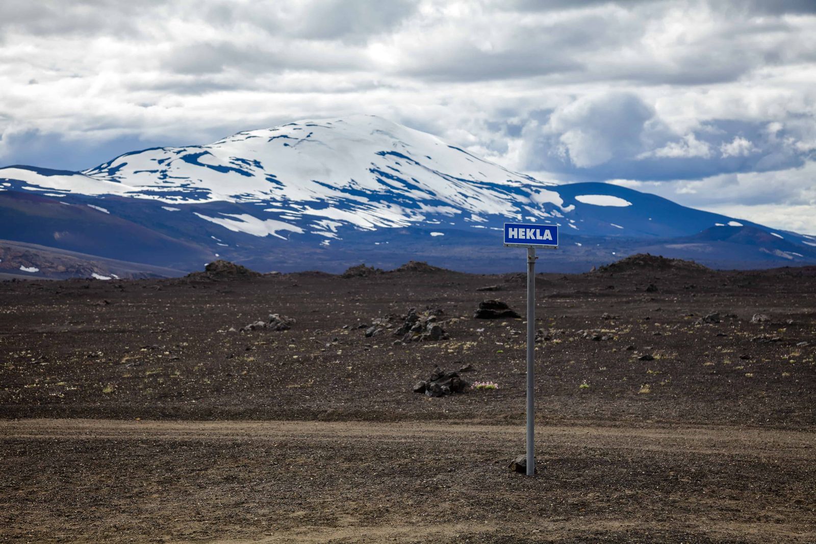
Hekla volcano, the Gateway to Hell

South IcelandVolcanoFree entrySummit hiking discouraged
HEKLA IN SHORT

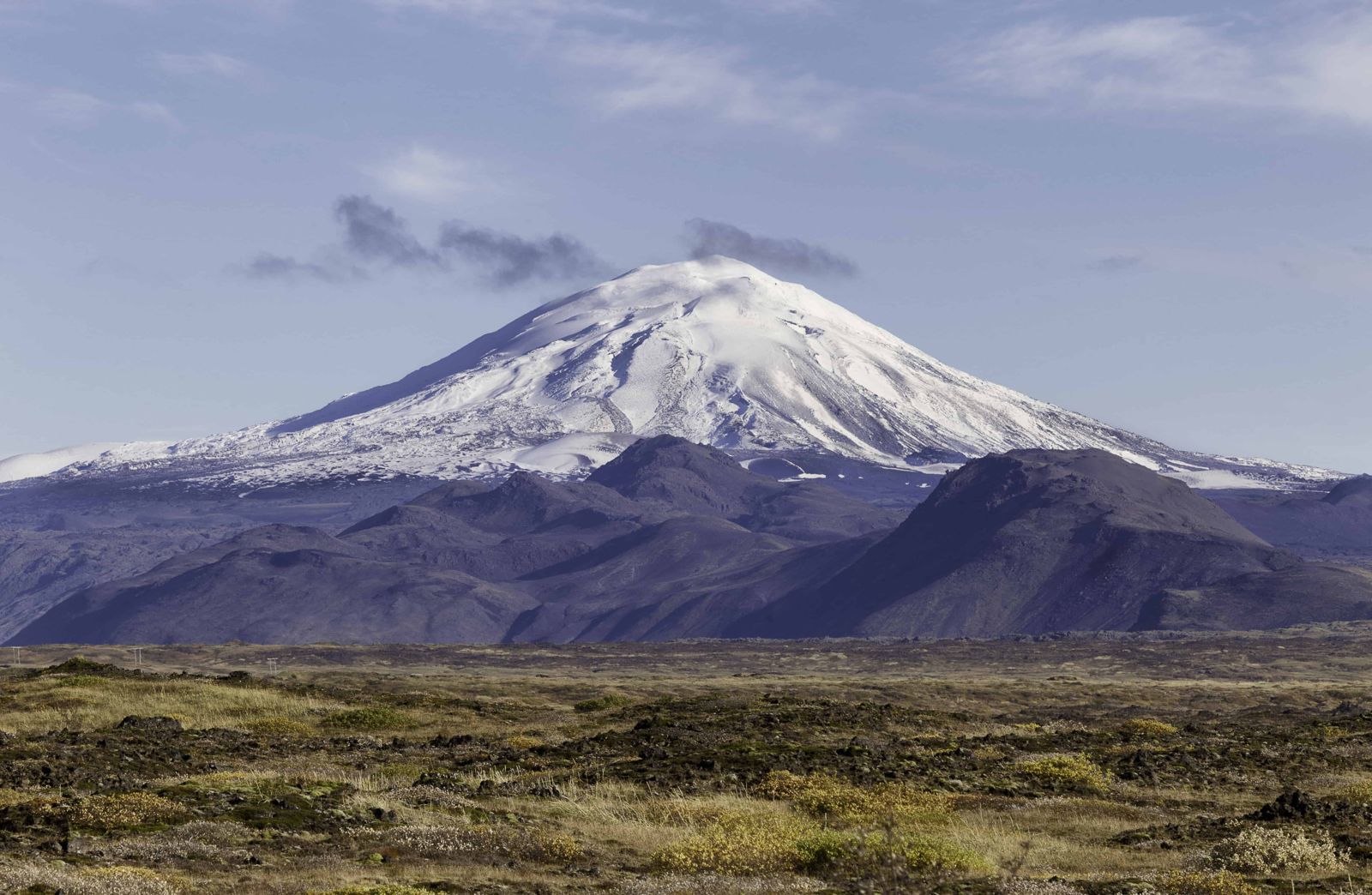
Hekla is a 1,491-metre volcano in South Iceland, one of the country's most active and historically feared, once nicknamed the "Gateway to Hell". It is about 110 km (roughly 1 hour 30 minutes) from Reykjavík, free to view from a distance, and summit hiking is discouraged because warning time before an eruption can be as short as 30 minutes.

ON THIS PAGE
Quick factsHistoryGetting thereNext eruptionSummit hikeViewpointsBest time to visitSafety tipsFacilitiesMapNearbyWhere to stayFAQ

About Hekla

Hekla is a long ridge-shaped volcano that has erupted around 20 times since Iceland was settled in the 9th century. The first eruption on record, in 1104, was also the largest, and buried farmland across South Iceland in ash. After that eruption, medieval writers began describing Hekla as a gateway to Hell, an idea that spread across Europe and lingered for centuries, partly kept alive by monks retelling the story.

The volcano is still very much active: its most recent eruption was in the year 2000, and it is watched closely because it tends to give very little warning before erupting again. That short warning window is the main reason authorities advise strongly against hiking to the summit, even though a marked path exists most of the way up.

The mountain is the highest part of a volcanic ridge about 40 km long. The most active stretch is Heklugjá, a fissure about 5.5 km long that runs along the top and can open along its whole length in the larger eruptions. There are several craters on the summit ridge, and two of them have erupted more often than the rest. Hekla stands north of Eyjafjallajökull, the volcano most visitors have heard of, and is sometimes called the Queen of Iceland's mountains.

Its output is hard to overstate. About 10% of all the ash and pumice that has fallen on Iceland in the last thousand years came from Hekla, along with some 8 km³ of lava. The name is an old Icelandic word for a short hooded cloak, which may refer to the cloud that so often sits on the summit.

Quick facts

Height1,491 m
TypeActive fissure/stratovolcano
RegionSouth Iceland, near Þjórsárdalur
EruptionsAround 20 since settlement; the first on record, in 1104, was the largest
Last eruption2000 (before that 1991, 1980–81, 1970 and 1947–48)
First ascent20 June 1750, by Eggert Ólafsson and Bjarni Pálsson
Volcanic ridgeAbout 40 km long; the Heklugjá summit fissure is about 5.5 km
From ReykjavíkAbout 110 km, around 1 hour 30 minutes by car
EntryFree (viewing from a distance)
Summit hikeStrongly discouraged by Icelandic authorities due to short eruption warning time

The Gateway to Hell

After Hekla's huge 1104 eruption buried farms and fields in ash, stories about the mountain spread across medieval Europe describing it as an entrance to Hell, with tales of tortured souls and monstrous birds around its summit. The idea is thought to have been encouraged, in part, by Cistercian monks retelling and embellishing the accounts of travellers.

That reputation held for centuries, well into the 1800s, even as Icelanders themselves lived and farmed in its shadow. Today Hekla is studied and monitored rather than feared as a supernatural gateway, but its record of frequent, sudden eruptions still commands real respect.

People believed it, too. In the Middle Ages the fear of Hekla reached far beyond Iceland, and clerics on the continent are said to have welcomed news of each eruption as proof that Hell existed. Nobody is known to have climbed the mountain until 1750.

How to get to Hekla

On a guided tourHighland and volcano-focused tours from Reykjavík or Hella often include viewpoints of Hekla, with a guide who can explain current activity levels.
By carFrom Reykjavík, take Route 1 east and turn onto Route 26 (Landvegur) a few kilometres before Hella, then follow it north-east towards the mountain. It's about 110 km in all. Route 26 is paved for much of the way and passable in an ordinary car; anything closer to the mountain is gravel or a 4x4 track.
Where exactly is Hekla?Hekla stands in a remote area between Route 26 to the west, the F225 mountain road to the north and the F210 mountain road to the south, just west of the Fjallabak Nature Reserve. No road goes up the mountain. A 4x4 and a confident driver are needed for the tracks around it, and the only way to get right up to the volcano is on foot.
By public transportThere is no public transport to the base of Hekla, so a car or a guided tour is the practical way to visit.

Hiking to the summit is strongly discouraged by Icelandic authorities: Hekla has historically given as little as 30 minutes' warning before erupting, and you should never plan a summit attempt around a promised evacuation window. Viewing from the surrounding area or lower trails is the recommended way to experience it.

When can we expect the next eruption?

In the 20th century Hekla erupted in 1947, 1970, 1980–81, 1991 and 2000. From 1970 onwards that was roughly once a decade, and then it went quiet. Scientists report that the pressure in the magma chamber beneath the mountain is now higher than it was before the last eruptions. Nobody can say exactly when the next one will come, but it could be soon.

When it does come, it could be over in a few days or carry on for more than a year. The eruption that began in 1947 ran on into 1948.

Hekla is unusual in how little notice it gives. The earthquakes that announce an eruption have typically started only 30 to 80 minutes before the lava appears. That is the reason for all the warnings on this page.

The biggest eruption of all came long before anyone lived here. Around 1000 BC the eruption known as Hekla 3 threw out an estimated 7.3 km³ of ash and rock, cooled the northern hemisphere for several years, and left traces that have been found in peat bogs in Scotland.

Hiking to the summit of Hekla

We don't recommend hiking Hekla on your own, and the authorities advise against summit trips because of the short warning time. If you are weighing it up, this is what the climb involves.

The routeThe usual way up follows the northern end of the summit ridge, which is about four kilometres long. Since the 2000 eruption a path leads most of the way to the 1,491 m top. Lower down the ground is loose lava and ash; near the summit there is snow and ice.
Time and difficultyPlan a full day. The climb alone takes three to four hours, and with the descent, breaks and the slow drive in on rough tracks, around eight hours is realistic. It is a long, steady slog rather than a technical climb, but it is exposed, with no shelter and no water.
What you needGo with an experienced guide. You need a 4x4 to reach the start, proper boots, warm and windproof layers, and glacier equipment such as crampons and an ice axe if you plan to go all the way to the top. Check safetravel.is and vedur.is on the day and leave a travel plan.
When to goSummer only. The days are long, the mountain tracks are open and there is less snow on the ridge, with clear spots to rest on the way up.
The first ascentFor centuries nobody dared to climb Hekla. The first recorded ascent was on 20 June 1750 by the naturalists Eggert Ólafsson and Bjarni Pálsson, who came back down unharmed and helped put the old stories to rest.

If the ground starts to shake or you receive a civil protection alert on your phone while on the mountain, head down at once.

Where to see Hekla from

You don't need to climb Hekla to appreciate it. On a clear day it dominates the southern lowlands.

From the Ring RoadHekla is visible from Route 1 and the South Coast on a bright day, most clearly on the stretch around Hella and Hvolsvöllur.
From Route 26Driving up Route 26 brings you alongside the mountain, with lava fields from past eruptions beside the road. This is the easiest close view in an ordinary car.
On the way to LandmannalaugarThe F225 mountain road leaves Route 26 and passes north of Hekla on its way to Landmannalaugar. It gives a different angle and the nearest views by vehicle, but it is a highland track for 4x4 vehicles and open in summer only.

Best time to visit Hekla

SummerBest access to the surrounding roads and viewpoints, with the mountain often visible for miles across the South Iceland lowlands.
WinterSnow-capped and dramatic from a distance, but access roads nearer the base can be closed or require a 4x4.

Safety and practical tips

  • Do not attempt to hike to the summit; Icelandic authorities advise strongly against it because of Hekla's short eruption warning time.
  • View the volcano from marked roads, viewpoints or lower trails instead of the summit route.
  • Check the Icelandic Meteorological Office (vedur.is) for current seismic activity before planning a visit to the area.
  • Combine a Hekla viewpoint with nearby Þjórsárdalur sights like Háifoss or Stöng, rather than treating it as a stand-alone stop.
  • Roads nearer the base can be gravel or require 4x4; check conditions before driving in beyond Route 26.
  • Pick a clear day. Hekla often hides in cloud, and from the lowlands you see nothing when it does.
  • If you want to get onto the mountain, book a guided trip rather than going alone.

Facilities and accessibility

No facilities at the volcano itself. Fuel, food and accommodation are available in Hella, the nearest town. The closest campsite is Rjúpnavellir, just above the Galtalækjarskógur woods off Route 26, which all cars can reach.

On the map

Open in Google Maps →

Nearby places worth a stop

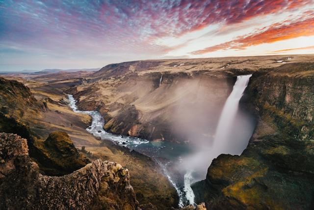
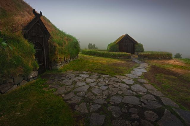
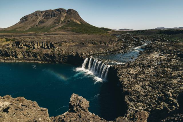
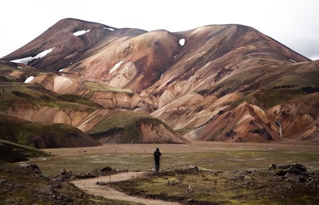
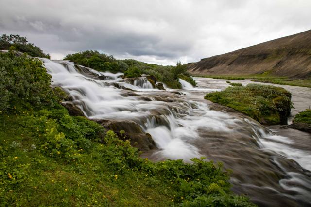
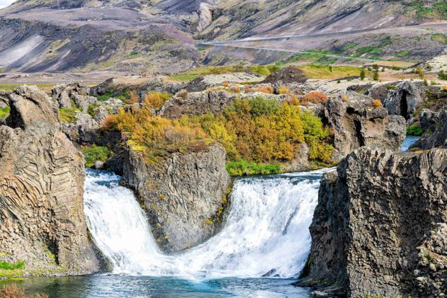
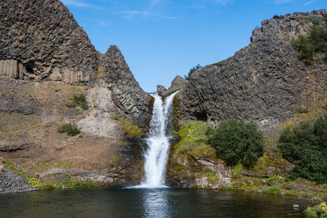
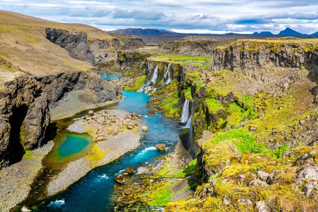
HáifossHáifossOne of Iceland's tallest waterfalls, in the same valleyÞjóðveldisbærinn StöngÞjóðveldisbærinn StöngReconstructed Viking-age farmhouseÞjófafossÞjófafossWaterfall on the Þjórsá riverLandmannalaugarLandmannalaugarColourful highland hiking area further eastFossabrekkurFossabrekkurSmall green oasis of waterfalls just off Route 26HjálparfossHjálparfossTwin waterfall in ÞjórsárdalurGjáinGjáinSmall gorge with waterfalls and lava formationsSigöldugljúfurSigöldugljúfurCanyon lined with small waterfalls, further into the highlands

Where to stay near Hekla

Hella is the closest town with a good range of accommodation, or you can base yourself further afield in Selfoss or Hvolsvöllur and drive out to view Hekla for a few hours.

Hekla FAQ

Can I hike to the top of Hekla?

A trail exists, but Icelandic authorities strongly advise against summit hikes because Hekla can give as little as 30 minutes' warning before erupting.

Is Hekla currently active?

It is one of Iceland's most active volcanoes and is monitored closely. Its last eruption was in 2000. Check vedur.is for current status before visiting.

Why is Hekla called the Gateway to Hell?

After its major 1104 eruption, medieval European writers described it as an entrance to Hell, a reputation that lasted for centuries.

How far is Hekla from Reykjavík?

About 110 km, around 1 hour 30 minutes by car.

Is it safe to view Hekla from nearby roads?

Yes, viewing from marked roads and viewpoints away from the summit is considered safe under normal conditions.

How long does the hike up Hekla take?

The climb takes three to four hours, and the whole outing is around eight hours with the descent and the drive in. It should only be done in summer, with an experienced guide.

When will Hekla erupt next?

Nobody knows. It last erupted in 2000, pressure under the mountain is reported to be higher than before that eruption, and it gives very little warning.

Do I need a 4x4 to visit Hekla?

Not to see it from Route 1 or Route 26. You do need one for the mountain tracks around the volcano, such as the F225.

See Hekla with a local

Tours and trips that include Hekla, booked directly with a local travel agency in Iceland.
Landmannalaugar Super Jeep Tour from ReykjavíkDAY TOURLandmannalaugar Super Jeep Tour from ReykjavíkFrom 46,125 ISK per personLandmannalaugar Super Jeep Tour From HellaDAY TOURLandmannalaugar Super Jeep Tour From HellaFrom 44,990 ISK per personFjallabak Super Jeep TourDAY TOURFjallabak Super Jeep TourFrom 45,000 ISK per personLandmannalaugar Private Tour in IcelandPRIVATELandmannalaugar Private Tour in IcelandFrom 207,000 ISK per group
More places in South Iceland