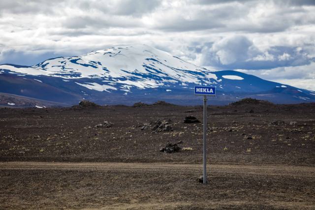
FOSSABREKKUR IN SHORTFossabrekkur is a green oasis of small waterfalls and rapids, about 150 metres wide, where the western branch of the Ytri-Rangá river drops off a ledge at the foot of Hekla. It lies just off Route 26, about 2 km south of the F225 turn-off to Landmannalaugar and 6 km north of Þjófafoss. It is free, little visited, and takes 45–60 minutes.
About Fossabrekkur
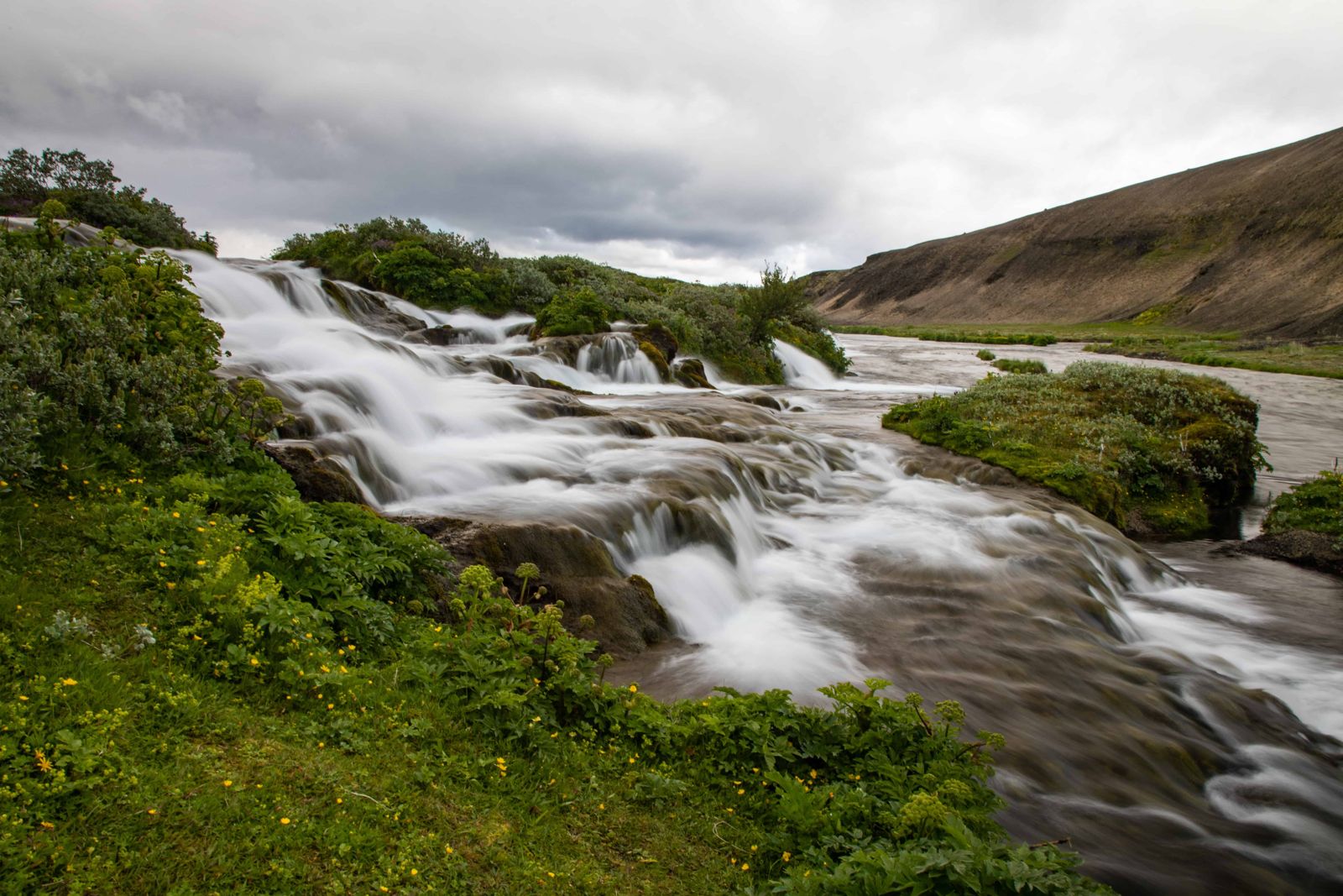
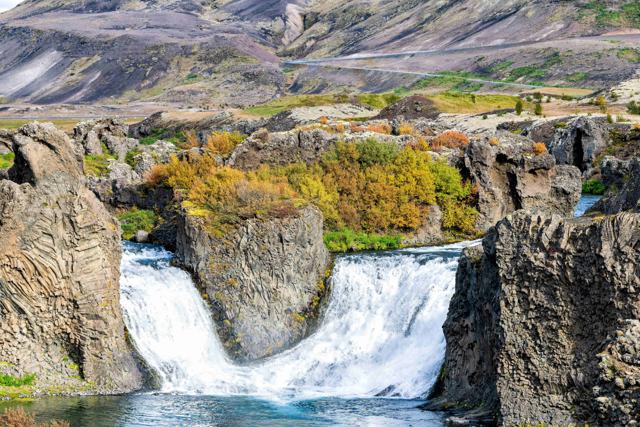
Fossabrekkur sits where the western arm of the Ytri-Rangá river drops over a series of ledges into a green, sheltered gully. The name means "waterfall slopes", and it describes the place well: rather than one clean drop, the river breaks into many small falls spread across a width of about 150 metres. Here the western arm meets the eastern one, and from this point the river runs in a single channel almost to the sea.
What makes the spot memorable is the contrast with its surroundings. This is the uppermost stretch of the Ytri-Rangá, close to its source, on the edge of the common land of Landmannaafréttur. All around is a wide plain of volcanic ash, pumice and sand from Hekla, with only a few streams. On the slope by the river, though, the water has made a small, fertile pocket of green, a quiet contrast to the black and grey desert around it.
Because it is tucked below the level of the road, most people drive straight past on their way to Landmannalaugar. That has helped keep it as it is. On a clear day, with blue sky and the mountains behind, it is one of the prettiest short stops on Route 26. The falls on the Þjórsá at Tröllkonuhlaup and Þjófafoss are close by, so the three fit into one outing.
Quick facts
RiverThe western arm of Ytri-Rangá, at its uppermost falls
RegionEdge of the highlands at the foot of Hekla, where the Landmannaafréttur common land begins
WidthAbout 150 m of small falls
Location on Route 26About 6 km north of Þjófafoss and 2 km south of the F225 junction
EntryFree
Opening hoursOpen all year; easiest from late spring to autumn, and harder to reach in winter
RoadRoute 26 (Landvegur), then a short signed side track to a car park. Not an F-road
Time needed45–60 minutes to explore
WalkA short marked trail from the car park
How to get to Fossabrekkur
By car from ReykjavíkThe route is the same as for the start of Landmannaleið. Drive east on the Ring Road (Route 1). After you cross the bridge over the Þjórsá, look for the turn onto Route 26 (Landvegur) and follow it north for approximately 50 km. Fossabrekkur is signed from the road, with Búrfell mountain across the Þjórsá to the north-west. The whole drive takes about two hours.
The last few hundred metresTurn off Route 26 at the Fossabrekkur sign and drive a few hundred metres to the parking area. From there a short, well-marked trail leads down to the falls. You can also follow the river upstream for about 2 km to its source springs.
On the way to LandmannalaugarThe mountain road F225 (Landmannaleið) leaves Route 26 about 2 km north of Fossabrekkur and continues to Landmannalaugar, passing near Rauðufossar and Ljótipollur. That road has river crossings and needs a 4x4, but the stop at Fossabrekkur itself does not.
By public transportThere is no scheduled bus to Fossabrekkur. Highland buses towards Landmannalaugar pass through the wider area in summer, but do not stop at the falls.
Services are thin north of the Ring Road and phone signal is patchy, so fill the tank in the lowlands and bring food and water. If you carry on along the F225, tell someone your plan.
Natural attractions near Fossabrekkur
Fossabrekkur is a short stop, so it works best combined with the other sights around Hekla and the Þjórsá valley.
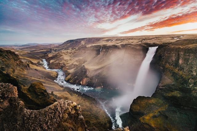
HáifossAbout 17 km away in a straight line, in the Fossárdalur valley on the far side of the Þjórsá, and a longer drive by road. At 122 m it is among the tallest waterfalls in Iceland. It is fed by the Fossá river, which flows on into the Þjórsá, the longest river in the country. A second, slightly smaller waterfall drops beside it, and you see both at once from the viewing area on the south side.
HólaskógurClose to Háifoss, in the mid-highlands. The name means a wood, but the trees are long gone. There is a mountain hut here used by hikers and riders, which makes it a possible overnight stop if you are exploring the area.
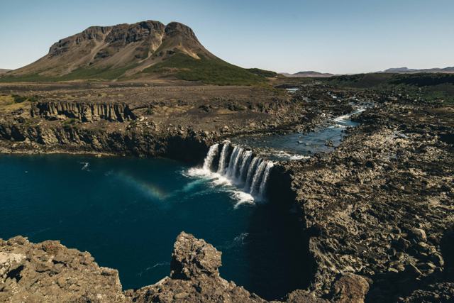
Þjófafoss and TröllkonuhlaupTwo falls on the Þjórsá, both reached from Route 26 a few kilometres south of Fossabrekkur. Þjófafoss has Búrfell as a backdrop; Tröllkonuhlaup is a low, wide fall split by rock islands.
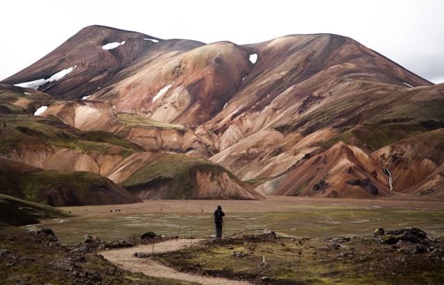
Landmannalaugar by the F225With a 4x4 in summer, continue along Landmannaleið to the rhyolite mountains and hot pool at Landmannalaugar. Rauðufossar and the crater lake Ljótipollur are along the way.
Best time to visit Fossabrekkur
Summer (June–September)The best time. The vegetation is at its greenest, the side track and trail are dry, and the highland roads beyond are open if you want to continue to Landmannalaugar.
Spring and autumnQuiet and usually reachable, but the track and trail can be muddy and slippery after rain. Drive carefully.
WinterYou can visit in any season, but winter is difficult. The upper part of Route 26 gets snow and ice, daylight is short, and the F225 is closed. Check umferdin.is before you go and turn back if conditions are poor.
Water levels vary. The river is spring-fed, and there are times when less water than usual comes over the ledge.
Safety and practical tips
- You do not need a 4x4 for Fossabrekkur itself, only for the F-roads beyond it. Check your rental terms for gravel roads all the same.
- Bring your own food, water and fuel, as there is nothing available at or near the falls.
- Check umferdin.is and the weather forecast before setting out, since conditions change quickly this close to the highlands.
- This is a quiet, undeveloped site, so stay on the marked trail and take care not to damage the vegetation around the falls.
- Combine it with Þjófafoss, 6 km to the south, for two very different waterfalls in one stop.
Facilities and accessibility
There is a parking area and a marked trail, and nothing else. The nearest fuel, shops and restaurants are in the lowlands near the Ring Road, with a few places to stay and eat along the lower part of Route 26.
Nearby places worth a stop
Where to stay near Fossabrekkur
There is no accommodation at Fossabrekkur itself. There are a few hotels, farms and cottages along Route 26, the towns of Hella and Hvolsvöllur have hotels and guesthouses for a lowland base, and Landmannalaugar has a mountain hut and campsite in summer.
Fossabrekkur FAQ
How do I reach Fossabrekkur?
From the Ring Road, take Route 26 north for about 50 km. Turn off at the Fossabrekkur sign, drive a few hundred metres to the car park and walk the short marked trail to the falls.
Do I need a 4x4 to visit Fossabrekkur?
No. It is beside Route 26, which is not an F-road. You only need a 4x4 if you continue on the F225 towards Landmannalaugar.
Is there an entrance fee?
No, it is free to visit.
When can I visit Fossabrekkur?
In any season in principle, but summer is best. In winter the road can be snowy or icy and the visit is difficult.
What makes Fossabrekkur different from other Iceland waterfalls?
It is a wide row of small falls rather than a single large drop, and its green surroundings stand out against the bare pumice and ash plain below Hekla.
What else is there to see near Fossabrekkur?
Þjófafoss and Tröllkonuhlaup on the Þjórsá, Hekla, Háifoss in Fossárdalur, and Landmannalaugar by the F225.
 Iceland Travel GuideLOCAL TRAVEL AGENCY IN ICELAND
My trip
Talk to a local