Iceland Travel Guide logo Iceland Travel GuideLOCAL TRAVEL AGENCY IN ICELAND My trip Talk to a local
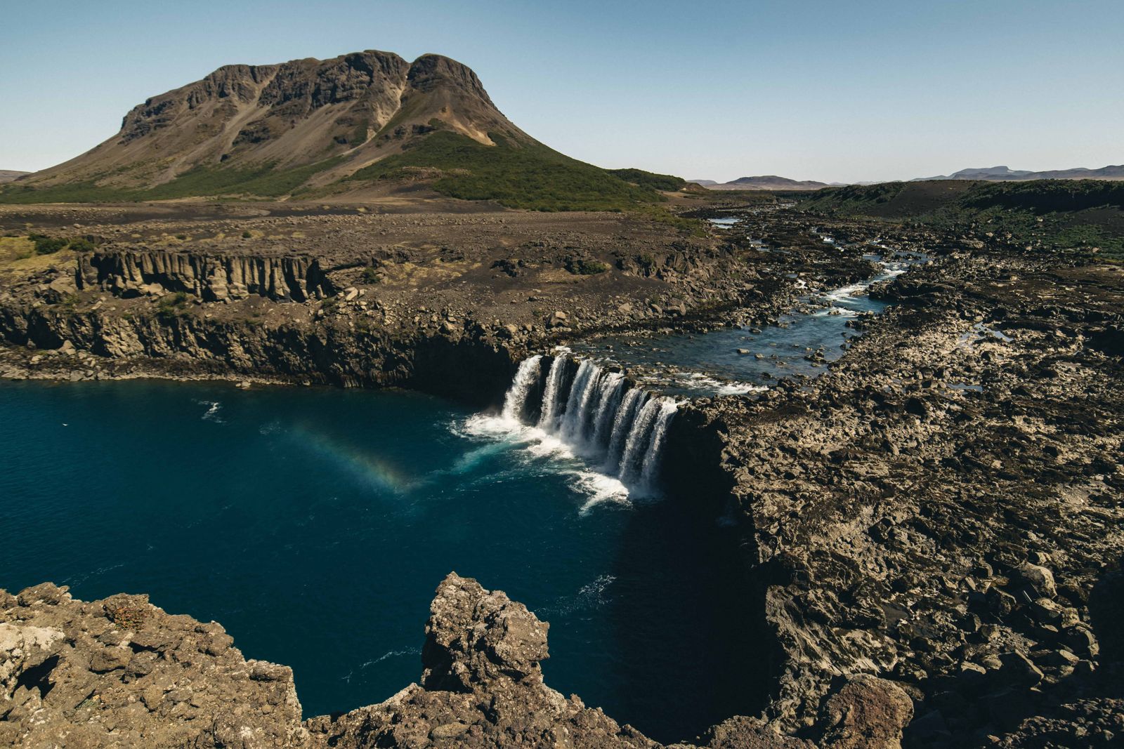
Þjófafoss waterfall

ÞjórsárdalurWaterfallFree entry4x4 only
ÞJÓFAFOSS IN SHORT

Þjófafoss is a wide, horseshoe-shaped waterfall on the Þjórsá river in Þjórsárdalur, South Iceland, in view of Mount Hekla. It is roughly 150 km from Reykjavík, free to visit, and reached by a short unpaved track that needs a 4x4. Most people spend 20–30 minutes here on the way to Háifoss or Landmannalaugar.

ON THIS PAGE
Quick factsHistoryGetting thereWater flowAroundBest time to visitSafety tipsFacilitiesMapNearbyWhere to stayFAQ

About Þjófafoss

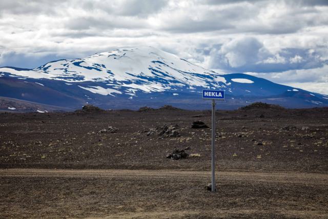
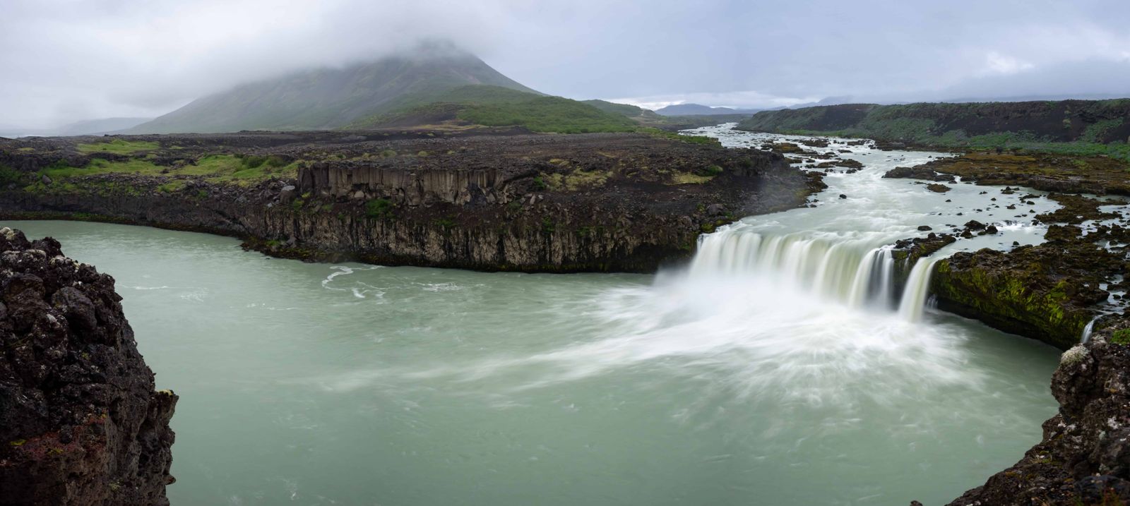
Þjófafoss (“Thieves' Falls”) drops about 12 metres over a wide, curved ledge on the Þjórsá, Iceland's longest river. In normal flow the ledge is around 50 metres wide; after heavy rain it widens further and the water turns from its usual clear teal to a muddier, silt-heavy colour. Mount Búrfell rises behind it and Hekla is visible on the skyline, which makes it a popular stop for photographers heading further into the highlands.

The falls lie east of the Merkurhraun lava field, beneath Mount Búrfell, and are protected as a natural monument. Þjófafoss is one of the main waterfalls on the Þjórsá, which runs from the central highlands to the south coast and forms the old boundary between the counties of Árnessýsla and Rangárvallasýsla. It is not a tall waterfall. What makes it worth the detour is the width, the force of the water and the mountain standing directly behind it.

The Þjórsá has been dammed upstream for hydroelectric power, so the flow here is smaller and steadier than it would be naturally, and is generally highest in summer when meltwater and the reservoir release are greatest. The waterfall sits below the historical route into Þjórsárdalur, an area also known for the Stöng turf farm ruins buried by Hekla's 1104 eruption.

Quick facts

HeightAbout 12 m
WidthAbout 50 m in normal flow, wider after rain
RiverÞjórsá, Iceland's longest river
RegionSouth Iceland, Þjórsárdalur valley
From ReykjavíkAbout 150 km, around 2 hours by car
AccessRoute 26, then about 4 km of unpaved track
Road4x4 recommended; unpaved and can be rough
EntryFree
Opening hoursOpen all year, access depends on road conditions
Time needed20–30 minutes

Why it's called Thieves' Falls

Local tradition says the waterfall's name comes from a punishment once carried out here: people convicted of theft were said to have been drowned in the pool below the falls. Like many Icelandic place names tied to old punishments, the story is passed down rather than officially documented, but it has stuck to the waterfall ever since.

How to get to Þjófafoss

On a guided tourÞjófafoss is off the main tourist routes and usually visited as part of a private highland or super jeep tour rather than a standard day tour.
By carFrom the Ring Road (Route 1), turn north onto Route 26 (Landvegur) between Selfoss and Hella and drive about 45 km. A sign for Þjófafoss marks the turn-off, and from there it is about 4 km on an unpaved track to the parking area. A 4x4 is recommended, especially after rain.
South side or north sideThe waterfall can be reached from both banks, but the two approaches are a long drive apart and there is no way across the river at the falls. The south side, reached from Route 26 as described here, is the easier one and gives the better view, with Búrfell behind the water.
By public transportThere is no public transport to Þjófafoss.
ParkingA small unpaved parking area near the viewpoint, with no fee.

There is no fuel or services in this part of Þjórsárdalur, so fill up before heading in. The area sits close to the edge of the highlands, so check road conditions on road.is before you go, particularly outside summer.

Why the water level at Þjófafoss changes

Much of the Þjórsá is diverted past the waterfall for hydropower. The river is dammed at Sultartangi, where it forms the Sultartangalón reservoir. From there the water runs through the Sultartangi power station into the Bjarnarlón reservoir, and then through the Búrfell power station (Búrfellsstöð), before rejoining the riverbed below the falls.

The result is that Þjófafoss often carries only a fraction of the river, and the flow is lower in winter than in summer. The best time to see it at full strength is late summer, when Sultartangalón is full and the surplus spills down the old river channel and over the falls. On a low-flow day the water is clear and turquoise; when the reservoir overflows it is wide, milky and loud.

Places around Þjófafoss

Þjófafoss fits well into three different trips.

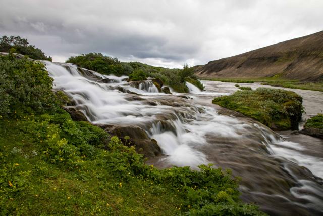
On the way to LandmannalaugarRoute 26 is one of the main approaches to <a href="/locations/landmannalaugar/">Landmannalaugar</a> and the highlands, and Þjófafoss is an easy stop on the way. <a href="/locations/fossabrekkur-waterfalls/">Fossabrekkur</a>, a small green oasis of waterfalls that few travellers know about, is only about 4 minutes' drive further along.
With the Þjórsárdalur valleyAcross the river is <a href="/locations/thjorsardalur-valley/">Þjórsárdalur</a>, with <a href="/locations/hjalparfoss-waterfall/">Hjálparfoss</a>, <a href="/locations/haifoss-waterfall/">Háifoss</a>, the <a href="/locations/thjodveldisbaerinn-stong/">Stöng turf farm</a> and <a href="/locations/gjain/">Gjáin</a>. You cannot cross the river at the waterfall, so allow for the drive around via the bridge near Búrfell.
As an extended Golden CircleIf you have a full day, you can add Þjórsárdalur and Þjófafoss to the classic stops at <a href="/locations/thingvellir-national-park-iceland/">Þingvellir</a>, <a href="/locations/geysir-geothermal-area/">Geysir</a> and <a href="/locations/gullfoss-waterfall/">Gullfoss</a>. It makes for a long day of driving, so start early.
Selfoss<a href="/locations/selfoss-village/">Selfoss</a>, on the Ring Road by the river Ölfusá about 57 km from Reykjavík, is the largest town in the south and the nearest place with a full range of shops, restaurants, accommodation and an outdoor geothermal swimming pool.

Best time to visit Þjófafoss

Summer (June–August)The most reliable access and, thanks to the hydro reservoir release, generally the fullest flow. Hekla and Búrfell are usually clear of snow.
WinterThe access track can be icy or snow-covered and is harder to judge. Only attempt it with a suitable 4x4 and good daylight.

Safety and practical tips

  • A 4x4 is recommended for the final stretch of unpaved track.
  • There is no fuel station nearby, so fill up in Selfoss or Hella first.
  • Stay well back from the ledge; the rock can be wet and slippery.
  • Check road.is before visiting outside summer, since conditions on the access track change quickly.
  • Combine the trip with Háifoss and Hjálparfoss, which are a short drive further into the valley.
  • For the fullest flow, come in late summer when the reservoir upstream is full and spills over the falls.
  • There are marked hiking routes in the area if you want to stretch your legs after the drive.

Facilities and accessibility

There are no facilities at Þjófafoss itself: no toilets, café or fuel. The nearest services are in Hella or Selfoss.

On the map

Open in Google Maps →

Nearby places worth a stop

FossabrekkurFossabrekkurSmall waterfalls in a green oasis, about 4 minutes' drive awayHáifossHáifossOne of Iceland's tallest waterfalls, further up the valleyHjálparfossHjálparfossTwin-cascade waterfall in ÞjórsárdalurStöngStöngReconstructed Viking-age turf farm buried by Hekla's 1104 eruptionGjáinGjáinSmall green gorge with waterfalls near StöngHeklaHeklaThe active volcano on the skyline to the east

Where to stay near Þjófafoss

Most visitors stay in Hella, Selfoss or along the South Coast and visit Þjófafoss as a detour on the way to the highlands or Landmannalaugar.

Þjófafoss FAQ

Do I need a 4x4 to reach Þjófafoss?

A 4x4 is recommended for the last few kilometres of unpaved track, especially after rain or in winter.

Is there an entry fee?

No, Þjófafoss is free to visit and there is no parking fee.

How far is Þjófafoss from Reykjavík?

About 150 km, around 2 hours by car.

Why is it called Þjófafoss?

Local tradition holds that people convicted of theft were once drowned in the pool below the falls, though this is folklore rather than documented history.

When does Þjófafoss have the most water?

Usually in late summer. Much of the Þjórsá is diverted through the Sultartangi and Búrfell power stations, and the falls are fullest when the Sultartangalón reservoir is full and the surplus flows down the old riverbed.

Which side of Þjófafoss is best?

The south side, reached from Route 26. It is easier to get to and has the better view. You cannot cross the river at the waterfall.
More places in South IcelandWaterfalls in Iceland