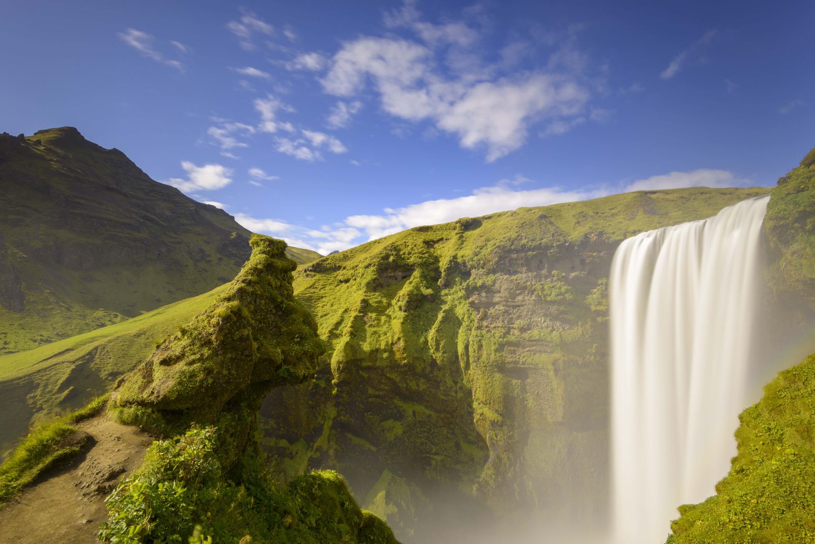
Fimmvörðuháls is a one-day mountain crossing of about 22–25 kilometres from Skógafoss to Þórsmörk, climbing roughly 1,000 metres between two glaciers and past the craters of the 2010 eruption. Most people take 8–10 hours. Before you plan it, read the trail status below: in late August 2026 the hiking clubs that look after the route warned hikers about new hazards on the pass.
Trail status: read this first
On 25 August 2026 the Icelandic Tourist Board published a joint warning from Ferðafélag Íslands, Útivist and the Dagrenning search and rescue team in Hvolsvöllur. Glacier retreat has opened new ravines and crevasses, with steep slopes and loose scree, on the section between the Baldvinsskáli shelter and the Fimmvörðuskáli hut. After heavy rain, parts of the trail became impassable because of ravines and water channels. The groups strongly advised against crossing Fimmvörðuháls under those conditions. The trail was not formally closed.
In early September 2026 Ferðafélag Íslands and Útivist published updated route advice. They recommend the better-marked blue route between the Skógá bridge and Baldvinsskáli, and a marked detour past the damaged area via Fimmvörðuskáli, rejoining the main trail towards Magni and Móði. When we last checked (early October 2026) the warning was still shown on the Ferðafélag Íslands hut page and we found no announcement that it had been lifted, and the clubs were still working on a new, safer line for the damaged section.
Our advice: do not cross on your own until the route is confirmed safe for the season you travel. Check safetravel.is and the hiking clubs' news before you go, register your trip plan with Safetravel, and consider a guided hike, where the guide knows the current line. If you want the scenery without the pass, the valley walks in Þórsmörk are a good alternative, for example on our guided Þórsmörk hike, which includes super jeep transport into the valley.
Fimmvörðuháls at a glance
- Start: Skógafoss waterfall at Skógar, about 2.5 hours' drive from Reykjavík.
- Finish: Básar in Þórsmörk, reached only by 4×4 bus or super jeep across unbridged rivers.
- Distance: about 22–25 km, depending on the route and where in Þórsmörk you finish.
- Climb: roughly 1,000 metres up from Skógar to the pass at about 1,100 metres, then a similar descent.
- Time: 8–10 hours for most fit hikers. Útivist estimates about 5 hours from Skógar to its hut and about 4.5 hours from the hut down to Básar.
- Difficulty: demanding. Long, steep in places, exposed to weather, with narrow ridges on the descent.
- Season: summer only, roughly mid-June to late August or early September, depending on snow.
Where is the Fimmvörðuháls trail?
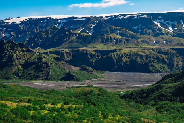
The Fimmvörðuháls trail is in South Iceland. It links Skógar on the South Coast with the Þórsmörk valley in the southern Highlands, crossing the pass between the Eyjafjallajökull and Mýrdalsjökull glaciers. The name means "five cairns pass".
Skógar, the start, is about 155 km from Reykjavík along Route 1, about 2.5 hours by car. Þórsmörk, the finish, is about 160 km from Reykjavík, but the last stretch is a rough mountain track with rivers to ford, so the trip back takes 3 hours or more by highland bus or super jeep.
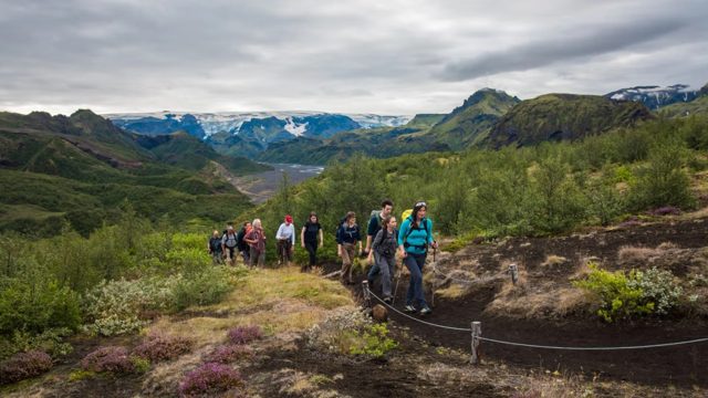
The day falls into three parts: the waterfall trail above Skógafoss, the bare volcanic plateau on the pass, and the steep descent into the green valley of Þórsmörk. Most people walk it from south to north, as described here. It can also be walked as the last stage of the Laugavegur trail from Landmannalaugar.
Step 1: Skógafoss and the waterfall trail
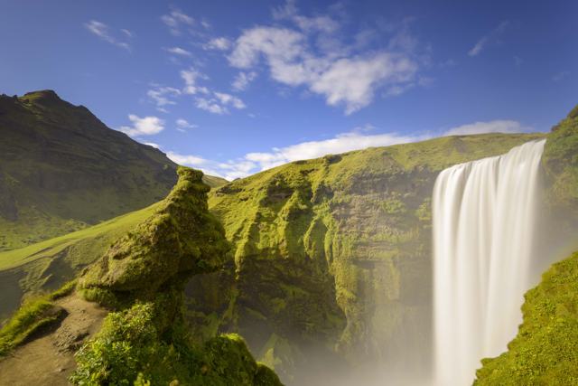
The hike starts at the foot of Skógafoss, the 60-metre waterfall on the South Coast. A long staircase climbs the east side of the falls to a viewing platform. From there the trail follows the Skógá river upstream.
This is the gentlest and greenest part of the day. The river drops through a long chain of more than 20 waterfalls, each one different, and you climb steadily beside them for a few hours with the sound of the water beside you. The path is clear and easy to follow. Take your time here, as the hard work comes later. Many people walk only this part as a day trip and turn back.
Step 2: Up to the pass between the glaciers
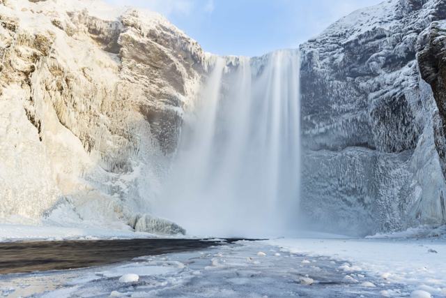
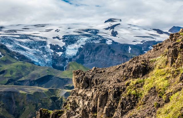
After the footbridge over the Skógá the landscape turns bare and grey. You now climb onto the pass between Eyjafjallajökull to the west and Mýrdalsjökull to the east, which covers the Katla volcano. Baldvinsskáli, a small hut owned by Ferðafélag Íslands, sits on this stretch at about 900 metres. It has 16 bunks, which must be booked ahead.
There are two marked lines here, a red and a blue route. For autumn 2026 the hiking clubs advise the blue route, which is shorter and better marked, with numbered posts whose positions are known to rescue teams. The section above Baldvinsskáli is where the 2026 damage is, so follow the marked detour via Fimmvörðuskáli if the warning is still in place.
Snow can lie on the pass well into summer, and fog is common. Stick to the marked posts, and do not walk onto the glaciers.
Step 3: Magni and Móði, the 2010 craters
At the top of the pass you cross the lava from the eruption that began on 20 March 2010 and opened a fissure on the northern side of Fimmvörðuháls. It was the prelude to the larger Eyjafjallajökull eruption that stopped flights across Europe a few weeks later. Two new craters formed and were named Magni and Móði, after the sons of Thor. The new lava field is called Goðahraun.
The ground here can still feel warm in places, and the black lava and red cinder make a sharp contrast with the white glaciers. It is a good spot for a break if the weather allows. For the background, see our guide to volcanoes in Iceland.
Step 4: The descent into Þórsmörk
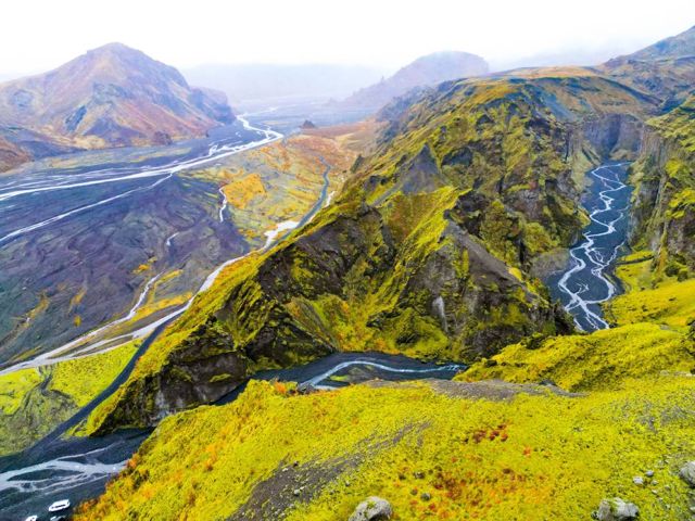
From the craters the trail crosses the Morinsheiði plateau and then drops steeply towards Þórsmörk. There are two short, narrow ridges: Heljarkambur, where a chain helps on the exposed part, and later Kattahryggir. They are not technical, but they are airy. In wind or ice they deserve real care, and anyone with a poor head for heights may find them hard.
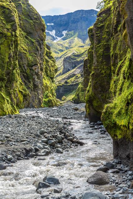
The last hour runs down through birch woods to Básar in Goðaland, the southern part of the Þórsmörk area. After a day of rock and ash, the green valley with glacial rivers all around is a welcome sight. Read more in our guide to hiking in Þórsmörk.
How difficult is the Fimmvörðuháls hike?
Count on a demanding day. In good weather a fit hiker would call it moderate to challenging. In bad weather it is a serious mountain route.
- Distance: about 22–25 km in one go. Most people need 8–10 hours, and up to 12 hours with long breaks, snow on the pass or a slower group.
- Climb: about 1,000 metres of ascent from close to sea level at Skógar, followed by a long, steep descent on tired legs.
- Weather: it changes fast on the pass. Strong wind, rain, fog and snow are possible in any summer month, even when Skógar is calm and mild.
- Terrain: a good path by the river, then loose gravel, ash, lava and snow patches on the plateau, and narrow ridges on the way down.
- Fitness: you should be used to full days of hill walking with a pack. There is no easy way out from the middle of the route.
When to hike Fimmvörðuháls
The hiking season is short. Útivist's hut on the pass is staffed and open for bookings from 15 June to 31 August. Buses into Þórsmörk also run only in summer. Outside that window you may meet deep snow, and it gets dark in the evenings from late August onwards.
Winter crossings are dangerous and we do not recommend them. Even in July, the weather on the pass can bring rain, strong wind and snow, while it is mild at Skógar. Always check the mountain forecast on vedur.is before you leave.
Huts and overnight options
Fimmvörðuskáli belongs to Útivist and sits at about 1,086 metres, higher up the pass than Baldvinsskáli. It sleeps 18, with gas stoves, cookware and dry toilets, but no running water. It is open with a warden from mid-June to the end of August, and part of the building is kept open all year as an emergency shelter. Book early, as spaces are few.
Baldvinsskáli belongs to Ferðafélag Íslands and sits lower down, at about 900 metres. It sleeps 16 in one dormitory and is usually open from about 20 June to mid-September, depending on snow and trail conditions. There is no fresh water, so bring your own, and book through the club.
Splitting the crossing into two days, with a night at one of the huts, makes it much easier and lets you see the craters in the evening light. At the Þórsmörk end there are huts and campsites at Básar and elsewhere in the valley. See our camping guide if you plan to camp.
Getting there and back
Getting to Skógar is easy: it is on Route 1, and summer buses stop there. The hard part is the return from Þórsmörk. The road in crosses several unbridged glacial rivers, so ordinary rental cars cannot drive it, and rental insurance does not cover river damage. Most hikers leave the car at home and use a summer highland bus or a super jeep back to the ring road or Reykjavík.
Check bus times before you set off and allow a margin. If you miss the last bus you will be spending the night in Þórsmörk. A guided tour with transport included takes this problem away.
What to pack
Pack for full winter conditions on the pass, even in July. Our Iceland packing list covers the basics.
- Waterproof jacket and waterproof trousers
- Warm base layers (merino wool works well) and a fleece or light down mid-layer
- Quick-drying hiking trousers, plus hat and gloves for the pass
- Broken-in waterproof hiking boots with good grip and ankle support
- Trekking poles for the long descent
- At least 2 litres of water. You can refill from streams low on the Skógar side, but not on the plateau
- A proper packed lunch and high-energy snacks such as nuts, energy bars and dried fruit
- Map and compass or GPS, and a charged phone with an offline map and a power bank. The trail is marked, but the posts are hard to see in fog
- Small first aid kit with blister plasters and painkillers, and an emergency whistle
- A headtorch after mid-August or for an early start
- A 25–35 litre daypack with a rain cover
Guided or on your own
In a normal summer, fit and experienced hikers with good navigation skills can cross Fimmvörðuháls without a guide, as long as the weather is good and they leave a trip plan with Safetravel. In 2026 the new hazards on the pass change that picture. Until the clubs confirm a safe route, a guided hike is the sensible choice.
A guide knows the current line, watches the weather and handles the transport back from Þórsmörk. See our hiking tours and Þórsmörk tours. If you would rather see the valley without the long climb, a super jeep tour reaches Þórsmörk across the rivers, and our Þórsmörk private tour does this with your own guide and vehicle. For a multi-day trek, many people combine Fimmvörðuháls with the Laugavegur trail from Landmannalaugar. Our guided Laugavegur & Fimmvörðuháls Trek covers both over six days, with nights in mountain huts and luggage transfers.
Tours to book
If you would rather have a guide and the transport sorted, these are the trips we would look at first.
- Laugavegur & Fimmvörðuháls Trek: six days on foot from Landmannalaugar to Þórsmörk with certified guides, including the crossing of the pass. Runs mid-June to mid-September; the 2026 season is over and we are now taking bookings for 2027.
- Þórsmörk Hike: a guided day of walking in the valley, with super jeep transport over the rivers.
- Þórsmörk Private Tour: a private super jeep day into Þórsmörk with your own local guide, at an easy pace.
Questions people ask
Is the Fimmvörðuháls trail open in 2026?
It is not formally closed, but on 25 August 2026 the hiking clubs and local rescue team strongly advised against crossing because of new ravines and crevasses between Baldvinsskáli and Fimmvörðuskáli. A marked detour was published in early September. Check the latest news before you go.
How long is the Fimmvörðuháls hike?
About 22–25 km from Skógafoss to Básar in Þórsmörk, with roughly 1,000 metres of climbing. Most hikers take 8–10 hours, or two days with a night at the hut.
How hard is Fimmvörðuháls?
Demanding. It is long, steep in places, exposed to fast-changing weather and has two narrow ridges on the descent. You need good fitness and hiking experience.
When is the best time to hike Fimmvörðuháls?
From mid-June to the end of August, when the hut is staffed and buses run to Þórsmörk. Snow can linger on the pass early in the season.
How do I get back from Þórsmörk?
By summer highland bus, super jeep or as part of a guided tour. The road into Þórsmörk has unbridged rivers, so ordinary rental cars cannot reach it.