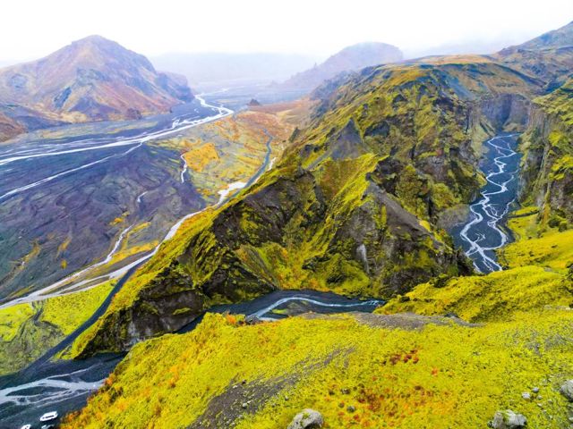
Þórsmörk is one of Iceland's best hiking areas: a green valley of birch woods, glacial rivers and ridges, ringed by three glaciers. You can do short day hikes from the huts, or finish the Laugavegur or Fimmvörðuháls treks here. The valley is only reachable by highland bus, super jeep or a guided tour, and the hiking season runs roughly from June to mid-September.
Where is Þórsmörk?
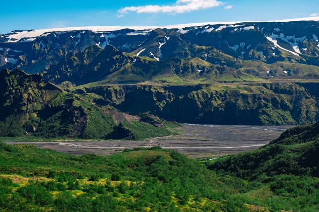
Þórsmörk means "Thor's woods", after the Norse god of thunder. It is a mountain valley in the southern highlands, about 150 kilometres from Reykjavík. It sits between three glaciers: Eyjafjallajökull to the south, Mýrdalsjökull to the east and Tindfjallajökull to the north.
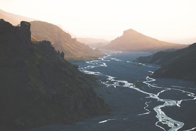
The mountains shelter the valley from the worst of the wind, so it is greener than you might expect. There are birch woods, moss, ferns and flowers, cut through by braided glacial rivers such as the Krossá and Markarfljót. Mist often gathers around the peaks where cold glacier air meets the valley.
People usually talk about three areas. Langidalur and Húsadalur are on the north side of the Krossá river, and Básar in Goðaland is on the south side. Each has huts and a campsite, and most day hikes start from one of them.
Best day hikes in Þórsmörk
Distances and times below are approximate and vary with the start point and your pace. Trails are marked, but take a map and check the weather first.
- Valahnúkur. The classic short hike. A climb of about 230 metres from Langidalur, or a loop from Húsadalur, gives a view over the whole valley, the rivers and the glaciers. Allow 1.5–3 hours.
- Tindfjöll circle. A ring route of about 8 kilometres from Langidalur or Húsadalur through birch woods and over rocky ridges, with around 360 metres of climbing. Allow 3.5–5 hours.
- Rjúpnafell. A side trip from the Tindfjöll route, climbing about 465 metres to a summit with views north over the Laugavegur area. Medium to hard. Allow 3–4 hours return.
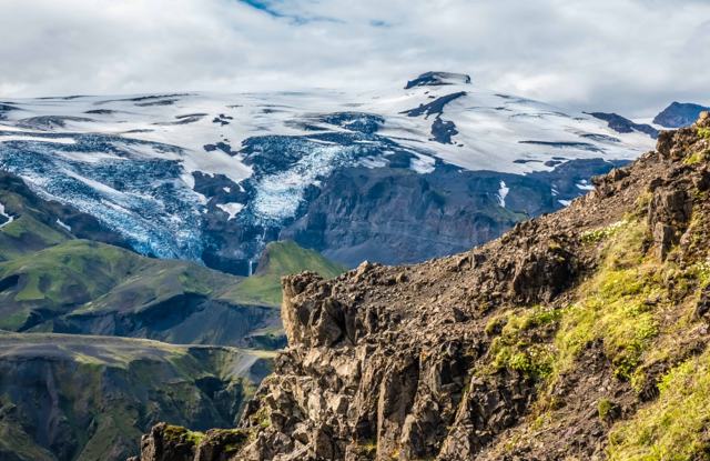
- Réttarfell. A circuit of about 4 kilometres from Básar with around 270 metres of climbing and good views of Eyjafjallajökull. Allow 3–4 hours.
- Útigönguhöfði. A steeper climb from Básar of about 500 metres. The top looks across to Mýrdalsjökull, the ice cap over Katla. Allow 3–4 hours return.
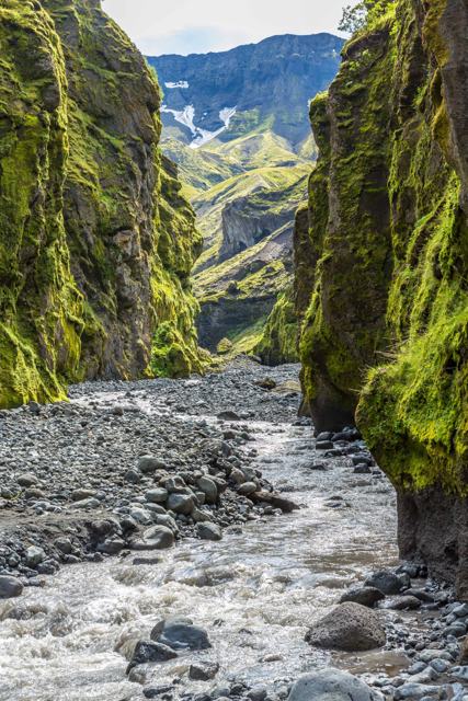
- Stakkholtsgjá. A narrow, mossy canyon beside the F249 road on the way in. An easy walk of about 40 minutes each way leads to a waterfall at the end. Many tours stop here.
Laugavegur: the trek that ends in Þórsmörk
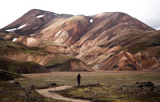
The Laugavegur is Iceland's best-known multi-day hike. It runs about 55 kilometres from Landmannalaugar to Þórsmörk, usually over four days, with huts at Hrafntinnusker, Álftavatn, Hvanngil and Emstrur. You walk from coloured rhyolite mountains and steam vents, past obsidian and snowfields, across the black sands of Emstrur and down into the birch woods of Þórsmörk.
There are rivers to ford and snow can linger on the high ground into July. Book huts or campsites early, as summer places fill up fast. Read our guide to hiking in Landmannalaugar for the northern end of the route.
Fimmvörðuháls: read this before you go
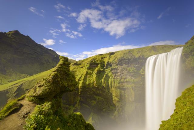
The Fimmvörðuháls trail runs about 25 kilometres from Skógafoss at Skógar over the pass between Eyjafjallajökull and Mýrdalsjökull, and down into Þórsmörk. It climbs about 1,000 metres and takes 8–11 hours, or two days with a night in a hut on the pass. On the way you pass a long chain of waterfalls on the Skógá river and the craters Magni and Móði, formed in the 2010 eruption.
In late August 2026 the Icelandic Tourist Board and partners warned hikers not to cross Fimmvörðuháls for the time being. Glacier retreat and heavy rain had opened ravines and water channels and left steep, loose scree on the section between the two huts on the pass. The trail was not formally closed, and work was under way to find a safer route. Check the latest conditions before you plan this hike for 2027, and consider going with a guide.
Our step-by-step Fimmvörðuháls guide has more detail on the route.
Where to stay: huts and camping
All three areas have mountain huts and campsites, usually open from May to early October depending on road access. Camping is not allowed before 20 May, to protect the vegetation. The hut in Langidalur sleeps 73 people in bunk rooms, with two kitchens, paid showers, a small shop and a summer warden. A bed there costs 17,000 ISK per night in 2026. Húsadalur also has cabins and rooms, and Básar has huts and a large campsite.
Huts give you a mattress, but you bring your own sleeping bag and food. Places sell out early for July and August, so book as soon as your dates are set. See our camping in Iceland guide if you plan to bring a tent.
Getting to Þórsmörk
The only road in is the F249 from the Ring Road near Seljalandsfoss. It is about 30 kilometres of gravel with several unbridged glacial rivers. The last one, the Krossá, is one of the most dangerous fords in Iceland, and its bed shifts from day to day.
Most rental agreements forbid driving the F249, and insurance does not cover river damage. The practical options are:
- Highland bus. Scheduled buses run daily in summer, roughly June to September, from Reykjavík and the South Coast. The trip from Reykjavík takes about four hours.
- Super jeep tour. Modified jeeps cross the rivers safely and can reach Þórsmörk in more of the year. See our super jeep tours; the Thorsmork Super Jeep Tour from Hella runs all year.
- Guided hiking tour. Transport and a guide who knows the trails and the weather. See our Þórsmörk tours and hiking tours.
When to go hiking in Þórsmörk
The hiking season is roughly from June to mid-September. The highland buses run in this window, and the F249 is usually passable to large 4×4s from late May or June. July and August have the warmest weather, the longest days and the lowest snow on the high trails, but also the most people and the fullest huts.
Late August and September are quieter, with autumn colours in the birch woods, but expect more rain and wind and shorter days. Outside summer the valley is only reachable by super jeep. For the weather month by month, see Iceland in July, Iceland in August and Iceland in September.
What to pack for hiking in Þórsmörk
Weather in the valley can change within an hour, and it is colder and windier on the ridges and passes. Layers and good waterproofs matter more than anything else. For a full list, see our camping packing list.
- Waterproof hiking boots with ankle support
- Waterproof jacket and trousers
- Thermal base layers, a fleece and a warm down or synthetic jacket
- Warm hat, gloves and thick wool socks
- Sandals or neoprene shoes for river crossings
- Walking poles, which help on steep scree and in rivers
- Map, compass or GPS, and a charged phone with a power bank
- First aid kit and blister plasters
- Sleeping bag if you stay in a hut, plus food and a stove if you camp
Safety in Þórsmörk
Check the weather forecast and road conditions on the morning you set out, and leave a travel plan with someone you trust. Never try to ford the Krossá on foot. Glacial rivers rise during the day as the ice melts, so cross smaller streams early where you can. In an emergency, call 112.
Þórsmörk sits close to Eyjafjallajökull and Katla, both active volcanoes. Their activity is monitored, and warnings are issued if anything changes.
Tours to book
If you would rather leave the rivers and the planning to someone else, these are the easiest ways in.
- Þórsmörk Private Tour: your own super jeep and guide from Reykjavík or the South Coast, May to September, with Seljalandsfoss, Stakkholtsgjá and Nauthúsagil on the way.
- Thorsmork Hike: a small-group day from Hvolsvöllur, April to October, with a guided climb of Valahnúkur.
- Thorsmork Super Jeep Tour from Hella: river crossings, Gígjökull and short walks in the nature reserve, and it runs all year.
Questions people ask
Can I drive to Þórsmörk in a rental car?
Usually not. Most rental agreements forbid the F249, and insurance does not cover river damage. The Krossá river is especially dangerous. Take the highland bus, a super jeep or a guided tour.
What is the best day hike in Þórsmörk?
Valahnúkur is the best short hike, with a view over the whole valley in 1.5–3 hours. For a longer day, the Tindfjöll circle or Útigönguhöfði are good choices.
Is the Fimmvörðuháls trail open?
In late August 2026 hikers were strongly advised not to cross Fimmvörðuháls because glacier retreat had made parts of the pass dangerous. The trail was not formally closed. Check current conditions before you go.
When is the best time to hike in Þórsmörk?
July and August are best for weather and trail conditions. The season runs roughly from June to mid-September. Book huts early for the summer months.
Do I need to book huts in Þórsmörk?
Yes, especially in July and August. Huts and cabins fill up fast. Bring your own sleeping bag and food.