Iceland Travel Guide logo Iceland Travel GuideLOCAL TRAVEL AGENCY IN ICELAND My trip Talk to a local
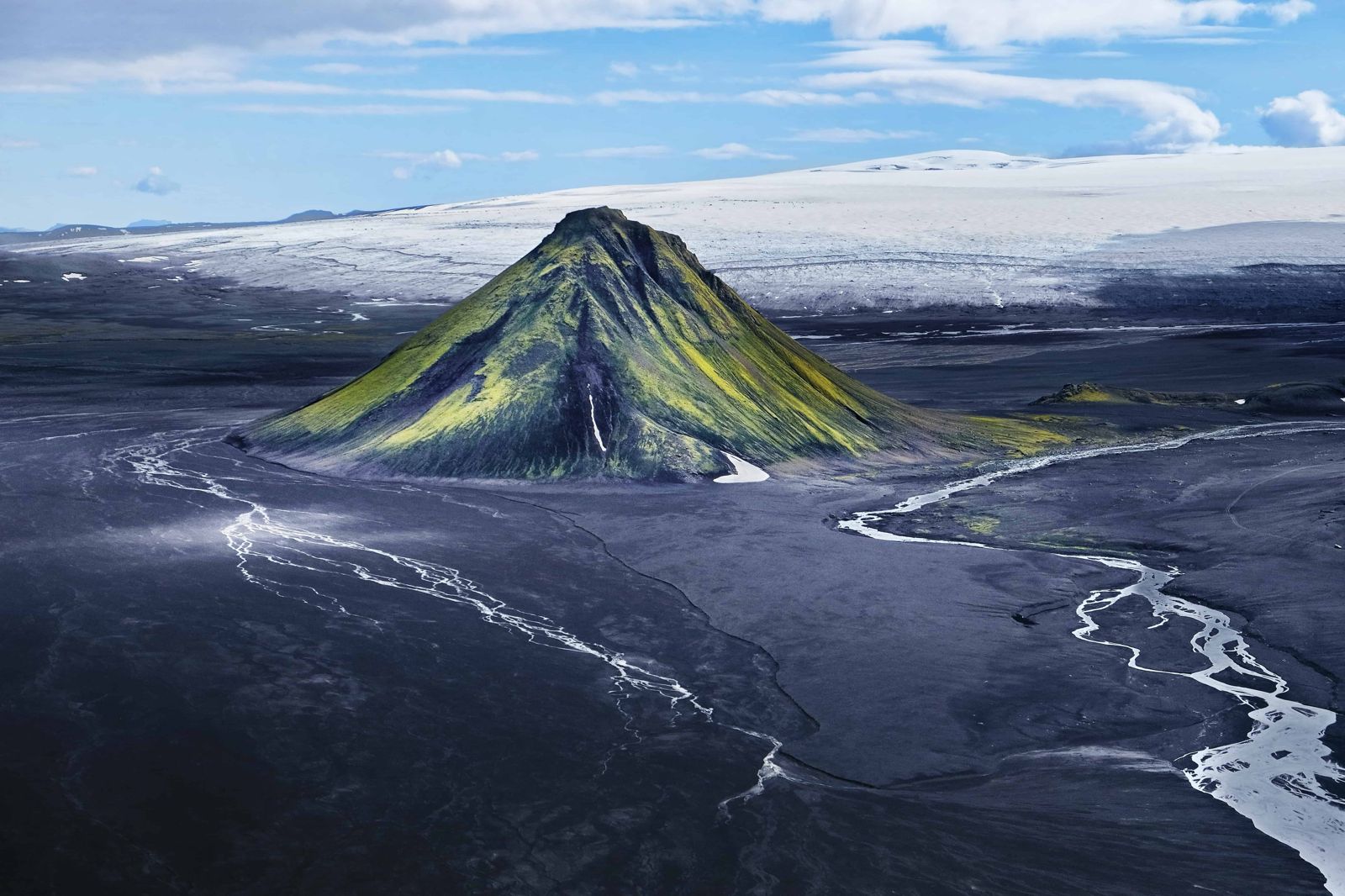
Mælifell volcano: the green mountain on the black sand

HighlandsMountainFree entry4x4 only
MÆLIFELL IN SHORT

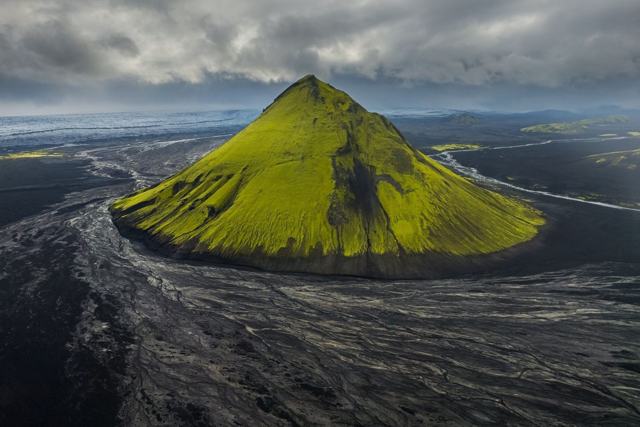
Mælifell is a 799-metre, cone-shaped volcano covered in green moss, rising about 200 m above the black sand plain of Mælifellssandur in the southern Highlands. It sits on the F210 Fjallabak route north of Mýrdalsjökull, is free to view, and is reachable only by 4x4, usually from early July to some time in September.

ON THIS PAGE
Quick factsGetting thereRoutesWhat to doSafetyBest time to visitSafety tipsFacilitiesMapNearbyWhere to stayFAQ

About Mælifell

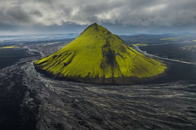
Mælifell formed under the Mýrdalsjökull ice cap around 10,000 years ago and now stands alone on the flat, dark sands of Mælifellssandur, between the glacier and the Fjallabak Nature Reserve. Its almost perfectly symmetrical cone, covered in thick green moss, makes it one of the most photographed mountains in Iceland, especially against the black sand and the ice cap behind it.

What is Mælifell? The name is usually translated as "measuring hill": cone-shaped hills like this stood out from far away and were used as landmarks by travellers. There are several Mælifells in Iceland, so make sure your map or GPS points to the one on Mælifellssandur, north of Mýrdalsjökull.

Where is Mælifell located? In the southern Highlands, north of the Mýrdalsjökull ice cap and south-east of Landmannalaugar, on the southern Fjallabak route (F210). It is completely isolated: no towns, no fuel stations and no mobile signal for a long way in any direction.

Why is Mælifell so green? The slopes are covered in moss that thrives on the damp volcanic ash. It is at its brightest in July and August, and brightest of all just after rain, when the wet moss almost glows against the black sand. In dry spells and late in the season it fades towards yellow-brown.

There is no marked trail up Mælifell and no facilities anywhere nearby. Most people see it from the F210 road or make a short stop to walk closer, rather than climbing it, since the moss cover is fragile and easily damaged by foot traffic.

Quick facts

Elevation799 m above sea level, about 200 m above the surrounding sand plain
TypeCone-shaped volcano formed under ice, around 10,000 years old
RegionSouthern Highlands, on the F210 Fjallabak route, north of Mýrdalsjökull
GPSAbout 63.7994° N, 18.9381° W
Access4x4 only, via F-roads (F210, F232, F261) with unbridged river crossings
SeasonUsually early July to mid or late September, weather dependent
From Vík or KirkjubæjarklausturAbout 2 hours each way by the easiest route; plan a full day of 7–10 hours with stops
From ReykjavíkRoughly 5 hours or more each way, depending on route and conditions
EntryFree

How to get to Mælifell

On a guided tourSuper Jeep tours into the Fjallabak or Mælifellssandur area include Mælifell as a stop, which avoids the need to drive an unfamiliar F-road and river crossings yourself.
By carOnly with a proper 4x4 with good ground clearance, on the F210, which crosses Mælifellssandur right past the mountain. You reach the F210 from the south on the F232, from the west on the F261 or F210, or from the east via the F208. All of them involve river crossings that change in depth and force from day to day. See the routes below.
By public transportThere is no bus route to Mælifell. Highland buses run on some nearby F-roads in summer, but do not stop at the mountain itself.

F-roads to Mælifell are only open in summer, and even then conditions change quickly after rain. Never attempt a highland river crossing you are unsure about, and check road status on road.is before setting out.

How to get to Mælifell: the routes

There is no easy road to Mælifell. These are the usual approaches. Which one is passable depends on the week, the weather and your vehicle, so check road.is and ask locally before you commit.

From the south: F232 ÖldufellsleiðUsually the least rough approach. From the Ring Road east of Vík, take Route 209 inland and continue on the F232 north along the eastern edge of Mýrdalsjökull to join the F210 a short way east of Mælifell. There is a river crossing by the waterfall Bláfjallafoss and you pass Hólmsárfoss on the way. Allow about 2 hours from Vík.
From the west: F261 or F210From Hvolsvöllur, the F261 runs up Fljótshlíð and past Emstrur to meet the F210, which then heads east across the sand to Mælifell. Alternatively the F210 comes in from the Hella side past Álftavatn. Both are slow, rocky and very scenic, with crossings of glacial rivers such as Bláfjallakvísl and Kaldaklofskvísl.
From the east: F208 and F210From Kirkjubæjarklaustur or Landmannalaugar, the F208 connects to the eastern end of the F210. This approach includes the ford over the Hólmsá river, which is deep and is generally a job for modified super jeeps only.
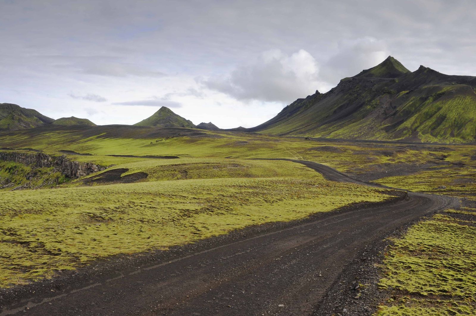
Crossing MælifellssandurThe track over the sand is marked with posts. Meltwater from the glacier spreads across the plain on warm afternoons and after rain, so the sand can be wet, soft or under shallow water. Follow the posts, drive slowly and never leave the track: off-road driving is illegal and tyre marks stay for years.

A small rental 4x4 is not enough for most of these routes. If you are unsure about the vehicle or the river crossings, a guided super jeep tour is the safer way to see Mælifell.

What to do at Mælifell

PhotographyThis is one of the most photographed mountains in Iceland for a reason: a bright green cone on flat black sand, with Mýrdalsjökull behind it. Overcast and showery days often give the best colour. The classic view is from the F210 on either side of the mountain.
Walking around the baseThere is no marked trail, but you can walk on the sand around the foot of the mountain and get a sense of its scale. Climbing it is discouraged: the slope is very steep and the moss does not recover from footprints.
A super jeep day in the HighlandsGuided tours usually combine Mælifell with other stops in the area, such as the Markarfljótsgljúfur canyon, Hólmsárfoss waterfall and viewpoints over Mýrdalsjökull.
More stops nearbyWith time and the right vehicle you can continue to <a href="/locations/strutslaug-hot-spring/">Strútslaug hot spring</a>, <a href="/locations/eldgja-crater/">Eldgjá</a> or <a href="/locations/landmannalaugar/">Landmannalaugar</a> on the F208. The Laki craters are a separate day trip from Kirkjubæjarklaustur.

Weather and safety in the Highlands

Is Mælifell dangerous to visit? Not if you are prepared, but people do get stuck or stranded trying to reach it in the wrong vehicle. The real risks are deep or fast rivers, sudden weather, and the fact that there is no fuel, no food and no quick help nearby.

Even in July and August expect anything from 5 to 15°C, with sudden rain and strong wind. Bring layers, full waterproofs and a windproof jacket, plus food, water and a full tank.

There is no mobile signal once you are deep in the Highlands. Download offline maps, carry a paper map, and leave your travel plan with someone (you can register it at safetravel.is). Do not rely on a phone GPS alone.

Best time to visit Mælifell

Summer (July–August)The best time to visit. The F-roads are normally open, the moss is at its greenest and the days are long.
Early autumn (September)Roads may still be open but can close with little notice as the weather turns, and the moss starts to fade. Check conditions daily.
October to JuneThe highland roads are closed by snow, meltwater and impassable rivers. Mælifell cannot be reached by ordinary means.

Opening dates change every year with the snowmelt. Some years the roads open in late June, in others not until well into July.

Safety and practical tips

  • Travel in July or August for open roads and the greenest moss.
  • Only attempt the F-roads in a proper 4x4; regular cars and most rental insurance do not cover F-roads or river crossings.
  • Check road.is and the weather forecast before setting out, since conditions can close the route with little warning.
  • Stay off the moss; it grows extremely slowly and does not recover from foot traffic.
  • Carry extra fuel, food, water and warm clothes; there are no services in this part of the Highlands.
  • Do not attempt a river crossing you cannot see the bottom of or that looks faster than walking pace. Glacial rivers are lowest in the morning.
  • Download offline maps, bring a paper map and tell someone your route; there is no phone coverage.
  • Leave no trace: take all rubbish out with you and never drive off the marked track.

Facilities and accessibility

None. There is no fuel, food, toilets or phone coverage in the area around Mælifell; plan as you would for any remote highland trip.

On the map

Open in Google Maps →

Nearby places worth a stop

StrútslaugRemote hot spring reached by a hike north of Mælifellssandur
ÞórsmörkSheltered highland valley, reachable by 4x4 or highland bus
LandmannalaugarLandmannalaugarColoured rhyolite mountains and hot spring bathingEldgjáEldgjáA vast volcanic fissure further along the Fjallabak route
AxlafossWaterfall on the Hólmsá river, south-east of Mælifell
MýrdalsjökullMýrdalsjökullThe ice cap just south of the mountain

Where to stay near Mælifell

There is no accommodation at Mælifell and no official campsite. Wild camping is not allowed in protected areas such as the Fjallabak Nature Reserve, so for an overnight trip use the highland huts and campsites, for example at Álftavatn, Hólaskjól or Landmannalaugar, or base yourself in Vík or Kirkjubæjarklaustur and drive in for the day.

Mælifell FAQ

Where is Mælifell located?

In the southern Highlands of Iceland, on the black sand plain of Mælifellssandur just north of Mýrdalsjökull glacier, beside the F210 track.

Can I visit Mælifell without a tour?

Only if you have a suitable 4x4, experience with F-roads and river crossings, and have checked road conditions. If in doubt, book a guided super jeep tour.

Can you drive to Mælifell in a normal rental car?

No. The F-roads here need a 4x4 with river-crossing capability, and standard rental insurance usually excludes F-roads and water damage.

When is the road to Mælifell open?

Usually from early July until some time in September, depending on the year and the weather. For the rest of the year the Highlands are closed.

How long does it take to get to Mælifell?

From Vík or Kirkjubæjarklaustur, plan a full-day trip of 7 to 10 hours with stops. From Reykjavík it is not realistic as a self-drive day trip; day tours by super jeep do run.

Can you climb Mælifell?

There is no trail, the slope is very steep and the moss is fragile, so climbing is discouraged. Most visitors walk on the sand around the base instead.

Can I camp at Mælifell?

There is no campsite at the mountain and wild camping is not allowed in protected areas without permission. Use the highland huts and campsites instead.

Is Mælifell worth visiting?

Yes, if you like remote places. The green cone on black sand with the glacier behind is one of the most distinctive sights in the Highlands, and you will share it with very few people.

See Mælifell with a local

Tours and trips that include Mælifell, booked directly with a local travel agency in Iceland.
Private Mælifell Super Jeep TourPRIVATEPrivate Mælifell Super Jeep TourFrom 260,000 ISK per groupFjallabak Super Jeep TourDAY TOURFjallabak Super Jeep TourFrom 45,000 ISK per person
More places in Highlands