Iceland Travel Guide logo Iceland Travel GuideLOCAL TRAVEL AGENCY IN ICELAND My trip Talk to a local
Vatnajökull National Park

Southeast IcelandNational parkFree entryOpen all year
VATNAJÖKULL NATIONAL PARK IN SHORT

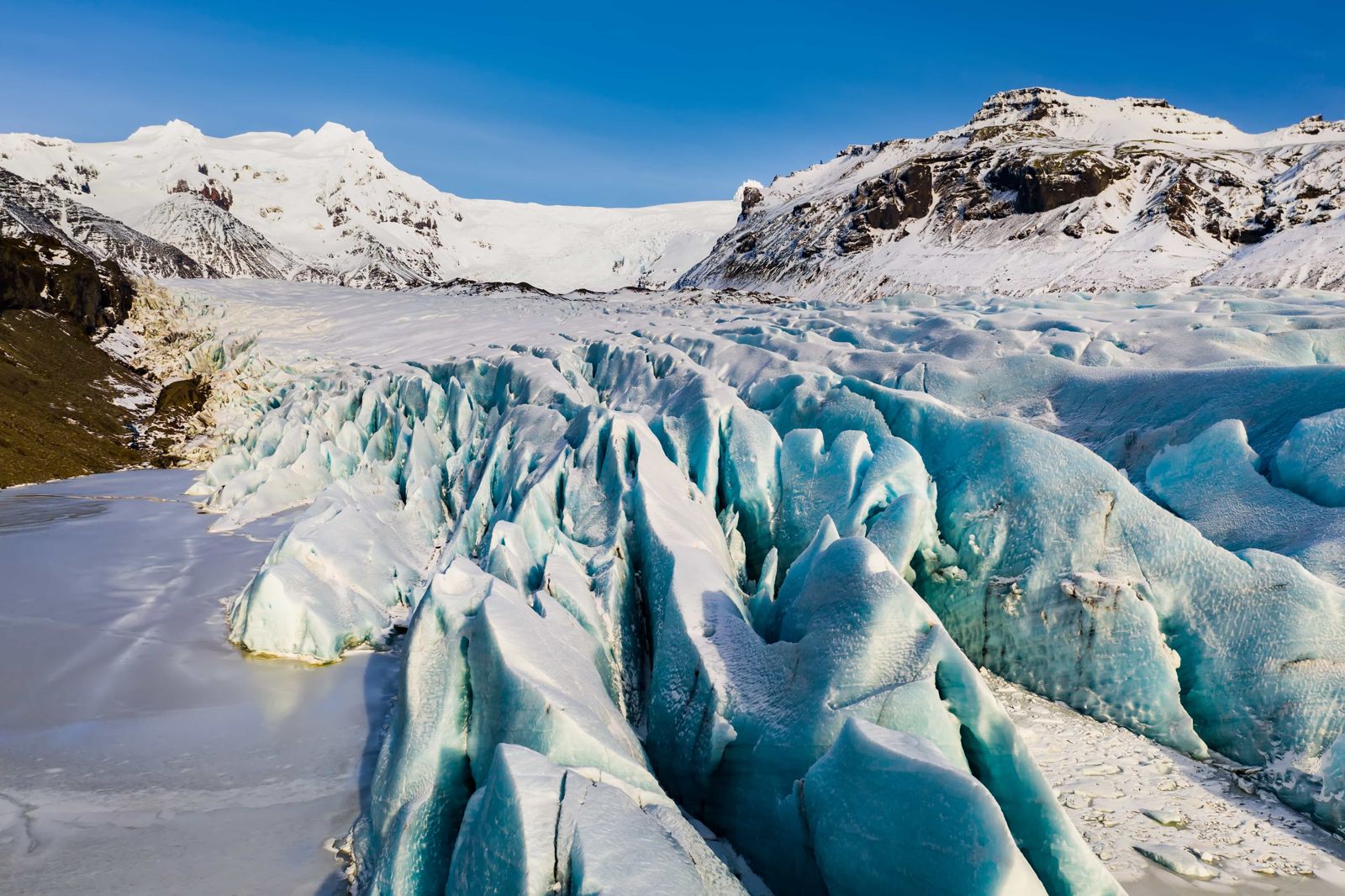
Vatnajökull National Park is Iceland's largest national park, built around Europe's biggest ice cap, and covers roughly 14,967 km² (about 14% of the country). It has no single entrance: most visitors reach it through Skaftafell in the southeast, about 330 km (4–5 hours) from Reykjavík, or through Ásbyrgi and Jökulsárgljúfur in the north. Entry to the park is free, it is open all year, and how long you stay depends entirely on what you come to do, from an hour at a viewpoint to several days of hiking.

ON THIS PAGE
Quick factsHistoryGetting thereRegionsSightsBest time to visitSafety tipsFacilitiesMapNearbyWhere to stayFAQ

About Vatnajökull National Park

Vatnajökull National Park was established in 2008 by joining the older Skaftafell and Jökulsárgljúfur national parks with the ice cap between them. It covered about 12,000 km² at the start and has grown since, with Lakagígar, Langisjór, Krepputunga and Jökulsárlón among the areas added. In 2019 UNESCO listed it as a World Heritage Site for showing, in one place, the push and pull of glaciers, volcanoes and rivers that has shaped Iceland. It is often called the largest national park in Europe. By area it is the second largest, after Yugyd Va in Russia.

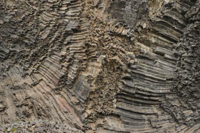
The park is split into four regions, each with its own character: the south around Skaftafell, with black basalt columns, glacier tongues and Iceland's highest peak; the north around Ásbyrgi and the Jökulsárgljúfur canyon, home to Dettifoss; the east around Kverkfjöll, a remote area of ice caves and geothermal heat; and the west around Lakagígar, the crater row from the 1783 Laki eruption. Most travellers see only one or two of these on a single trip, and that is normal: the park is too large to cover in a day.

Because it is really several regions under one name, it helps to think of it not as one attraction but as the frame around many of Iceland's biggest sights: Jökulsárlón, Svartifoss, Dettifoss and the glacier itself all sit inside its boundary.

Within its borders are Europe's largest ice cap, Iceland's highest mountain and the most powerful waterfall in Europe, along with glacier lagoons, black sand, active volcanoes and highland desert. You could spend weeks here and not see all of it.

Quick facts

Area14,967 km², roughly 14% of Iceland
Established7 June 2008 (about 12,000 km² at first), expanded since
UNESCO statusWorld Heritage Site since 2019
Main regionsSouth (Skaftafell), North (Ásbyrgi/Jökulsárgljúfur), East (Kverkfjöll), West (Lakagígar)
From Reykjavík (Skaftafell)About 330 km, around 4–5 hours by car
EntryFree; parking and camping fees apply at some sites
Opening hoursOpen all year; visitor centres have seasonal hours
Highest pointHvannadalshnjúkur, 2,110 m, Iceland's highest peak

Fire and ice, side by side

UNESCO's listing calls the park a place of "fire and ice": under Vatnajökull's ice cap lie several active volcanic systems, including Grímsvötn and Bárðarbunga, and their eruptions regularly melt tunnels through the ice and send sudden floods, called jökulhlaup, down the rivers that drain the glacier. The 1783–84 Laki eruption in the park's western area was one of the most devastating in Icelandic history, and its crater row, Lakagígar, is still visible today.

That combination of ice and fire is also why the landscape changes faster here than almost anywhere else in Iceland. Glacier tongues have retreated visibly within a single generation, and rivers have carved new courses after floods. Rangers and researchers use the park partly to track those changes, which is part of why it earned UNESCO recognition alongside its scenery.

How to get to Vatnajökull National Park

On a guided tourMost visitors see the park as part of a South Coast or glacier lagoon tour that stops at Skaftafell, or a Diamond Circle tour that stops at Ásbyrgi and Dettifoss. A private tour lets you combine a visitor centre with a glacier walk or ice cave.
By carSkaftafell is just off Route 1 in the southeast. In the north, Ásbyrgi is on Route 85, and Dettifoss is reached from Route 1 on Route 862 (west bank, paved) or Route 864 (east bank, gravel, summer only). The southern and northern areas are not directly connected by road; travelling between them means driving most of the Ring Road.
By public transportSeasonal buses run along the Ring Road and stop near Skaftafell in summer. There is no regular public transport to the northern or eastern parts of the park.
ParkingParking fees apply at some sites, including Skaftafell, and are paid via the Parka app or on-site machines. Fees vary by location and vehicle type.

Because the park has several unconnected entrances, plan around one region per trip rather than trying to see all of it. Kverkfjöll, Askja and Lakagígar are on mountain roads that need a 4x4 and are only open in summer.

What to see in each region

A quick guide to which part of the park suits your trip.

South: SkaftafellSvartifoss waterfall, glacier hikes, and views of Vatnajökull's outlet glaciers. The most visited area and the easiest to reach from Reykjavík.
North: JökulsárgljúfurÁsbyrgi's horseshoe-shaped canyon and Dettifoss, Europe's most powerful waterfall, reached from Akureyri or Húsavík.
East: KverkfjöllIce caves, geothermal areas and highland scenery, reached only by 4x4 in summer. For experienced highland travellers.
West: LakagígarThe crater row from the 1783 Laki eruption, reached from Kirkjubæjarklaustur on mountain roads open in summer only.

What to explore in Vatnajökull National Park

The best-known sights and walks inside the park, from south to north.

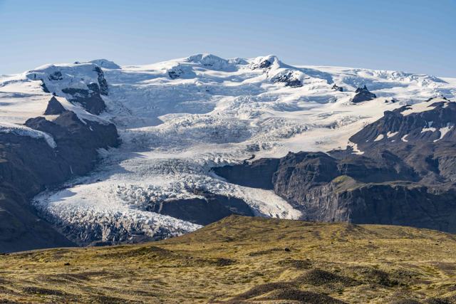
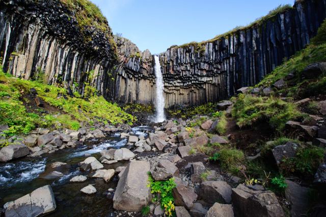
Svartifoss and SjónarnípaSvartifoss, in Skaftafell, falls over a cliff of black basalt columns. The walk from the visitor centre and back takes about an hour and a half and suits most levels of fitness, though the last stretch by the waterfall can be muddy, so wear proper shoes. You can carry on to the viewpoint Sjónarnípa, which looks down on the Skaftafellsjökull glacier tongue.
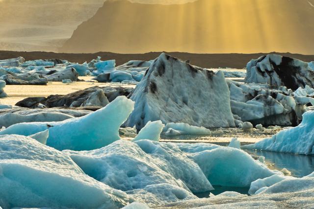
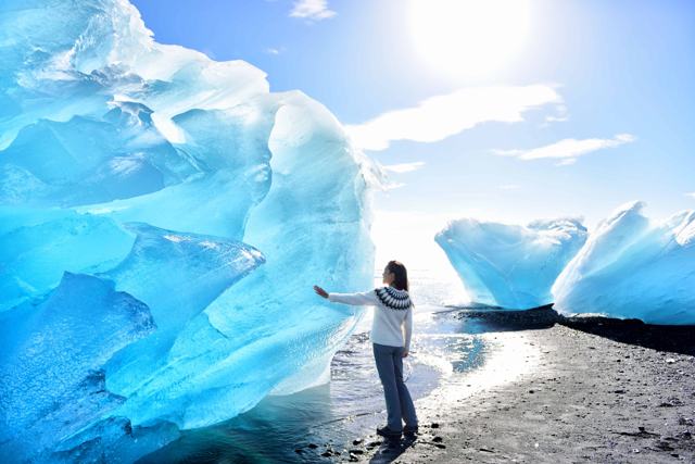
Jökulsárlón and FjallsárlónJökulsárlón is a glacier lagoon full of icebergs, with boat tours in summer and seals that are often seen in the water or resting on the ice. Fjallsárlón is a smaller, quieter lagoon a short drive west. A marked trail links the two for keen hikers; allow about 5 hours one way.
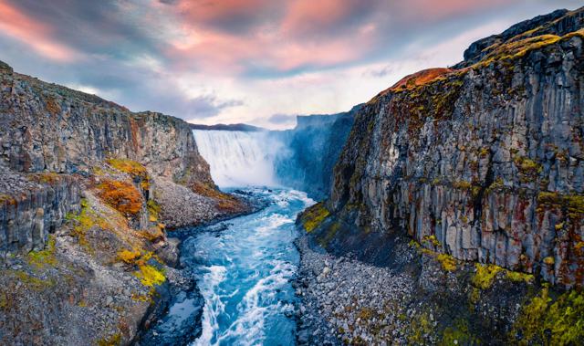
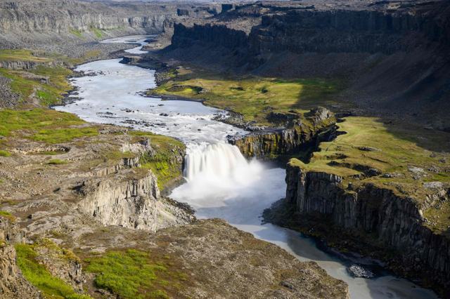
Dettifoss, Selfoss and HafragilsfossJökulsárgljúfur is the northernmost part of the park. The river in the canyon, Jökulsá á Fjöllum, flows from Vatnajökull near the subglacial volcano Bárðarbunga. Dettifoss, the most powerful waterfall in Europe, is here, with the smaller but still forceful Selfoss just upstream and Hafragilsfoss downstream.
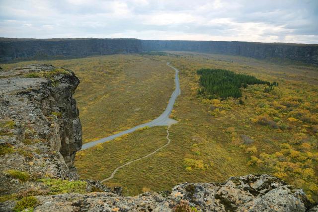
ÁsbyrgiA horseshoe-shaped canyon enclosed by cliffs 90 to 100 metres high on every side except the north, where they drop away to the lowland. The northern visitor centre and a large campsite are here.
AskjaA nested caldera in the Dyngjufjöll mountains, deep in the highlands in the park's northern territory. The setting is stark and very photogenic. It is reached on mountain roads in a 4x4 in summer only, or on a guided highland tour.
Visitor centresStop at a visitor centre before you set out. The rangers have maps and current trail conditions, and can suggest hikes to fit your time, at Skaftafell, Ásbyrgi, Skriðuklaustur and Kirkjubæjarklaustur.

Best time to visit Vatnajökull National Park

Summer (June–August)All regions and roads are open, including the highland approaches to Kverkfjöll, Askja and Lakagígar and the roads along Jökulsárgljúfur. Days are long and the weather is mild, so this is the time for the hiking trails. It is also the busiest time at Skaftafell and Ásbyrgi.
Winter (October–April)Skaftafell stays open and is the base for ice cave tours into Vatnajökull, but the highland regions are closed, days are short and storms can come at any time.

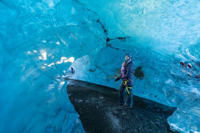
Ice caves inside Vatnajökull can usually only be visited with a guide from around November to March, when the ice is stable enough to tunnel safely.

Safety and practical tips

  • Pick one region and build your day around it rather than trying to cover the whole park.
  • Check road conditions on umferdin.is before driving to any part of the park, especially highland routes.
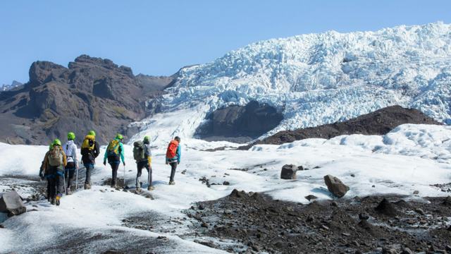
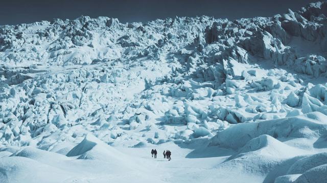
  • Glacier ice is dangerous without a guide. Only walk on Vatnajökull with a certified glacier guide.
  • Weather changes fast in the highlands. Bring warm, waterproof layers even in summer.
  • Book ahead for ice cave tours and glacier hikes in the busy summer and winter periods.
  • Respect trail markers and ropes. The park's terrain, especially near glacier edges, can be unstable.

Facilities and accessibility

Visitor centres with toilets, information and small exhibitions are at Skaftafell (open all year), Ásbyrgi and Skriðuklaustur (seasonal) and Kirkjubæjarklaustur, with an information centre in Höfn. Campsites operate at Skaftafell and Ásbyrgi in summer. Fuel and shops are in nearby towns such as Kirkjubæjarklaustur, Höfn and Húsavík, not inside the park itself.

On the map

Open in Google Maps →

Nearby places worth a stop

SkaftafellSkaftafellThe park's main southern visitor areaJökulsárlónJökulsárlónGlacier lagoon, now part of the parkVatnajökull glacierVatnajökull glacierThe ice cap the park is built aroundFjallsárlónFjallsárlónA quieter glacier lagoon nearbyDettifossDettifossPowerful waterfall in the park's northern regionÁsbyrgiÁsbyrgiHorseshoe canyon in JökulsárgljúfurSvartifossSvartifossWaterfall over basalt columns in SkaftafellDiamond BeachDiamond BeachIcebergs on black sand below JökulsárlónSelfossSelfossWide waterfall just upstream of DettifossHafragilsfossHafragilsfossWaterfall in the canyon below DettifossHljóðaklettarHljóðaklettarBasalt rock formations in JökulsárgljúfurAskjaAskjaHighland caldera in the northern territory

Where to stay near Vatnajökull National Park

Where to stay depends on which region you visit. For the south, Kirkjubæjarklaustur, Skaftafell and Höfn all have hotels and guesthouses. For the north, Húsavík and Akureyri are the main bases. Inside the park itself you camp: the Skaftafell campsite is the most popular in the south, and the one in Ásbyrgi is a good choice in the north.

Vatnajökull National Park FAQ

Is there an entrance fee for Vatnajökull National Park?

No, entry to the park is free. Parking fees and camping fees apply at specific sites such as Skaftafell.

Can I visit the whole park in one day?

No. The park's regions are far apart and not directly connected by road, so most visitors see one region per trip.

Do I need a 4x4 to visit the park?

Not for Skaftafell or Ásbyrgi, which are reached on paved roads. The Kverkfjöll and Lakagígar areas need a 4x4 and are open in summer only.

What is the park best known for?

Vatnajökull, Europe's largest ice cap, plus Jökulsárlón glacier lagoon, Dettifoss waterfall and the black basalt columns at Svartifoss.

Is Vatnajökull the largest national park in Europe?

It is often described that way. By area it is the second largest in Europe, after Yugyd Va in Russia, and it covers about 14% of Iceland.

How long is the hike to Svartifoss?

About an hour and a half there and back from the Skaftafell visitor centre. The path climbs steadily and can be muddy near the waterfall.

When is the best time to visit Vatnajökull National Park?

Summer, when all roads are open, including the highland routes and the roads along Jökulsárgljúfur, and the days are long. Winter is the season for ice caves from Skaftafell.

See Vatnajökull National Park with a local

Tours and trips that include Vatnajökull National Park, booked directly with a local travel agency in Iceland.
Skaftafell Glacier HikeDAY TOURSkaftafell Glacier HikeFrom 14,208 ISK per personSkaftafell Glacier HikeDAY TOURSkaftafell Glacier HikeFrom 20,037 ISK per personCrystal Ice Cave in IcelandDAY TOURCrystal Ice Cave in IcelandFrom 19,330 ISK per person
More places in Southeast Iceland