Iceland Travel Guide logo Iceland Travel GuideLOCAL TRAVEL AGENCY IN ICELAND My trip Talk to a local
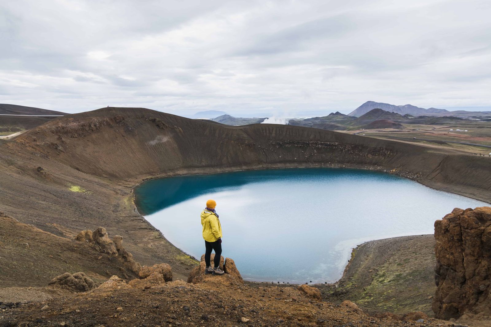
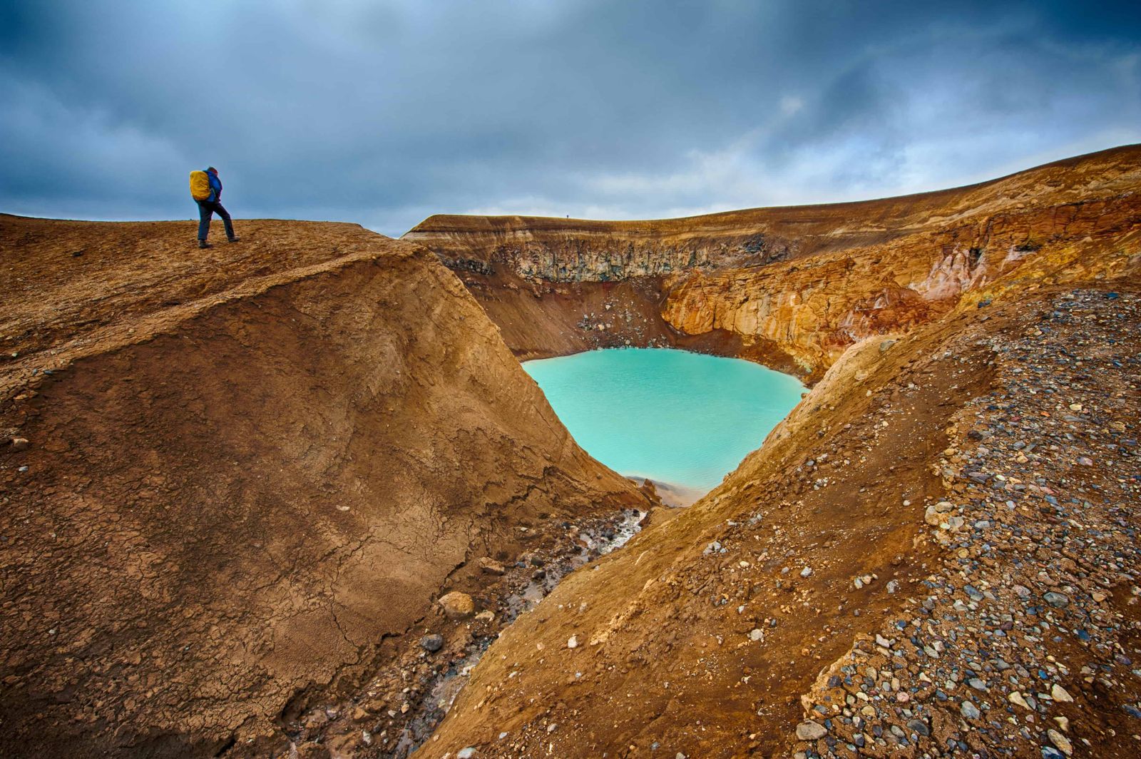
Askja caldera and Víti crater

HighlandsVolcanoFree entrySummer only4x4 only
ASKJA IN SHORT

Askja is a vast volcanic caldera in the Dyngjufjöll mountains of Iceland's central Highlands, within Vatnajökull National Park. It holds the lake Öskjuvatn and, beside it, the smaller, warm Víti crater. Askja lies about 100 km south of the Ring Road by mountain track, a drive of 3–4 hours each way from Mývatn in a 4x4, and a two-day trip from Reykjavík. It is free to visit, open only from about late June to early September, and most visitors spend half a day on the walk to Víti and back.

ON THIS PAGE
Quick factsHistoryGetting thereRouteVítiBest time to visitSafety tipsFacilitiesMapNearbyWhere to stayFAQ

About Askja

Askja is one of Iceland's largest active volcanic systems. The caldera covers about 50 square kilometres in the Dyngjufjöll massif, and inside it a second, younger caldera collapsed after a catastrophic eruption in 1875. That eruption dropped more than a centimetre of ash over roughly 5,000 square kilometres of eastern Iceland, ruining farmland and forcing some families to emigrate. The collapse left behind Öskjuvatn, a deep, cold lake covering about 11 square kilometres and reaching 217 metres deep, Iceland's second-deepest lake after Jökulsárlón.

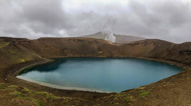
Beside it sits Víti, a smaller explosion crater holding milky-blue, mineral-rich water that is noticeably warmer, typically 20–30°C. From the Vikraborgir car park, a marked trail leads about 2.5 km to the rim of Víti, a walk of 30–40 minutes across stark, otherworldly volcanic ground. The descent into the crater itself is steep and can be slippery when wet, and swimming is sometimes restricted by rangers depending on conditions.

Askja is really several calderas, one inside another. The largest is about 8 km across and is thought to have formed in a big explosive eruption around 10,000 years ago, at the end of the Ice Age. The mountains around it were built up by eruptions under the Ice Age glacier, and the highest point of Dyngjufjöll reaches just over 1,500 metres. All around lies Ódáðahraun, the largest lava desert in Iceland, which covers several thousand square kilometres of the north-eastern Highlands.

The volcano is still active. Its last eruption was in 1961, and since 2021 the ground inside the caldera has been rising slowly, which scientists are watching closely. For visitors this means following the rangers' advice and checking for any restrictions before you set out.

Quick facts

TypeVolcanic caldera with the crater lakes Öskjuvatn and Víti
CalderaAbout 50 km²; the main caldera is about 8 km across
Last eruption1961
RegionCentral Highlands, within Vatnajökull National Park
From ReykjavíkRoughly 600 km by road via Akureyri and Mývatn, then mountain tracks. Plan it as a two-day trip at least
From MývatnAbout 100 km of mountain track from the Ring Road; allow 3–4 hours each way
EntryFree
Opening hoursF-roads typically open late June to early September; closed the rest of the year
RoadF905/F910/F894 or the shorter, harder F88; river crossings, high-clearance 4x4 required
Öskjuvatn lakeAbout 11 km² in area, 217 m deep
Víti crater waterTypically 20–30°C, milky blue
Car parkVikraborgir, at the end of the F894, about 8 km from the Dreki huts
Time neededHalf a day for the walk to Víti and back

The 1875 eruption

On 28–29 March 1875, Askja produced one of Iceland's most destructive eruptions in modern history, throwing rhyolitic ash and pumice over a huge area of eastern Iceland. Farms were buried, livestock died, and the hardship that followed pushed a wave of Icelanders to emigrate to North America. The eruption also emptied out part of the magma chamber beneath the volcano, and the ground above it slowly collapsed to form the caldera that now holds Öskjuvatn.

How to get to Askja

On a guided tourDay tours run from Mývatn in the summer season, handling river crossings and F-road navigation, a good option if you are not confident driving Highland roads yourself.
By carFrom Mývatn, the easiest route is the Ring Road east, then Route 901 (Möðrudalsleið), the F905 and the F910 to the Dreki huts. It is longer than the alternative but the fords are small, so it is more manageable for a standard 4x4. The shorter F88 (Öskjuleið) leaves the Ring Road east of Mývatn and has two bigger river crossings, on the Grafarlandaá and the Lindaá, which need a high-clearance vehicle and experience.
Hiking thereFrom the Vikraborgir car park, a marked trail of about 2.5 km leads to the rim of Víti crater, roughly 30–40 minutes each way.

Askja is only reachable by F-roads, which are closed outside roughly late June to early September and always require a 4x4. Check road.is and a ranger or tour operator for current conditions before setting out, and never attempt a river crossing you are not confident about.

How to reach Askja: step by step

This is the easier of the two routes, by way of Möðrudalur. All of it beyond Route 901 is for 4x4 vehicles only.

Step 1: Ring Road to Route 901Drive Route 1 past Akureyri and Mývatn and continue east. Turn off onto Route 901, Möðrudalsleið, the old main road past the farm at Möðrudalur. The farm is the last place to buy food, and you should arrive with a full tank.
Step 2: The F905Turn right onto the F905, a rough mountain road. Follow it for about 21 km until it meets the F910.
Step 3: The F910 to DrekiJoin the F910 and stay on it all the way. The first ford comes after about 5 km, and there are two or three small crossings in all. The road ends at the Dreki huts and campsite, by the Drekagil ravine.
Step 4: The F894 to VikraborgirFrom Dreki, the F894 climbs about 8 km into the caldera, roughly 20 minutes' drive, to the Vikraborgir car park at the end of the road.
Step 5: The walk to VítiA marked trail crosses the flat caldera floor to Víti and the shore of Öskjuvatn, about 2.5 km and 30–40 minutes each way. Snow often covers parts of the path into July.

Fords change with rain and snowmelt. Stop at the ranger station at Dreki or ask a passing ranger about the rivers, and turn back if you are not sure.

Öskjuvatn and bathing in Víti

The two lakes sit side by side but could hardly be more different.

ÖskjuvatnThe big lake fills the caldera that collapsed after the 1875 eruption. It is dark blue, very cold and about 217 metres deep. You see it from the rim of Víti and from the shore just beyond.
VítiA round explosion crater formed in the same 1875 eruption, with opaque, milky-blue water kept warm from below. Parts of the crater floor still steam and bubble, and the mud at the bottom can be much hotter than the water.
Bathing safelyIf the rangers allow bathing, go down only when the path is dry enough to climb back up. Do not bathe on a completely still day: carbon dioxide can collect just above the water when there is no wind, and it can make swimmers dizzy or short of breath.

There are no changing rooms, no showers and no lifeguard. The path into the crater is steep clay and gets very slippery in rain.

Best time to visit Askja

Summer (late June–early September)The only period when the F-roads into Askja are open. Even then, conditions can change quickly with rain or snowmelt affecting river crossings.

Outside the short summer season, Askja is accessible only with specialist super-jeep operators equipped for winter Highland travel.

Safety and practical tips

  • Only self-drive if you have a proper 4x4 and experience with river crossings; otherwise take a guided super-jeep or bus tour from Mývatn.
  • Check with rangers on site about whether swimming in Víti is currently permitted, as this changes with conditions.
  • The crater descent is steep and loose underfoot, so take care, especially in wet weather.
  • Bring warm, waterproof layers even in summer; the Highlands can be cold, windy and exposed with little shelter.
  • Fill the tank before leaving Mývatn, as there is no fuel available on the F-roads into Askja.
  • Do not bathe in Víti when the air is completely still. Carbon dioxide can gather above the water, so a little wind is safer.
  • Askja has been rising slowly since 2021 and is closely monitored. Check safetravel.is and ask the rangers at Dreki about current restrictions.

Facilities and accessibility

There are basic toilets near the Vikraborgir car park in season. There is no shop, café or fuel at Askja itself; the nearest services are back at Mývatn.

On the map

Open in Google Maps →

Nearby places worth a stop

HerðubreiðIceland's "queen of mountains", visible on the drive in
MývatnMývatnLake and geothermal area, the usual base for reaching Askja
DrekagilRavine and campsite near the Askja car parks
HoluhraunLava field from the 2014–2015 eruption, south of Askja
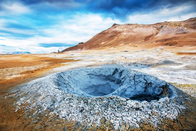
KraflaKraflaVolcanic area with its own Víti crater, near MývatnNámaskarðNámaskarðMud pots and steam vents beside the Ring Road at Mývatn

Where to stay near Askja

There is no accommodation inside the caldera. The Dreki huts and campsite at Drekagil, about 8 km from the car park, are the closest place to sleep and give you an early start on the walk to Víti. Otherwise most visitors base themselves at Mývatn, or at Möðrudalur, which has a campsite and is about 2.5 hours' drive from Askja.

Askja FAQ

Can I self-drive to Askja?

Yes, with a proper high-clearance 4x4 and experience with unpaved F-roads and river crossings. Many visitors prefer a guided tour from Mývatn instead.

When is Askja open?

The F-roads leading in are typically open from late June to early September, weather and river conditions permitting.

Can you swim in Víti crater?

Sometimes. Rangers may restrict swimming depending on conditions, so check locally before planning to swim.

How long is the walk to Víti?

About 2.5 km each way from the Vikraborgir car park, roughly 30 to 40 minutes on foot.

Is there an entrance fee for Askja?

No, it is free to visit, though reaching it requires a 4x4 or a guided tour.

When did Askja last erupt?

In 1961. The best-known eruption was in 1875, which formed Víti and led to the collapse that now holds Öskjuvatn.

How deep is Öskjuvatn?

About 217 metres, which makes it the second-deepest lake in Iceland after Jökulsárlón.

How do you get to Askja from Mývatn?

Drive east on the Ring Road, then Route 901, the F905 and the F910 to the Dreki huts, and finally the F894 to the Vikraborgir car park. Allow 3–4 hours each way in a 4x4.

See Askja with a local

Tours and trips that include Askja, booked directly with a local travel agency in Iceland.
Volcano Tour & Reykjanes SightseeingDAY TOURVolcano Tour & Reykjanes SightseeingFrom 15,990 ISK per personReykjanes GeoParkDAY TOURReykjanes GeoParkFrom 19,300 ISK per personReykjanes Peninsula Private TourPRIVATEReykjanes Peninsula Private TourFrom 179,900 ISK per groupEiríkstaðir Viking LonghouseTICKETEiríkstaðir Viking LonghouseFrom 2,900 ISK per person
More places in Highlands