Iceland Travel Guide logo Iceland Travel GuideLOCAL TRAVEL AGENCY IN ICELAND My trip Talk to a local
Hljóðaklettar

JökulsárgljúfurRock formationsFree entrySummer access easiest
HLJÓÐAKLETTAR IN SHORT

Hljóðaklettar, meaning "Echo Rocks", is a group of twisted basalt formations in Vesturdalur in the Jökulsárgljúfur canyon, part of Vatnajökull National Park in North Iceland. It lies between Ásbyrgi and Dettifoss, is free to enter, and is easiest to reach in summer. A 30-minute loop from the car park covers the main rocks, including the Kirkjan cave.

ON THIS PAGE
Quick factsHistoryGetting thereNamed rocksThe echoTrailsBest time to visitSafety tipsFacilitiesMapNearbyWhere to stayFAQ

About Hljóðaklettar

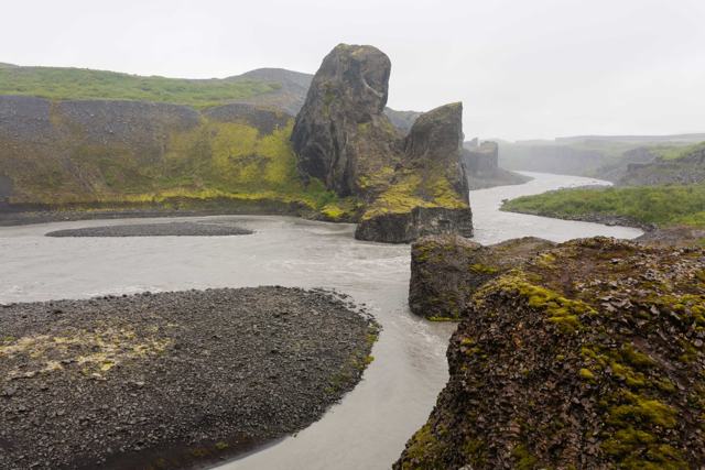
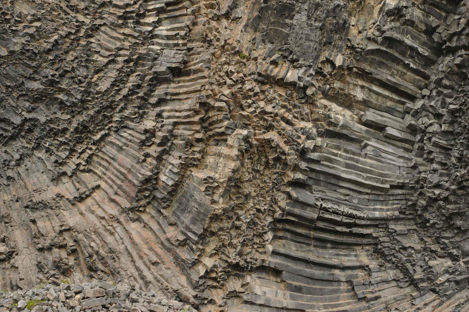
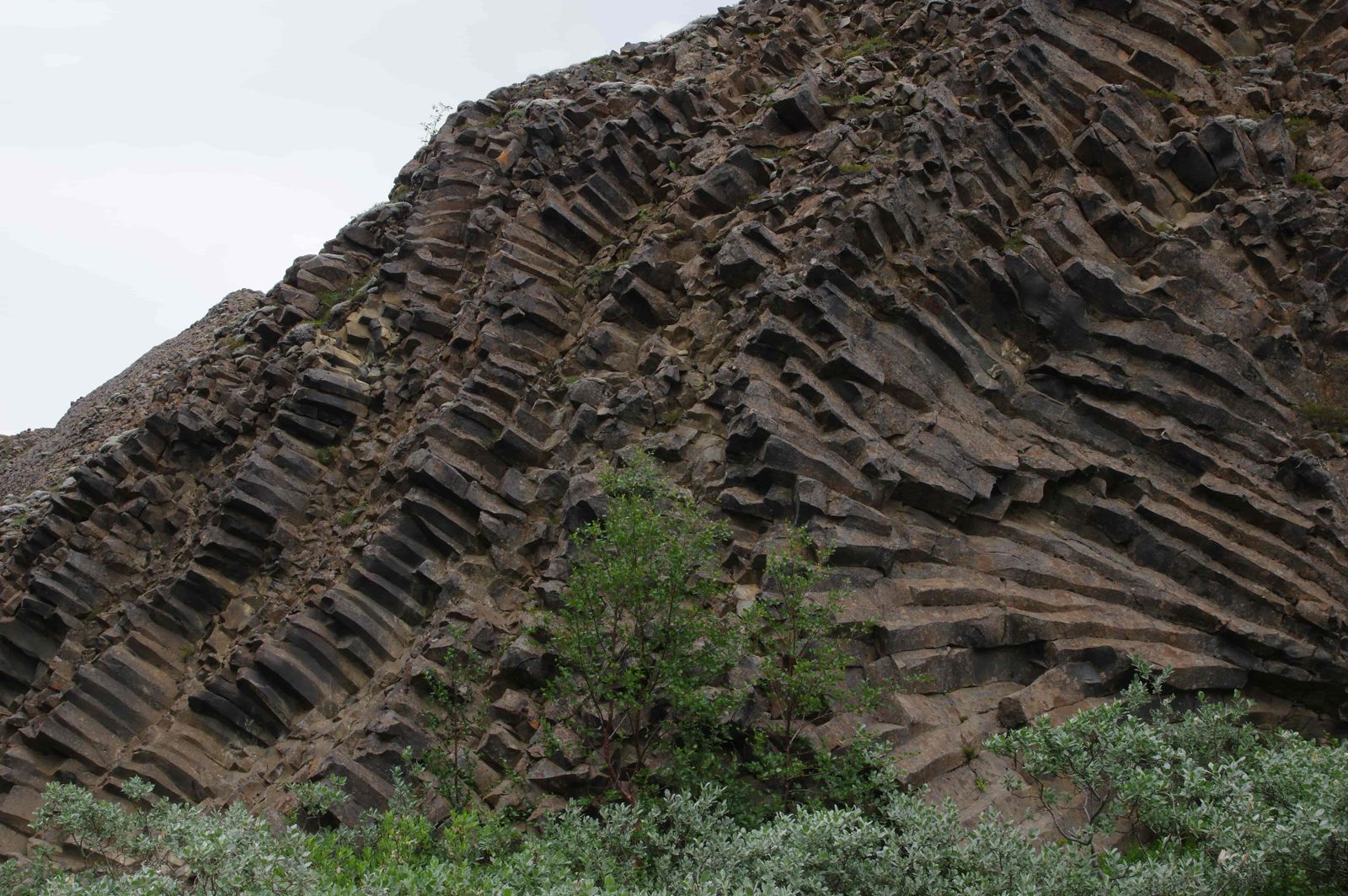
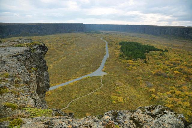
Hljóðaklettar sits where old volcanic craters were cut through by the Jökulsá á Fjöllum river, leaving behind basalt columns set at odd, twisting angles rather than the usual straight rows. Some formations show a honeycomb pattern where the rock has weathered, and hollow, cave-like chambers run through parts of the cliffs. The name refers to the way sound echoes and bounces strangely off the rock walls and the river.

The rocks are the insides of a row of craters about 6 km long that erupted 8,000–9,000 years ago. Later the river, in flood, washed away the loose cinder and left the hard cores where the magma had set inside the vents. The national park describes this as a rare sight anywhere in the world. Because the rock cooled in different directions, the columns lie flat, stand upright, lean at an angle, fan out and curl into spirals.

Walk slowly and you can pick out swirls, rosettes, fans and honeycombs in the cliff faces. Honeycomb weathering, where the surface is pitted with rows of small hollows, is uncommon in Iceland, and this is one of the best places to see it. The landscape looks random and ordered at the same time.

Hljóðaklettar lies in the valley of Vesturdalur, on the west bank of the river, about 15 km south of the horseshoe canyon of Ásbyrgi and north of Dettifoss. It is one of the stranger landscapes on the Diamond Circle route and quieter than either neighbour. It is a good stop for anyone who likes to walk among rock formations and not only look at them from a viewpoint.

Quick facts

RegionNorth Iceland, within Vatnajökull National Park
AreaVesturdalur, Jökulsárgljúfur canyon, west bank of the Jökulsá á Fjöllum
GPS65.9390, -16.5326 (N65° 56' 20" W16° 31' 57")
RoadRoute 862, then the signposted side road into Vesturdalur
From ÁsbyrgiAbout 15 km south
From AkureyriAbout 150 km, around 2 hours by car
FormedA crater row about 6 km long, erupted 8,000–9,000 years ago and later stripped by the river
Trails1.2 km (30 minutes) to 5 km (1.5–2 hours)
EntryFree
Opening hoursOpen all year; the road is reliably open only in summer
Time needed30 minutes to 2 hours, depending on the trail
ProtectedPart of Vatnajökull National Park; walking off the marked paths is not allowed

Why they are called the Echo Rocks

Hljóðaklettar means "sounding rocks", and you will also see it translated as the Echo Rocks or the Whispering Rocks. The national park explains the name by the sound of the Jökulsá á Fjöllum. The roar of the river bounces between the cliffs and caves, so it seems to come from several directions at once and it can be hard to tell where the river actually is.

The rocks are tied to troll stories too. In Icelandic folklore trolls turn to stone when sunlight touches them, and several of the formations here are named as if that is what happened. Tröllið, also called Tröllkarlinn, is the troll. A short walk away, the two pillars Karl og Kerling, the old man and the old woman, stand beside the river. According to the park, these names go back to tales from the settlement of Iceland.

How to get to Hljóðaklettar

From the south: Ring Road and DettifossFrom Route 1 between Mývatn and Egilsstaðir, turn north on Route 862. It is paved and passes the Dettifoss car park. Carry on north towards Ásbyrgi and take the signposted side road down into Vesturdalur, where the Hljóðaklettar car park is.
From the north: Húsavík and ÁsbyrgiDrive Route 85 from Húsavík towards Ásbyrgi and turn right onto Route 862 shortly before you reach the canyon. The turn into Vesturdalur is about 15 km south of Ásbyrgi.
Not from the east sideRoute 864 runs along the east side of the river and does not reach Hljóðaklettar. There is no bridge across the canyon here, so use Route 862.
By public transportThere is no regular bus to the trailhead; this is a stop for self-drivers or a Diamond Circle tour.
ParkingA car park sits at the start of the trail network in Vesturdalur, with no fee. There is a second car park at Langavatnshöfði, on the rim above the valley.

Route 862 is paved, and a normal car is fine in summer. Older descriptions of a rough gravel road that needs a 4x4 are out of date for the main road. In winter the stretch north of Dettifoss gets little or no service and is often closed by snow for months, so plan a summer or early autumn visit and check road.is before you set out.

The named rocks: Kastali, Tröllið and Kirkjan

The short loop passes three formations that have their own names. You meet them in this order as you walk from the car park towards the river.

Kastali (the Castle)The first big outcrop on the walk. Two masses of rock stand together like a fortress: the larger one is the stronghold and the smaller one looks like a turret beside it.
Tröllið (the Troll)Only a few steps further on. From some angles this rock looks like a huge soldier standing guard over the castle. It is one of the many Icelandic rocks said to be a troll caught by the sunrise.
Kirkjan (the Church)About a hundred metres past the Troll, where the path turns away from the river. An almost symmetrical arch opens into a domed cave, known for its acoustics. This is the place to try the echo.
Honeycomb rock and columnsBetween the named rocks, look at the cliff faces. You will see columns lying flat, standing up and fanning out, and patches of honeycomb weathering where the surface is pitted with small hollows.

Stay on the marked paths. The national park does not allow walking off them at Hljóðaklettar or Rauðhólar, to protect the plants.

The Whispering Rocks: the echo at Hljóðaklettar

Step through the arch of Kirkjan and you hear why the place has its name. A shout or a clap does not come back as one clean echo. The sound bounces around the cave and the cliffs outside and returns from several directions, and the rumble of the river is mixed into it. Some visitors find it eerie and others just find it fun.

The effect comes from the shape of the rock. The basalt columns point every way, with hollows and caves between them, so sound is thrown back at many angles. Calm days are best. In strong wind you hear the wind and little else.

Hiking trails at Hljóðaklettar

All trails start from the Hljóðaklettar car park in Vesturdalur. The national park marks them with a letter and a number. A short loop covers the main formations, and with the longer loops you can fill anything from 3 to 6 hours.

Short loop: Hljóðaklettar–Tröllið (V-2)About 1.2 km, roughly 30 minutes, rated easy. It passes the main rock formations closest to the car park, including Kastali, Tröllið and Kirkjan.
Hljóðaklettar circle (V-3)About 3 km, 1 to 1.5 hours, rated challenging by the park. A longer loop that adds more cliffs, columns and cave-like formations.
Rauðhólar (V-4)About 5 km, 1.5 to 2 hours, rated challenging. It continues to the red hills of Rauðhólar, craters that still look as the whole row did before the river stripped it. There are wide views over the river and back to Hljóðaklettar.
Karl og Kerling (V-5)About 2–3 km, 1 hour, easy. A separate walk from Vesturdalur to a viewpoint over two rock pillars beside the river, said to be an old troll couple.
Eyjan in Vesturdalur (V-1)About 1 km, 30 minutes, easy. A short walk on Eyjan, the rock "island" in the middle of the valley.
Ásbyrgi to DettifossThe long-distance trail through the canyon is 32 km and takes two days. It passes through Vesturdalur and Hljóðaklettar, with Hólmatungur and Hafragilsfoss further south.

Trails are marked but uneven in places, with some scrambling over rock. The Jökulsá is fast, cold and grey with silt, so keep well back from the bank.

Best time to visit Hljóðaklettar

Summer (June–August)The most reliable time to visit, with the road open, the trails dry and the Vesturdalur campsite running. Long daylight gives you time for the Rauðhólar loop as well.
Spring and autumnSeptember is often still good, with autumn colour in the birch and heath. In spring the road can stay closed well after the snow has gone lower down, so check before you drive.
Winter (November–March)The road north of Dettifoss is generally not in service and is often closed by snow, so this is not a realistic winter stop for most visitors.

Safety and practical tips

  • Wear sturdy shoes; the paths involve some rock scrambling.
  • Clap or call out inside Kirkjan to hear the echo, and go on a calm day if you can.
  • Combine it with Ásbyrgi and Dettifoss for a full day on the Diamond Circle.
  • Route 862 is paved, but check road.is early and late in the season, when the stretch north of Dettifoss can be closed.
  • There is no shop, food or fuel here, so bring water and a snack. The nearest services are at Ásbyrgi.
  • Stay on the marked paths, which the park requires here, and keep back from the river.
  • Weather changes fast in the canyon. Bring a windproof layer even on a bright day.

Facilities and accessibility

No shop, café or fuel. In summer the national park runs a simple campsite in Vesturdalur, close to the trailhead, with toilets and water. The visitor centre, Gljúfrastofa, is at Ásbyrgi, about 15 km north.

On the map

Open in Google Maps →

Nearby places worth a stop

ÁsbyrgiÁsbyrgiHorseshoe-shaped canyon about 15 km northDettifossDettifossEurope's most powerful waterfall, further south on Route 862SelfossSelfossWide waterfall a short walk upstream from DettifossHafragilsfossHafragilsfossWaterfall in the canyon below Dettifoss
HólmatungurSprings and columnar rock in the canyon to the south
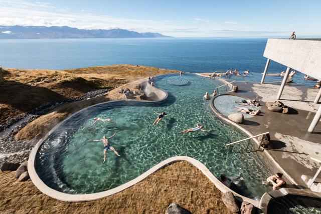
Jökulsárgljúfur canyonJökulsárgljúfur canyonThe wider canyon system Hljóðaklettar sits withinHúsavíkHúsavíkWhale watching town on Route 85GeoSeaGeoSeaGeothermal sea baths in Húsavík

Where to stay near Hljóðaklettar

There is a simple summer campsite in Vesturdalur itself and a larger one at Ásbyrgi. Ásbyrgi and Kópasker have limited accommodation; most visitors base themselves in Húsavík or Mývatn and drive out for the day.

Hljóðaklettar FAQ

What does Hljóðaklettar mean?

"Echo Rocks" or "sounding rocks", named for the way the sound of the river and of voices reflects off the unusual basalt formations.

What are Kastali, Tröllið and Kirkjan?

Three named formations on the short loop: Kastali (the Castle) is a fortress-like pair of rocks, Tröllið (the Troll) stands a few steps on, and Kirkjan (the Church) is a domed cave with an arched entrance, known for its echo.

How do I get to Hljóðaklettar?

Take Route 862, either north from the Ring Road past Dettifoss or south from Route 85 near Ásbyrgi, and follow the signposted side road into Vesturdalur. It is about 15 km south of Ásbyrgi.

Do I need a 4x4?

Not in summer. Route 862 is paved and a normal car is fine. In winter the road north of Dettifoss is often closed.

Is there an entrance fee?

No, it is free to visit as part of Vatnajökull National Park.

Can you visit in winter?

It is difficult. The road north of Dettifoss gets little or no winter service and is often closed by snow.

How long does the visit take?

The short loop takes about 30 minutes; the longer circuit trails take 1 to 2 hours. With Rauðhólar and Karl og Kerling you can spend half a day.

Can you camp at Hljóðaklettar?

Yes, in summer. The national park has a simple campsite in Vesturdalur, close to the trailhead. Camping elsewhere in the park is not allowed.
More places in North Iceland