Iceland Travel GuideLOCAL TRAVEL AGENCY IN ICELAND
My trip
Talk to a local
Iceland Travel GuideLOCAL TRAVEL AGENCY IN ICELAND
My trip
Talk to a local
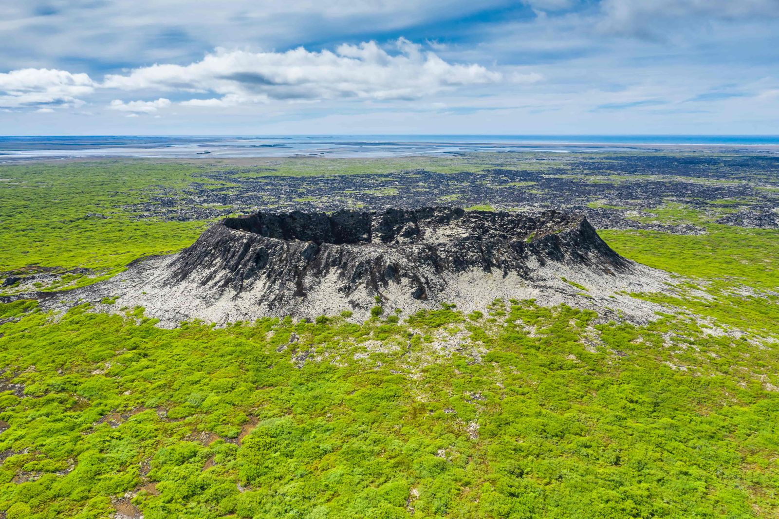
Eldborg is a 60-metre spatter cone crater in the Hnappadalur valley in West Iceland, reached by an easy round-trip hike of about 6.6 km from the Snorrastaðir farm. It is roughly 115 km (around 1 hour 40 minutes) from Reykjavík, free to visit, open all year, and the walk takes around 1.5 to 2 hours.
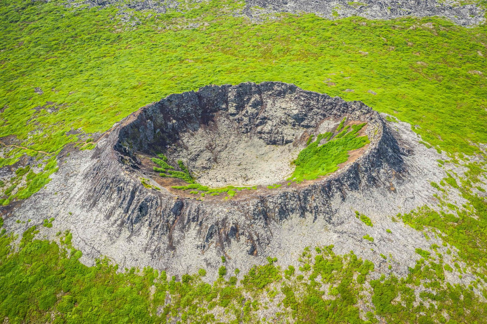
Eldborg, meaning "fire castle", is one of Iceland's most strikingly regular volcanic craters: a near-perfect ring of jagged black rock rising about 60 metres above the surrounding lava field, with a bowl around 50 metres deep. It formed as a spatter cone along a short volcanic fissure, built up from lava fountaining out of a single vent rather than spreading sideways.
The crater is oval, about 200 metres across at its longest, and its rim stands roughly 100 metres above sea level. It is the largest in a short row of craters along the same volcanic rift, and from the top you can pick out the smaller ones nearby. Standing alone on a flat plain with mountains and, on clear days, the Snæfellsjökull glacier behind it, it looks from a distance like a fortress guarding the lava.
That lava is the Eldborgarhraun field, about 32 square kilometres of basalt that poured out of the rift. It has had a long time to cool and is now well vegetated, with moss, shrubs and low birch growing over the rock.
The crater has been a protected natural monument since 1974, and the surrounding Hnappadalur lava field, covered in moss and low vegetation, is part of the appeal of the walk out to it. From the rim, the view stretches over the lava field towards the sea and, on a clear day, across to Snæfellsjökull.
Eldborg means "fortress of fire" or "fire castle", and the name fits the shape. Geologists reckon it was one of the most active volcanoes in the area some 5,000 to 8,000 years ago.
Landnámabók, the medieval Book of Settlements, tells a different story. It describes an eruption in the days of the first settlers and says that a farm stood where the crater is today and burned when the fire came up. The dates don't match what the rocks say, so the tale may belong to another eruption nearby, but it has stuck to Eldborg ever since.
Because it is close to Route 54, Eldborg can be reached in any season. The trail is open all year, but it gets muddy in autumn and can be icy or snow-covered in winter, so proper footwear matters outside summer.
An easy walk of about 6 to 6.6 km there and back. Allow 1.5 to 2 hours.
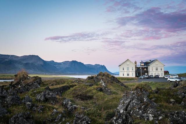
A toilet is available near the trailhead at Snorrastaðir, which also has accommodation. There is no café or shop directly at the crater.
Snorrastaðir, right by the trailhead, offers accommodation, and the villages of Borgarnes and Grundarfjörður have more hotel and guesthouse options within easy reach.
The round trip is about 6.6 km and takes roughly 1.5 to 2 hours at an easy pace.
No, it is free to visit, though it is a protected natural monument and visitors are asked to stay on the marked path.
About 115 km, roughly 1 hour 40 minutes by car.
It is rated easy, though there are some steep, chain-assisted steps near the crater rim and the surface is uneven lava rock.
At Snorrastaðir farm, reached by a side road off Route 54. There is parking and a toilet at the farm.
It is thought to have erupted around 5,000 to 8,000 years ago, although the Book of Settlements tells of an eruption here in settlement times.
Yes. The trail goes right up to the rim, where you look down into a bowl about 50 metres deep.