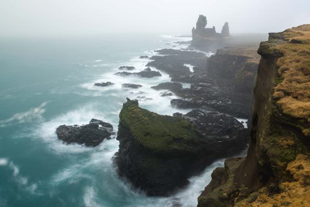
SVÖRTULOFT IN SHORTSvörtuloft is a 4 km stretch of black lava cliffs on the westernmost point of the Snæfellsnes peninsula, marked by the small orange Svörtuloft lighthouse. It is about 215 km (around 3 hours) from Reykjavík, free to visit and open all year, though the last few kilometres are rough gravel. Allow 20–30 minutes for the cliff views, the sea arch and, in early summer, nesting seabirds.
About Svörtuloft
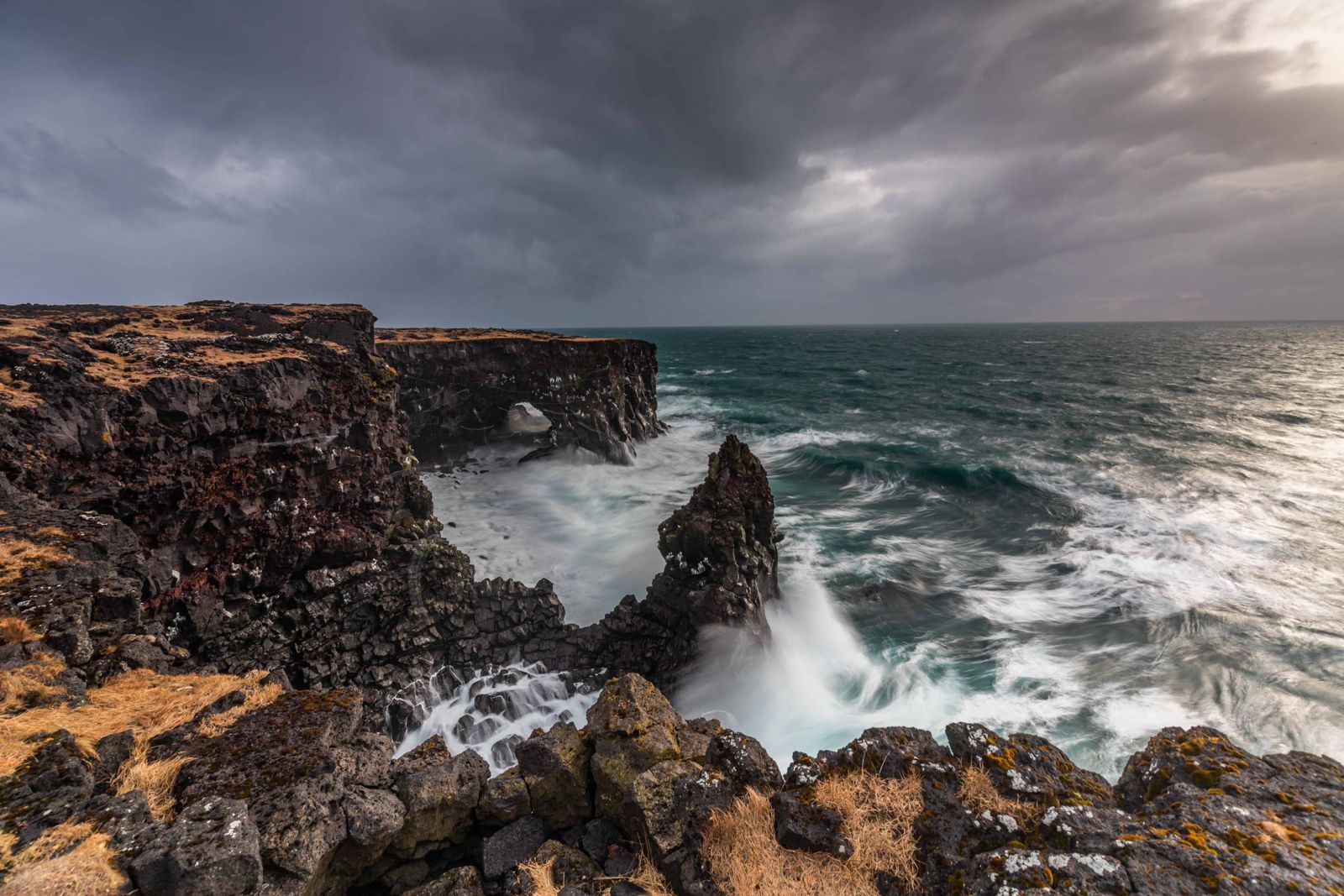
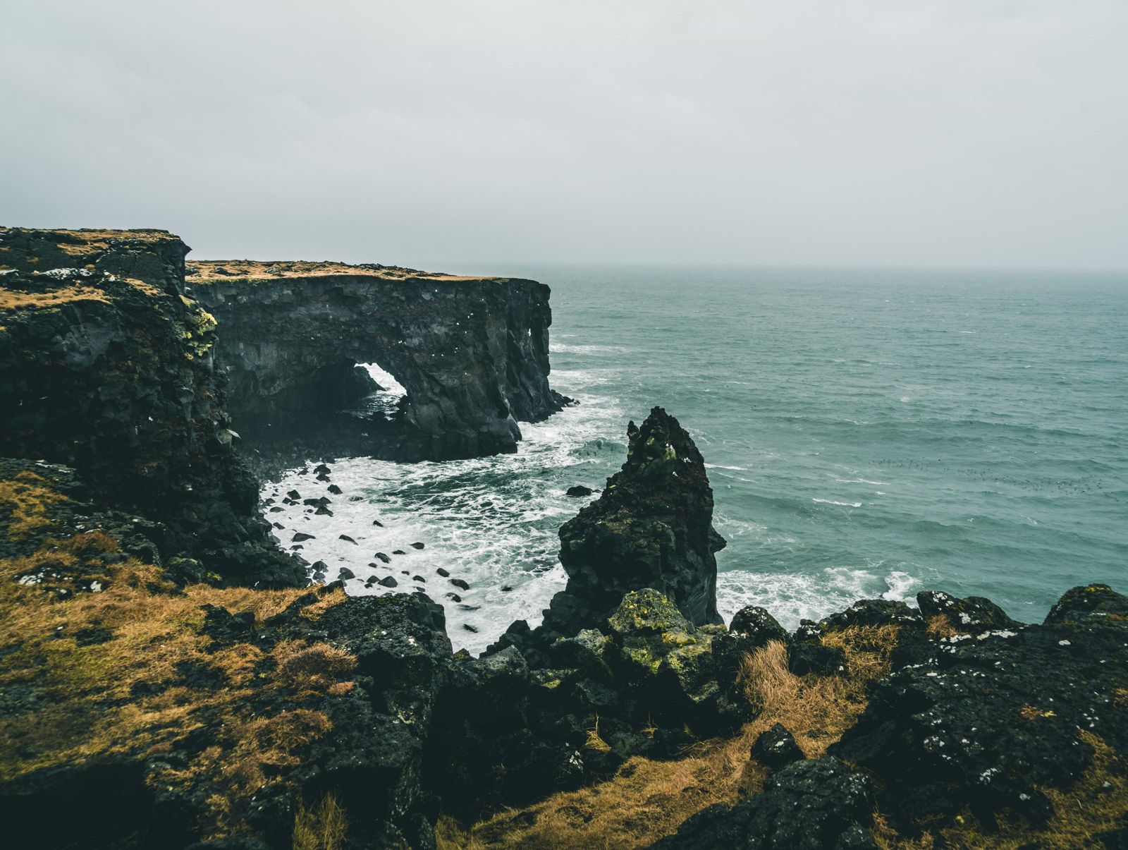
At Svörtuloft, an old lava flow kept going until it reached the cold sea, and the waves have since cut it into a nearly sheer black wall that runs for about 4 km along the coast. The lava looks as if it has been sliced with a knife. The pitch-black rock gives the area its name ("Black Skies" or "Black Vault"), and the small concrete lighthouse, painted bright orange to stand out against the rock, has marked this exposed corner of Snæfellsnes since 1931.
The cliffs sit inside Snæfellsjökull National Park, on a coastline shaped by the same lava flows and volcanic activity as the glacier-capped volcano further along the peninsula. Beside the lighthouse there is a natural sea arch, a lone rock stack and a fenced viewing platform. From May to August seabirds nest on the cliff ledges, and the area is popular for short stops on a longer Snæfellsnes loop.
Svörtuloft is a name used from the sea. Sailors gave it to the black wall they saw from their boats, while people on land call the southern part of the cliffs Saxhólsbjarg and the northern part Nesbjarg. Pick a calm day for your visit: in strong wind the cliff top is no place to stand, and the gravel road out here is no fun in bad weather.
Quick facts
CliffsAbout 4 km of black lava cliffs
LighthouseSvörtuloftaviti (also called Skálasnagaviti), about 12.8 m tall, concrete, in use since 1931
GPS of the lighthouse64.8638, -24.0390
RegionSnæfellsnes, part of Snæfellsjökull National Park
From ReykjavíkAbout 215 km, around 3 hours by car
RoadRoute 574 (Útnesvegur), then Road 579 (Öndverðarnesvegur); the last part is narrow, bumpy gravel
ParkingSmall free car park by the lighthouse, room for about eight cars
EntryFree
Opening hoursOpen all year, best visited in calm weather
BirdsMay to August: kittiwakes, fulmars, guillemots, razorbills, sometimes puffins
Time needed20–30 minutes
A coast that sailors feared
For centuries this was one of the most feared stretches of coast in Iceland. Strong Atlantic currents push straight onto the cliffs, and ships driven ashore on the sharp lava had little chance. That is why a light was put on the point: the first lighthouse, an iron-frame tower, went up in 1914, and the concrete tower you see today replaced it in 1931.
The lighthouse is officially named after the point it stands on, Skálasnagi, so you will see both Skálasnagaviti and Svörtuloftaviti on maps. Svörtuloft itself is a common place name in Iceland. Around 14 places are said to share it, all of them dark cliffs.
How to get to Svörtuloft
From ReykjavíkTake Ring Road 1 north to Borgarnes, then turn left onto Route 54 and follow it west along Snæfellsnes for about an hour. Continue on Route 574 (Útnesvegur) around the tip of the peninsula, or cross to the north side and drive through Ólafsvík and Hellissandur. The whole drive is about 215 km.
The last stretch: Road 579About 10 km west of Ólafsvík, just past Hellissandur, turn off Route 574 onto Road 579 (Öndverðarnesvegur). It passes Skarðsvík beach and then becomes a narrow, bumpy gravel track across the lava. At the end of the track turn left (south) for Svörtuloft; right leads to Öndverðarnes. The lighthouse is roughly 6 km from the main road.
On a guided tourSvörtuloft is included on some full-day and private Snæfellsnes peninsula tours from Reykjavík. Many standard tours skip the gravel road, so check the itinerary.
By public transportThere is no public transport directly to Svörtuloft; a car or tour is needed.
A 4x4 is not strictly needed in summer, but drive slowly, as the gravel is rough and narrow. Treat it as a summer road: in winter it can be icy or impassable. The cliffs are exposed to wind and sea spray, so visit in calm weather and keep well back from the edges, especially in wind or at high tide.
What to see at Svörtuloft
Everything is within a few minutes' walk of the car park.
Svörtuloft lighthouseA square concrete tower about 12.8 m tall, painted orange so that it stands out against the black rock. You cannot go inside, but you can walk right up to it.
The black cliffsThe fenced viewing platform, added a few years ago, lets you look along the sheer cliff face and watch the swell break at its foot without going near the edge.
The sea arch and the stackBeside the lighthouse the sea has cut a natural arch through the lava, with a lone stack standing in the water nearby. Both are easy to photograph from the platform.
Seabirds and whalesBetween May and August kittiwakes, fulmars, guillemots and razorbills nest on the ledges, and puffins are sometimes seen. Whales, including orcas, are occasionally spotted offshore, so bring binoculars.
There are no boardwalks beyond the platform. The ground is loose lava and gravel, and it is muddy after rain.
Places to visit around Svörtuloft
Svörtuloft fits into a loop of the western end of Snæfellsnes. These stops are on the same drive.
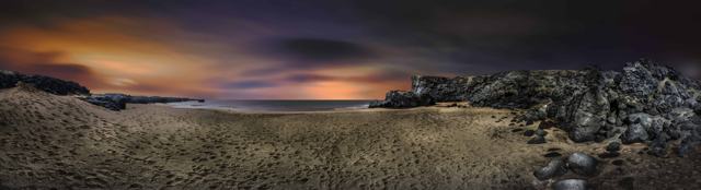
Skarðsvík and ÖndverðarnesYou pass the pale golden sand of Skarðsvík cove on the way out along Road 579. At the end of the track, the right-hand turn leads to the small Öndverðarnes lighthouse and an old well, about 3 km from Svörtuloft.
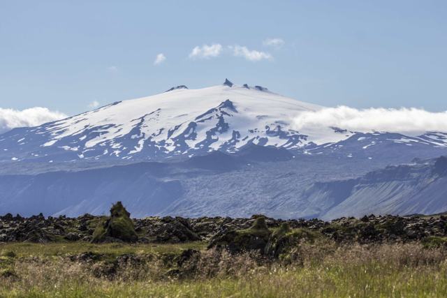
SnæfellsjökullThe glacier-capped stratovolcano at the tip of the peninsula stands 1,446 m high and gives the national park its name. On a clear day it can be seen across the bay from Reykjavík. You can admire it from the road all year, or go up with a guide.
Djúpalónssandur and LóndrangarOn the south side of the park are the black pebble beach of Djúpalónssandur and the twin rock pinnacles of Lóndrangar, both a short drive along Route 574.
Bjarnarfoss waterfallOn the south coast near Búðir, Bjarnarfoss drops in tiers from a basalt cliff into green fields. It is visible from Road 54 at the junction where the road over Fróðárheiði to Ólafsvík meets the coast road to Búðir and Arnarstapi. In strong wind the upper fall blows upwards. An easy path leads from the car park towards the falls.
Best time to visit Svörtuloft
Summer (May–August)The best time to visit: the road is at its easiest, the views are longest, and seabirds including puffins are on and around the cliffs.
WinterFewer birds, but dramatic in stormy weather from a safe distance. Wind can be very strong and the gravel road may be icy or closed by snow, so check conditions first.
Safety and practical tips
- Stay well back from the cliff edge; outside the viewing platform there are no barriers and the drop is sheer.
- Go in calm weather. Wind here can be much stronger than inland, so hold on to hats, camera gear and car doors.
- Drive the gravel section slowly and check that your rental agreement allows gravel roads.
- The car park holds only about eight cars, so in July and August come early or late in the day.
- Bring binoculars if you want a good look at nesting seabirds in early summer.
- Wear sturdy shoes; the lava around the lighthouse is uneven.
- Combine the stop with other west-Snæfellsnes sights like Skarðsvík, Djúpalónssandur and Lóndrangar.
Facilities and accessibility
There are no facilities at Svörtuloft: no toilets, café or fuel. The nearest services are in Hellissandur, about 15 minutes away, and Ólafsvík.
Nearby places worth a stop
Where to stay near Svörtuloft
Most visitors see Svörtuloft as a stop on a Snæfellsnes day trip or loop, staying overnight in Ólafsvík, Hellissandur or Stykkishólmur.
Svörtuloft FAQ
Is there an entry fee for Svörtuloft?
No, it's free to visit, and parking is free.
How far is it from Reykjavík?
About 215 km, around 3 hours by car.
Do you need a 4x4 to reach Svörtuloft?
Not in summer, but the last few kilometres are narrow, bumpy gravel, so drive slowly. In winter the road can be impassable.
Can you go inside the lighthouse?
No, the lighthouse is not open to visitors; it's viewed from outside.
Why is it called Svörtuloft?
The name refers to the pitch-black lava cliffs. It was the sailors' name for the cliffs as seen from the sea.
When is the best time to see puffins here?
Roughly May to August, when seabirds nest on the cliff ledges.
 Iceland Travel GuideLOCAL TRAVEL AGENCY IN ICELAND
My trip
Talk to a local