Iceland Travel Guide logo Iceland Travel GuideLOCAL TRAVEL AGENCY IN ICELAND My trip Talk to a local

Lakagígar craters

HighlandsCraters4x4 onlySummer only
LAKAGÍGAR IN SHORT

Lakagígar (the Laki craters) is a long row of more than 130 volcanic craters formed in the 1783–1784 Skaftáreldar eruption, one of the most devastating in recorded history. It lies within Vatnajökull National Park in the southern Highlands, reached only by the F206 highland road, open in summer and requiring a large 4x4. Allow a full day for the drive and a walk among the craters.

ON THIS PAGE
Quick factsHistoryGetting thereHow to visitWhat to seeTrailsWhat to packBest time to visitSafety tipsFacilitiesMapNearbyWhere to stayFAQ

About Lakagígar

What are the Laki craters? In June 1783 a volcanic fissure opened here and erupted for eight months, sending out huge amounts of lava and toxic gas. Sources give the length of the crater row as anything from 25 to over 29 km, depending on how it is measured, and the national park counts more than 130 craters. The eruption is known in Icelandic as Skaftáreldar (the Skaftá Fires).

The effects were severe. Ash and gas poisoned the grazing land, more than half of Iceland's livestock died, and the famine that followed killed between a fifth and a quarter of the population. The sulphur haze spread across Europe, where it damaged crops and health and is linked to thousands of deaths. Some historians suggest the food shortages that followed added to the unrest that led to the French Revolution.

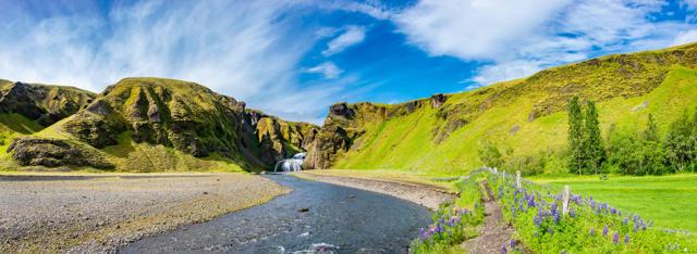
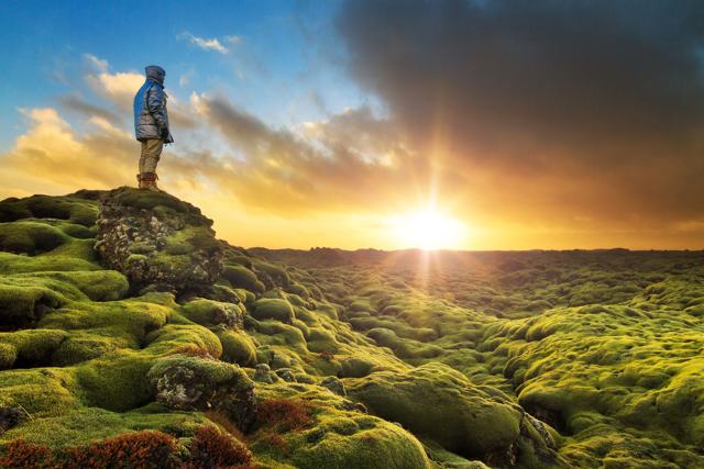
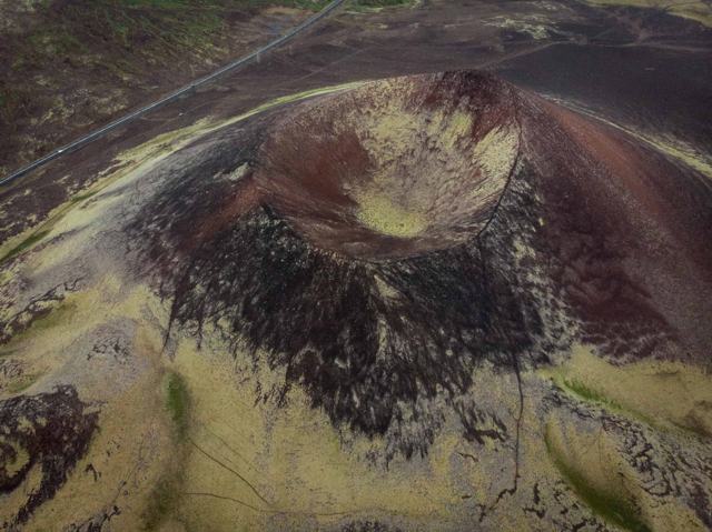
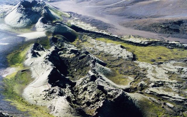
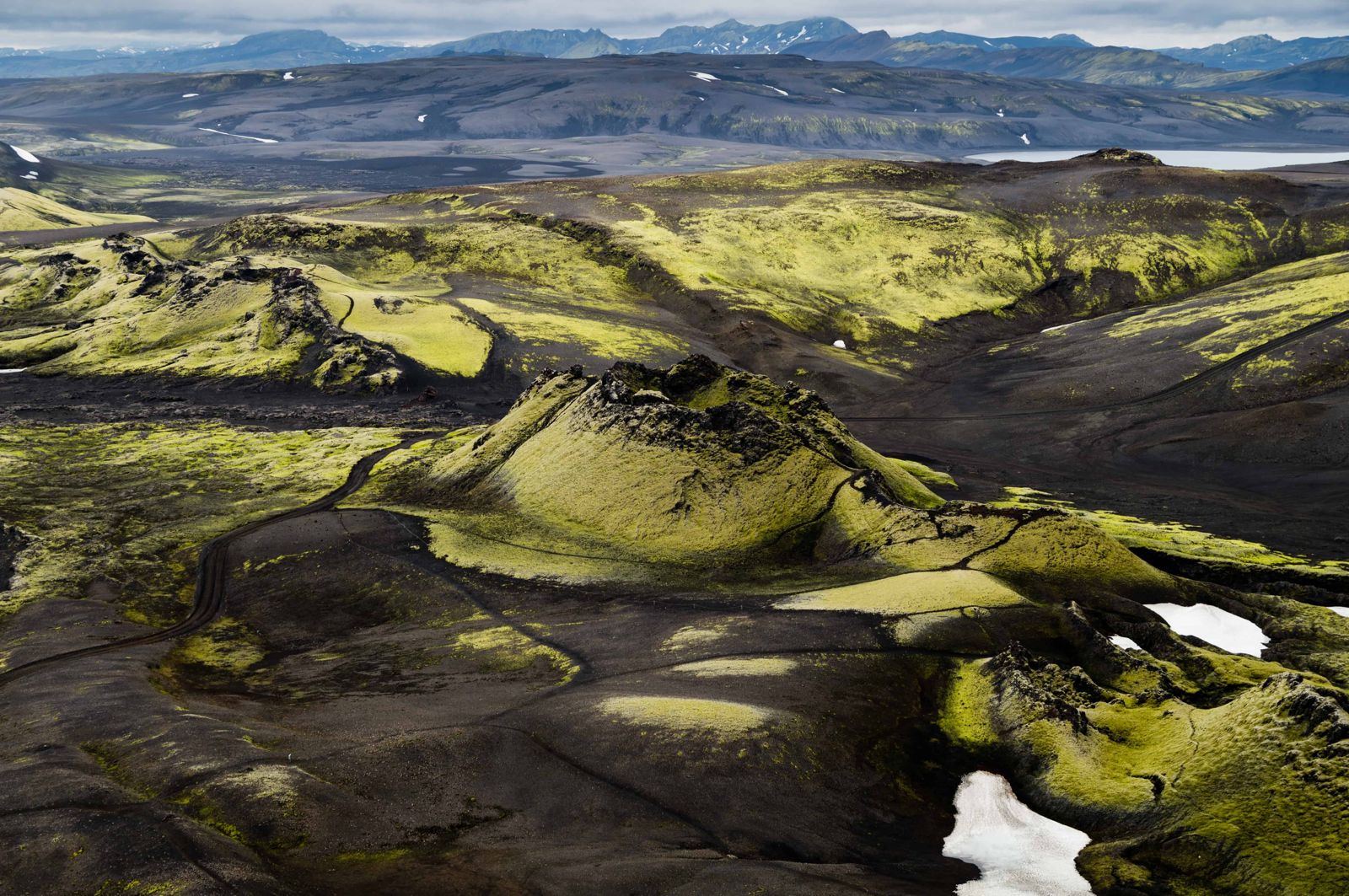
Today Lakagígar is a chain of craters covered in thick grey-green moss, with Mount Laki itself in the middle offering a wide view over the crater row. A marked visitor trail lets you walk among the craters and see the scale of the fissure, while the wider landscape of lava fields, rivers and highland desert gives a sense of how remote and empty this part of Iceland is.

Where is Laki located? The craters lie in the southern Highlands, inland from Kirkjubæjarklaustur and south-west of the Vatnajökull ice cap, in the same volcanic belt as Eldgjá and Landmannalaugar further west. The area is only reachable in summer, and the mountain tracks include several unbridged rivers.

It is a place for people who like geology, photography, walking and history in equal measure. You come for a full day, you see few other people, and you leave with a clear picture of what one eruption did to a whole country.

Quick facts

RegionSouthern Highlands, within Vatnajökull National Park
Crater rowMore than 130 craters along a fissure of roughly 25–29 km
EruptionJune 1783 to February 1784 (Skaftáreldar)
From KirkjubæjarklausturAbout 45–50 km on the F206, around 1.5–2.5 hours each way by 4x4, depending on conditions
RoadF206 and F207 highland roads, large 4x4 only, four unbridged river crossings
EntryFree
OpeningSummer only; the road typically opens from mid or late June and closes in September
Mount Laki trailAbout 2 km, 1–1.5 hours, steep in places
Visitor trailAbout 500 m, roughly 30–40 minutes, from the upper car park
FacilitiesRanger station, toilets and picnic tables at Laki; toilets and picnic tables at Tjarnargígur
ProtectedPart of Vatnajökull National Park

The Skaftá Fires of 1783

The Laki eruption is considered one of the deadliest in history. Poisonous gas and ash, known as the 'haze famine', killed most of Iceland's livestock and between a fifth and a quarter of the population through starvation and disease in the years that followed. The ash cloud spread over Europe and is thought to have affected weather and harvests as far away as North Africa and Asia.

The local pastor Jón Steingrímsson, known as the 'Fire Priest', is remembered for a sermon he gave as lava approached the village of Kirkjubæjarklaustur; the flow is said to have stopped before reaching the church.

How to get to Lakagígar

By carRoad 206 leaves Route 1 a few kilometres west of Kirkjubæjarklaustur, passes Fjaðrárgljúfur and becomes the F206. It is an unpaved highland road with four unbridged river crossings and requires a large 4x4; it is not suitable for a standard rental car or a camper van. The F207 continues around the crater row.
On a guided tourA super jeep tour from Kirkjubæjarklaustur or from further afield is a common way to visit without driving the F206 yourself.
By public transportThere is no public bus service to Lakagígar.

The road is only open in summer, roughly late June to September depending on conditions, and can close again quickly if the weather turns. Check road status on umferdin.is or with the national park before setting out, and never attempt the river crossings alone or in a small car.

How to visit the Laki craters

There are two ways in: drive yourself, or go with a guide in a super jeep. Both take a full day.

Option 1: Self-drivePossible, but only for confident highland drivers in a large 4x4. The F-roads are rough and poorly marked in places, and the river crossings, including the Geirlandsá near Fagrifoss and the Hellisá, rise fast after rain. If you have never forded a river, this is not the place to learn. Check your rental terms, and travel with a second vehicle if you can.
Option 2: Super jeep tourThe safer and easier way for most visitors. A local guide drives a vehicle built for highland tracks and rivers, explains the eruption and its history on the way, and knows the stops you might pass without noticing.
More walking, less backtrackingOn a guided day the guide often moves the jeep to the far end of a trail while you walk, so you can hike one way through the craters and see more.
Staying nearbyThe national park has a campsite and a small mountain hut at Blágil, south of the craters, for those who want two days in the area. Book the hut ahead through the park.

Tours usually set off in the morning, around 9:00, and return in the early evening.

What to see at Laki

The stops below are in the order most visitors meet them on the way in and out.

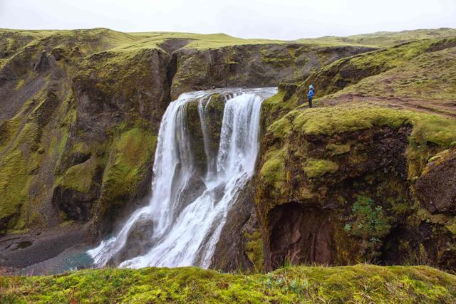
Fagrifoss waterfallOn the way up the F206 you pass Fagrifoss, the ‘Beautiful Waterfall’, a wide fall on the Geirlandsá in a dark gorge. It is a short walk from the track and a good first stop.
Mount LakiThe mountain in the middle of the crater row, which gave the craters their name. The eruption split the land on both sides of it. A fairly steep walk of 1 to 1.5 hours takes you up about 200 m to the top, for a full view along the craters in both directions and over the lava fields to the glaciers.
The crater rowWalk among the craters on the marked visitor trail. Black and red lava, soft moss and long summer light make this the place most photographers remember. The moss is fragile and takes decades to recover from a footprint, so stay on the path.
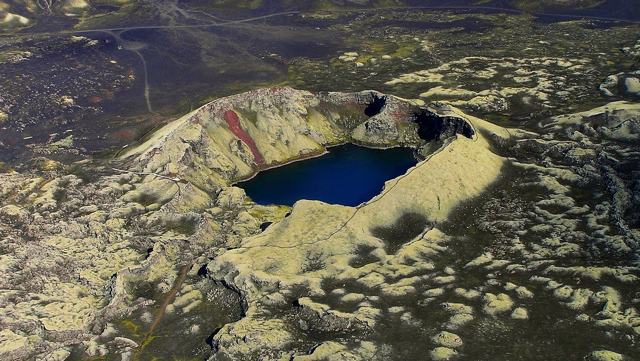
Tjarnargígur crater lakeA crater filled with clear water, ringed by moss and lava. An easy path of about 500 m leads to a viewing point. It is one of the calmest spots in the area.
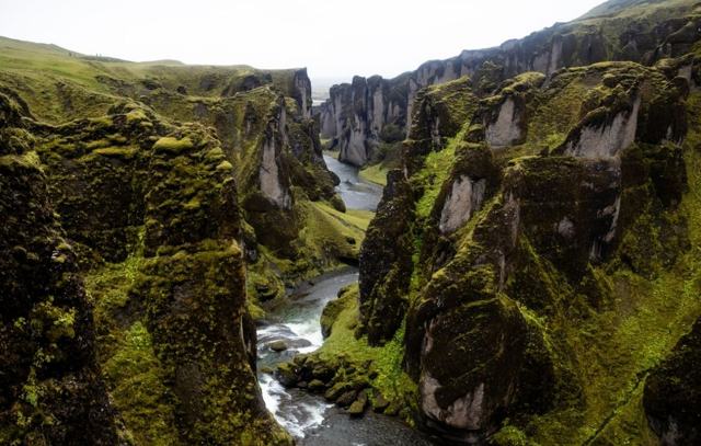
Fjaðrárgljúfur canyonThe winding canyon sits near the start of road 206, so it is often the last stop on the way back to the Ring Road.

Hiking trails at Lakagígar

The national park marks several trails. Times are for the walk only.

Laki summitAbout 2 km, 1–1.5 hours, rated challenging because of the climb. The best overview of the fissure.
Visitor trailAbout 500 m, around 30 minutes, with information signs among the craters near the Laki car park. Some steep steps.
TjarnargígurAbout 500 m, around 30 minutes, easy. To the crater lake.
Tjarnargígur to EldborgarfarvegurAbout 4.5 km, around 2 hours, from the crater lake along an old lava channel.
Longer day routesTwo routes of about 11 km and 4–5 hours each cross the hills at Kambar, by Lambavatn and by Úlfarsdalur and Snagi. For experienced walkers with a map.

Ask the ranger at Laki about conditions before a longer walk. Fog comes in quickly and the terrain looks alike in every direction.

What to pack for Laki

There is nowhere to buy anything once you leave the Ring Road.

Bring warm layers and a waterproof jacket and trousers, even on a sunny morning. Wear hiking boots, as the trails are loose volcanic gravel. Pack lunch, snacks and plenty of water for a full day. A camera is worth its weight here. Sunglasses and sunscreen are useful too: the highland sun is strong in summer and there is no shade. Self-drivers should start with a full tank and carry a paper map.

Best time to visit Lakagígar

Summer (late June–September)The only time the F206 is open and the site is accessible. In most years that means from mid or late June to mid-September.
Time of dayStart in the morning and plan to be back on the Ring Road by early evening. The long summer light helps, but you do not want to ford rivers when you are tired or the light is fading.

Outside summer, Lakagígar is completely cut off by snow and closed rivers. Even in July, expect weather that changes quickly: bring layers, waterproofs and sturdy boots.

Safety and practical tips

  • Only attempt the F206 in a proper large 4x4; do not cross rivers with a standard car.
  • Check road and weather conditions before setting out, and let someone know your plans.
  • Bring fuel, food and water, as there are no services on the route.
  • Stick to the marked trails to protect the moss-covered craters.
  • Allow a full day for the trip from Kirkjubæjarklaustur, including driving time both ways.
  • If you only do one walk, make it Mount Laki. The view explains the whole eruption.
  • Stop at the Skaftárstofa visitor centre in Kirkjubæjarklaustur first for current road and river information.
  • If the rivers are high, turn back. A guided super jeep tour is the better choice for anyone unsure about fording.

Facilities and accessibility

For such a remote place there is more than you might expect. There is a ranger station at Laki in summer, with toilets and picnic tables there and at Tjarnargígur. Blágil has a campsite and hut. There is no food, fuel or shop anywhere on the route. The Skaftárstofa visitor centre in Kirkjubæjarklaustur has information on the area, and that town has fuel, food and accommodation.

On the map

Open in Google Maps →

Nearby places worth a stop

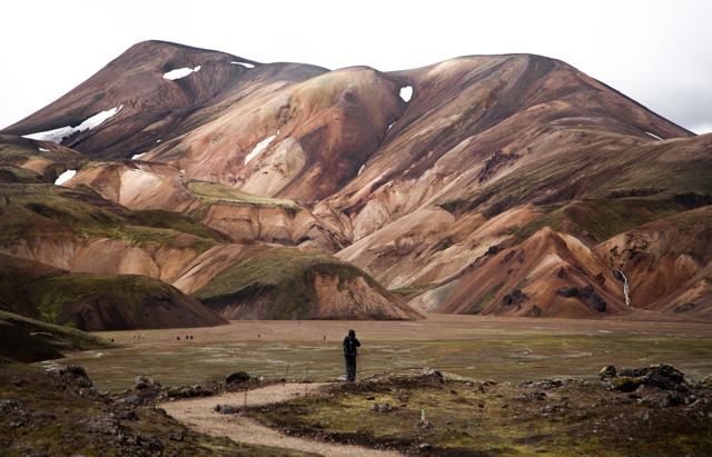
KirkjubæjarklausturKirkjubæjarklausturNearest village and starting point for the F206FagrifossFagrifossWaterfall along the F206 routeFjaðrárgljúfur canyonFjaðrárgljúfur canyonWinding canyon near the start of road 206Eldhraun lava fieldEldhraun lava fieldThe moss-covered lava that flowed from Laki in 1783, crossed by the Ring RoadEldgjáEldgjáAnother highland volcanic fissure, reached by the F208LandmannalaugarLandmannalaugarRhyolite mountains and hot springs further west in the Highlands
LangisjórLong highland lake north-west of the craters

Where to stay near Lakagígar

Kirkjubæjarklaustur is the practical base, with guesthouses, hotels and fuel, and the starting point for the drive up the F206.

Lakagígar FAQ

What are the Laki craters?

A row of more than 130 craters along a volcanic fissure that erupted for eight months in 1783–1784. The eruption, Skaftáreldar, caused a famine in Iceland and a haze that affected weather and harvests across Europe.

Where is Laki located?

In the southern Highlands of Iceland, inside Vatnajökull National Park, about 45–50 km inland from Kirkjubæjarklaustur on the F206.

Do I need a 4x4 to visit Lakagígar?

Yes, a large 4x4 is required. The F206 has several river crossings that a standard car or small SUV cannot safely manage.

When is Lakagígar open?

Only in summer, typically from mid or late June until sometime in September, depending on snow and river conditions that year.

Can I visit without driving myself?

Yes, super jeep tours run from Kirkjubæjarklaustur and elsewhere for visitors who do not want to drive the highland road themselves.

How long is the hike up Mount Laki?

About 2 km and 1 to 1.5 hours there and back, with a climb of roughly 200 m.

Are there toilets at Laki?

Yes. The national park has toilets and picnic tables at Laki and at Tjarnargígur.

Is there an entry fee?

No, entry is free, though this is a remote area with few services, so come prepared.

See Lakagígar with a local

Tours and trips that include Lakagígar, booked directly with a local travel agency in Iceland.
Laki Crater & Lakagígar Lava TourDAY TOURLaki Crater & Lakagígar Lava TourFrom 40,000 ISK per personLaki Craters & Surroundings Airplane TourDAY TOURLaki Craters & Surroundings Airplane TourFrom 51,900 ISK per person
More places in Highlands