Iceland Travel Guide logo Iceland Travel GuideLOCAL TRAVEL AGENCY IN ICELAND My trip Talk to a local
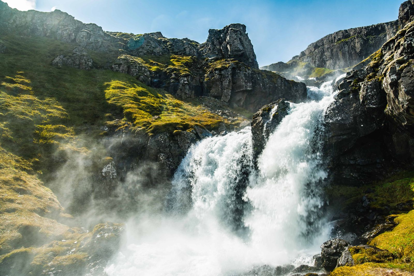
Klifbrekkufossar: the seven-tier waterfall

EastfjordsWaterfallFree entrySummer only
KLIFBREKKUFOSSAR IN SHORT

Klifbrekkufossar is a spring-fed waterfall in about seven steps, roughly 90 metres in total height, on the road down into the remote fjord of Mjóifjörður in East Iceland. It is about 26 km from Egilsstaðir on road 953, a narrow gravel mountain road that is normally only open from around June to September. Entry is free, and you can see the falls from the roadside in a few minutes, or stay longer and walk up beside the tiers.

ON THIS PAGE
Quick factsHistoryGetting thereThe fallsAccessMjóifjörðurBest time to visitSafety tipsFacilitiesMapNearbyWhere to stayFAQ

About Klifbrekkufossar

Klifbrekkufossar tumbles down a hillside in a series of steps, generally described as around seven, on the mountain road that drops into Mjóifjörður, one of the quietest and least visited fjords in the Eastfjords. Although the name is plural, it is easiest to think of it as one long waterfall with seven drops and a total height of about 90 metres. Some visitors count eight or nine steps, depending on which small ledges they include.

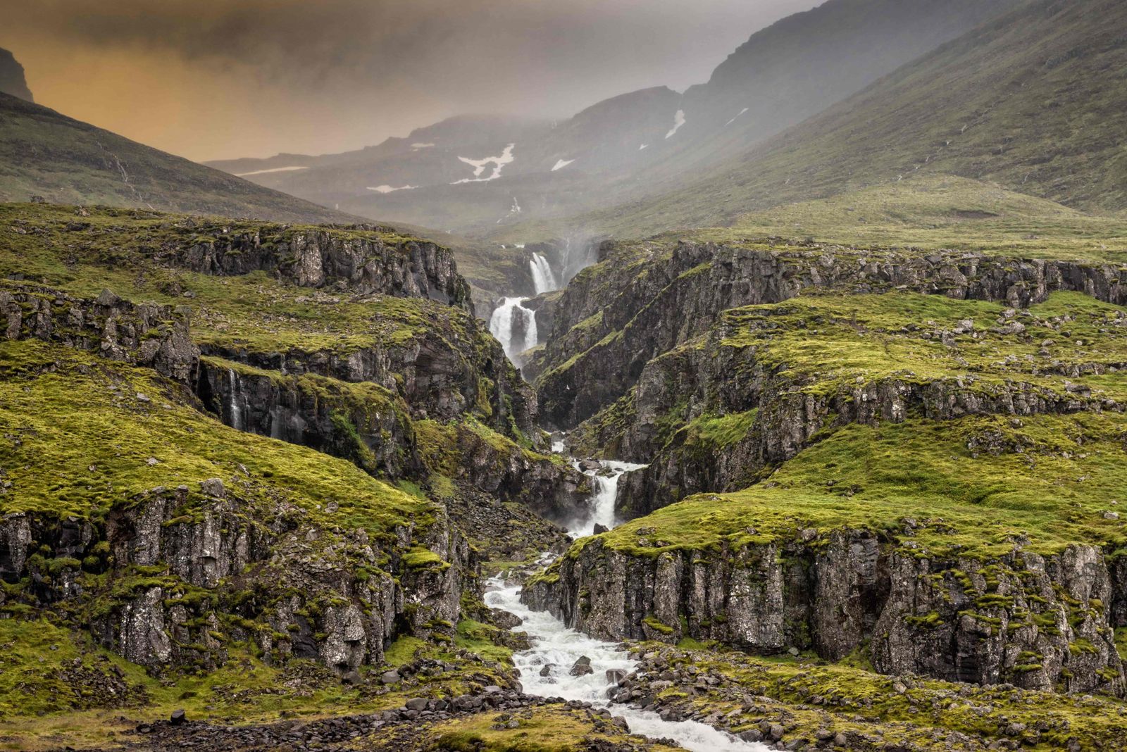
The falls sit between high cliffs at the head of the fjord, so the view changes as you move around: from the road you see the whole staircase, and from closer in you see one tier at a time. Because the river is fed by springs and small lakes rather than a glacier, the water is very clear instead of the grey-brown of a glacial river, the flow stays fairly steady, and the slopes around it turn bright green in summer.

The waterfall is right beside the gravel road, so most visitors see it without any real hike, though there are spots to pull over and walk closer to the base of the lower tiers. Mjóifjörður itself has only a handful of year-round residents, and the mountain road over Mjóafjarðarheiði that leads down to it is usually only passable from around June to September, weather depending.

Quick facts

HeightAbout 90 m in roughly seven steps
Name"Climbing slope waterfalls"
RiverFjarðará, a spring-fed river that collects water from springs and small lakes on the heath above
RegionEast Iceland, Eastfjords, at the head of Mjóifjörður
From EgilsstaðirAbout 26 km; allow 40 minutes to an hour by car
EntryFree
ParkingNo official car park; pull-offs along the gravel road
RoadRoad 953 (Mjóafjarðarvegur) from Route 1: narrow gravel over Mjóafjarðarheiði; a 4x4 is recommended
SeasonRoad normally open about June to September; in winter Mjóifjörður is reached by boat
From the Route 1 turn-offThe gravel road is about 17 km to the head of the fjord; the falls are on the way down
From ReykjavíkAbout 650 km, 8 hours or more of driving
WalkSeen from the road; informal path beside the falls, roughly 0.8 km and 15–30 minutes there and back
GPS65.1776, -14.0868 (the falls, beside road 953)

What the name Klifbrekkufossar means

Klifbrekkufossar translates roughly as "climbing slope waterfalls". The name fits what you see: the water comes down the hillside like a flight of stairs, one ledge after another. The "slope" in the name is the Mjóifjörður side of the mountain pass, the steep hillside the road itself has to work its way down.

Mjóifjörður means "the Narrow Fjord", and that name is just as literal. The fjord is about 18 km long and closed in by steep mountains on both sides. Only a very small community lives here all year, so the landscape around the falls has been left much as it is, with no building or development at the site.

How to get to Klifbrekkufossar

From ReykjavíkKlifbrekkufossar is about 650 km from Reykjavík, which is 8 hours or more of driving without stops. It does not work as a day trip from the capital. Plan it as part of a Ring Road journey with at least one night in East Iceland, and visit from Egilsstaðir or the Eastfjords.
From Egilsstaðir by carDrive south on Route 1 towards Reyðarfjörður. In the Fagridalur valley, between Egilsstaðir and Reyðarfjörður, turn off onto road 953 (Mjóafjarðarvegur), signed for Mjóifjörður. The road climbs over the Mjóafjarðarheiði heath and then drops towards the fjord. Klifbrekkufossar comes into view on your right on the way down, about 26 km from Egilsstaðir.
The mountain road (953)Road 953 is gravel, narrow and steep in places. It is about 17 km from the Route 1 turn-off to the head of the fjord, and the road then continues along the shore of the 18 km long fjord. Drive slowly, use the passing places and expect loose gravel and potholes. It is not an F-road, but a 4x4 is the safer choice, and you should check what your rental agreement says about gravel mountain roads.
By public transportThere is no regular public transport into Mjóifjörður, so a car is needed.
ParkingThere is no formal car park. Small pull-offs beside the road near the foot of the falls have room for a few cars. Pull off carefully where it is safe to do so, and do not block the narrow road.

The road into Mjóifjörður is unpaved, narrow and winds over a mountain pass, so it is usually only open in summer. When it is closed in winter, the people of the fjord travel in and out by boat, on a scheduled service from Neskaupstaður. Check road conditions on umferdin.is before setting out, even in summer.

Klifbrekkufossar: seven drops between the cliffs

Seven tiers, 90 metresThe river falls about 90 metres in total, split into roughly seven steps. No single drop is very high. It is the full staircase, seen at once from below, that makes the view.
Spring water, not glacier waterMost of Iceland's big waterfalls are on glacial rivers. Klifbrekkufossar is on the Fjarðará, which collects water from springs and small lakes on the heath above. The water carries no glacial silt, so it runs very clear.
Best view: the foot of the fallsStand in front of the waterfall at the bottom. From there you see all the tiers stacked above each other, with the cliffs on both sides. This is also the easiest spot to reach from the road.
Walking up beside the fallsAn informal path climbs the slope beside the tiers: roughly 0.8 km there and back, 15 to 30 minutes, with about 70 metres of climb. Going up does not give a better overall view, but it gets you close to the clear water and the individual drops. There is no marked trail and the grass is slippery when wet.

There are no fences or railings. Keep back from wet rock at the edges and keep children close.

Why you can only reach Klifbrekkufossar in summer

Klifbrekkufossar can only be visited by car from about June to September, and the exact dates depend on the weather and the snow each year. The mountain pass that leads from the heath down to the waterfall and the fjord is demanding even in summer, and in winter it is closed, typically from around October until some time in May.

While the road is shut, Mjóifjörður is cut off by land, and the residents rely on a boat to get in and out. For visitors that means a winter trip to the falls is not realistic. Early and late in the season the road can open late or close early after snowfall, so always check umferdin.is on the day.

Mjóifjörður, the Narrow Fjord

If you have come this far, it is worth driving on past the waterfall into the fjord itself.

Mjóifjörður is one of the least populated places in Iceland that you can still drive to. Only around a dozen people live here all year, in and around the tiny village of Brekka. The remote location keeps visitor numbers low, which is why the fjord feels so untouched.

Along the fjord you pass the Prestagil ravine and, across the water at Asknes, the remains of a whaling station built by Norwegians around 1900, which was one of the largest in the world at the time. The road ends at the Dalatangi lighthouses at the mouth of the fjord. Services are very limited and seasonal, so bring what you need.

The road beyond the head of the fjord is narrow and runs under steep slopes. Take it slowly and allow plenty of time to drive back out over the pass.

Best time to visit Klifbrekkufossar

Summer (June–September)The only reliable time to drive in, with green slopes and steady flow from the spring-fed river. The road often opens in June and closes again in autumn, depending on snow.
WinterThe mountain road is normally closed from around October into May, and Mjóifjörður is then cut off by road, with locals travelling by boat. This is not a realistic time to visit by car.

Safety and practical tips

  • Check road conditions on umferdin.is before you go; road 953 is a narrow gravel mountain road, not suitable for all rental cars.
  • For the best view, stand at the foot of the falls rather than climbing to the top.
  • There are no barriers at pull-off spots or beside the falls, so take care with children near the edge.
  • This is a quiet, little-visited waterfall, so don't expect facilities or other visitors.
  • A 4x4 is the safer choice for the mountain pass, especially outside peak summer.
  • Fill up with fuel in Egilsstaðir or Reyðarfjörður before you turn off; services in Mjóifjörður are very limited.
  • Weather changes fast on the heath. Fog and rain can come in quickly, so bring waterproofs and drive to the conditions.
  • Coming from Reykjavík, plan at least one night in East Iceland; it is too far for a day trip.

Facilities and accessibility

None at the waterfall. Limited services exist in the small village of Mjóifjörður itself further down the fjord.

On the map

Open in Google Maps →

Nearby places worth a stop

MjóifjörðurThe Narrow Fjord itself, 18 km long, with the tiny village of Brekka
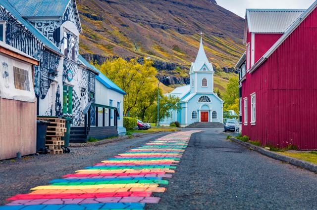
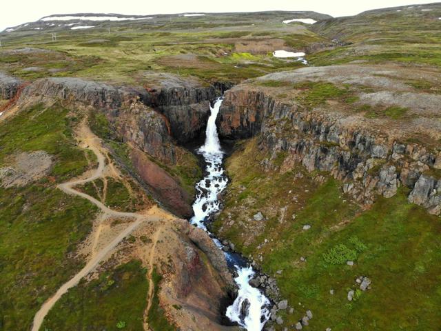
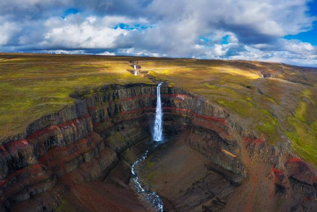
EgilsstaðirEgilsstaðirThe regional hub, about 26 km awaySeyðisfjörðurSeyðisfjörðurA colourful Eastfjords townFardagafossFardagafossWaterfall just outside Egilsstaðir, on the road to SeyðisfjörðurHengifossHengifossOne of Iceland's tallest waterfalls, with red layers in the cliff
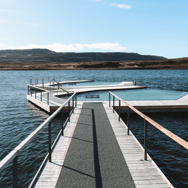
Klifbrekkufossar: the seven-tier waterfallVök BathsGeothermal pools floating on a lake near Egilsstaðir
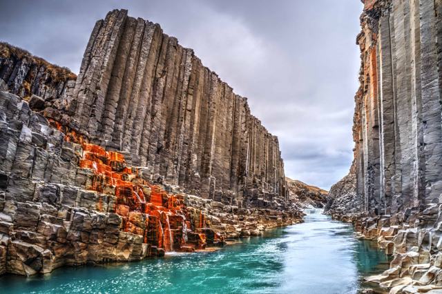
Stuðlagil canyonStuðlagil canyonBasalt column canyon in the region

Where to stay near Klifbrekkufossar

Egilsstaðir has the widest range of accommodation in the area, and makes a practical base for a day trip into Mjóifjörður.

Klifbrekkufossar FAQ

Is Klifbrekkufossar free to visit?

Yes, there is no entry fee and no parking fee.

How do I get to Klifbrekkufossar?

From Egilsstaðir, drive Route 1 towards Reyðarfjörður and turn onto road 953 (Mjóafjarðarvegur) in Fagridalur. Follow the gravel road over the Mjóafjarðarheiði heath. The falls are on your right on the way down to the fjord, about 26 km from Egilsstaðir.

Can I visit in winter?

The mountain road into Mjóifjörður is normally closed in winter, so a visit by car is usually only possible from about June to September. In winter the fjord is reached by boat.

Do I need a 4x4?

Road 953 is not an F-road, but it is narrow gravel over a mountain pass, so a 4x4 is recommended, especially outside midsummer. Check your rental terms for gravel mountain roads.

How many tiers does the waterfall have?

It is generally described as having about seven steps, with a total height of roughly 90 metres.

What does Klifbrekkufossar mean?

Roughly "climbing slope waterfalls", after the way the water steps down the steep Mjóifjörður side of the mountain pass.

Is there a hike to Klifbrekkufossar?

No hike is needed. The falls are visible from the road, and it is a short walk from the pull-offs to the foot. An informal path continues up beside the tiers for a closer look.

How far is Klifbrekkufossar from Reykjavík?

About 650 km, or 8 hours or more of driving, so plan it as part of a trip around East Iceland rather than a day trip.
More places in East IcelandWaterfalls in Iceland