Iceland Travel Guide logo Iceland Travel GuideLOCAL TRAVEL AGENCY IN ICELAND My trip Talk to a local

Íráfoss waterfall

South IcelandWaterfallFree entryOpen all year
ÍRÁFOSS IN SHORT

Íráfoss (also written Írárfoss, and sometimes called Árjánurfoss) is a narrow waterfall on the Írá river under the Eyjafjöll mountains in South Iceland, between Seljalandsfoss and Skógafoss. You can see it from the Ring Road, it is free to visit, and a stop takes about 20–30 minutes.

ON THIS PAGE
Quick factsGetting thereFind itBest time to visitSafety tipsFacilitiesMapNearbyWhere to stayFAQ

About Íráfoss

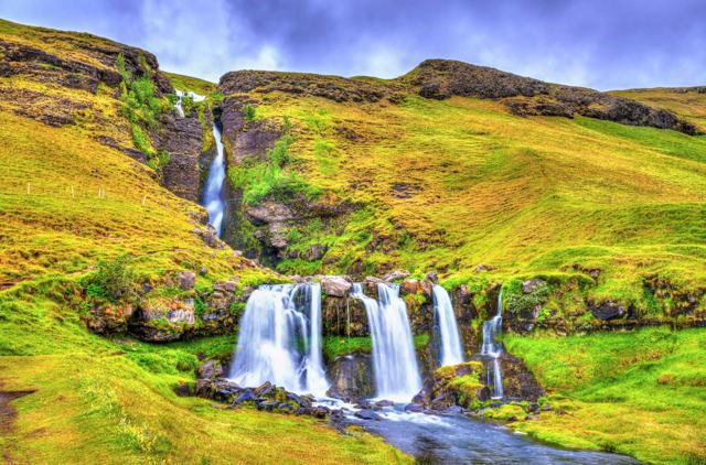
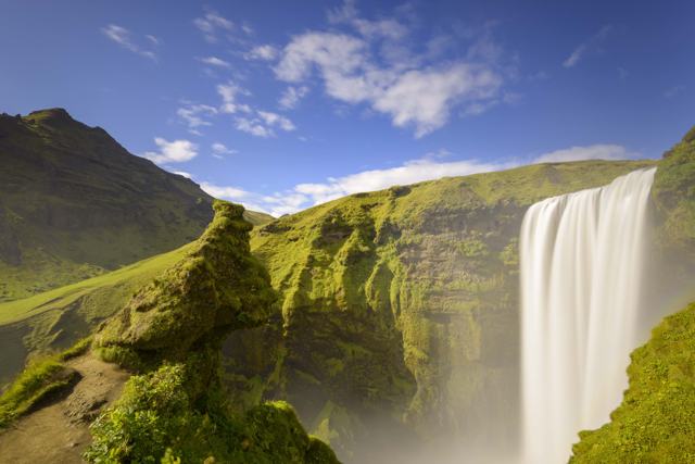
Íráfoss falls in a narrow stream over a rock face in the Eyjafjöll area, a few minutes from the farm Ásólfsskáli. The water lands on a rock skirt near the base and sprays out for the last part of the drop. Basalt columns frame the canyon above.

It is a quiet alternative on a busy stretch of the South Coast. You can see it from the road, and a short, easy walk brings you closer. Most visitors combine it with Seljalandsfoss and Skógafoss.

The Írá river comes down from the Eyjafjallajökull glacier and forms three larger waterfalls and a few smaller ones on its way. Íráfoss is the first of them, dropping out of a basalt canyon. Further up the river is Hestafoss, about 30 metres high, and from the top of Íráfoss you may spot other falls that have no well-known name.

From the Ring Road it does not look like much. Close up it is a different thing, and you will usually have it to yourself. Few travellers stop here and it is missing from most guidebooks, which is why we give the coordinates below.

Quick facts

HeightAbout 30–41 m (sources differ)
RiverÍrá
Other namesÍrárfoss, Árjánurfoss
RegionSouth Iceland, Eyjafjöll area
LocationBetween Seljalandsfoss and Skógafoss, near Ásólfsskáli
GPS63°34'39.4"N 19°49'44.2"W (63.5776, -19.8290)
RoadRoute 246, off the Ring Road (Route 1)
EntryFree
ParkingRoadside pull-out; no fee found
Opening hoursOpen all day, all year
Time needed20–30 minutes
WalkingShort, easy walk from the road

How to get to Íráfoss

By carDrive the Ring Road (Route 1) along the South Coast between Seljalandsfoss and Skógafoss. The falls are visible from the road near Ásólfsskáli. Use the marked pull-outs and do not stop on the road.
On a guided tourSouth Coast tours drive past the area but rarely stop here. A private tour can add it as a short extra stop.
By public transportBuses on the South Coast run along Route 1, but they do not stop at Íráfoss, so a car is the easy way.

How to find Íráfoss waterfall

The waterfall is not signposted, so use the coordinates and these directions.

Step 1: Set the coordinatesPut 63°34'39.4"N 19°49'44.2"W into your map app before you set off.
Step 2: Along the Ring RoadDriving east on Route 1, you pass through Hvolsvöllur and then past Seljalandsfoss. Keep going for about 10 minutes until Route 246 turns off to your left.
Step 3: Route 246 and the bridgeRoute 246 passes several private farms. You come to a bridge over the stream, and from the bridge you can see Íráfoss.
Step 4: The walkThe fall is a short, easy walk from the road. If you want to go further up the gorge, there is no marked trail. The going is not hard, but watch your footing and turn back if the ground is wet or icy.
On horsebackRiding tours on Icelandic horses operate around Eyjafjöll, and a ride is another way to see this side of the mountains.

This is working farmland. Park where you do not block gates or farm tracks, and leave gates as you found them.

Best time to visit Íráfoss

Summer (June–August)Easy access, long days and a steady flow. Nearby waterfalls are busy, so this is a calm alternative.
Winter (November–March)Ice can form around the falls. Paths and the road edge can be slippery and days are short.

The South Coast is open all year, so Íráfoss fits easily into a day that includes Seljalandsfoss and Skógafoss.

Safety and practical tips

  • Park only in marked pull-outs. Do not stop on the Ring Road.
  • Stay on the path and respect any fences. Some land nearby is private farmland.
  • Bring a waterproof jacket. Spray blows across the base.
  • Wear shoes with grip. The ground near the falls is wet.
  • Check vedur.is and umferdin.is before driving along the South Coast in winter.

Facilities and accessibility

There are no facilities at the falls. The nearest toilets, cafés and shops are at Skógar and Seljalandsfoss.

On the map

Open in Google Maps →

Nearby places worth a stop

SeljalandsfossSeljalandsfossWaterfall you can walk behindSkógafossSkógafossWide 60 m waterfall next to SkógarSkógarSkógarVillage with a folk museumRútshellirRútshellirHistoric man-made cave nearbyGluggafossGluggafossWaterfall with holes in the rock face, to the west

Where to stay near Íráfoss

Stay around Skógar, Hvolsvöllur or Vík. Guesthouses and hotels along the South Coast fill up in summer, so book ahead.

Íráfoss FAQ

Where is Íráfoss?

On the Írá river under the Eyjafjöll mountains, between Seljalandsfoss and Skógafoss, near the farm Ásólfsskáli.

How high is Íráfoss?

Sources differ between about 30 and 41 metres, so treat the height as approximate.

Is it free?

Yes, there is no entrance fee.

Can I see it from the Ring Road?

Yes, the falls are visible from Route 1, and you can walk a short distance to get closer.

How long should I stay?

20–30 minutes is plenty.

Is Íráfoss the same as Árjánurfoss?

Yes. The waterfall is written Íráfoss or Írárfoss and is sometimes called Árjánurfoss.

How do I find Íráfoss?

Use the coordinates 63°34'39.4"N 19°49'44.2"W. From Route 1 east of Seljalandsfoss, turn onto Route 246; the fall is visible from the bridge over the stream.
More places in South IcelandWaterfalls in Iceland