Iceland Travel GuideLOCAL TRAVEL AGENCY IN ICELAND
My trip
Talk to a local
Iceland Travel GuideLOCAL TRAVEL AGENCY IN ICELAND
My trip
Talk to a local
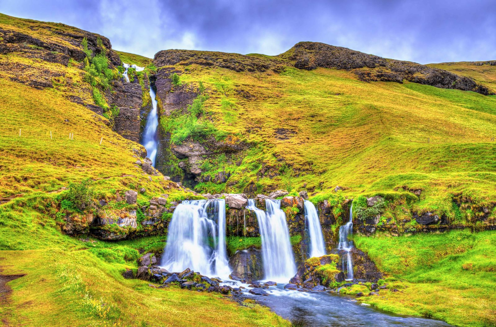
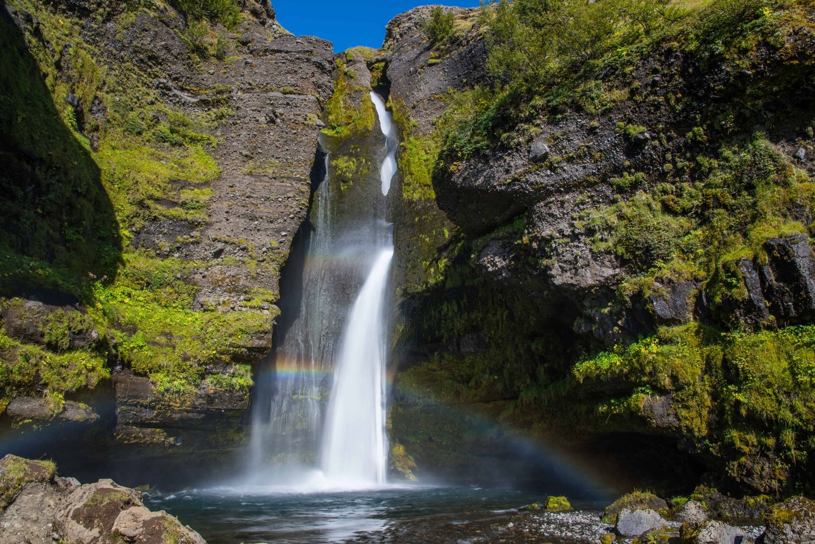
Gluggafoss, also known as Merkjárfoss, is a waterfall on the river Merkjá in Fljótshlíð, South Iceland, with a total drop of about 52 metres in two stages. It is about 130 km (around 1 hour 45 minutes) from Reykjavík, free to visit, open all year, and most people spend 30–45 minutes there.
The name Gluggafoss means "window falls", after the small openings and tunnels worn through the soft palagonite rock behind and beside the water. Through these gaps you can see parts of the falls that would otherwise be hidden, especially on the upper section. The river drops about 44 metres in the upper stage, then a further 8.5 metres lower down.
The lower step is the easier one to get close to. Here the river spreads over a hard basalt ledge and comes down in three channels side by side, a little like an upside-down trident. A short path leads right up to it, and you can walk in behind the water if you do not mind getting wet.
Gluggafoss sits a short way off the Ring Road in the farming district of Fljótshlíð, below the slopes that lead up towards Þórsmörk and the highlands. It is far less visited than Seljalandsfoss or Skógafoss nearby, which makes it a good stop if you want a waterfall without the crowds.
The setting is part of the appeal. Green hillsides rise behind the falls, farms spread out across the flat land below, and on a clear day you look straight across the valley to the Eyjafjallajökull ice cap. It is a calm place for a short walk and a picnic on a South Coast day.
The upper part of the cliff is palagonite, a tuff rock made of compacted volcanic ash, sand and stones. The lower ledge is hard basalt. Palagonite is soft and wears away easily, so the river has cut tunnels and holes through it, and the water shows through these openings. They are the "windows", <em>gluggar</em> in Icelandic, that give Gluggafoss, the Window Falls, its name.
The waterfall has changed within living memory, which is rare. According to the information board at the site, before 1947 the upper half of the falls could hardly be seen. The river ran down a vertical tunnel inside the cliff and showed only through three windows, one above the other, before pouring out of the lowest one in an arch.
Then Hekla erupted in 1947. The river carried a layer of volcanic ash about 20 cm thick downstream, the tunnel filled up, and the water was pushed out over the front of the cliff. It took close to 50 years for the river to wash the ash and debris away and for the falls to return to something like their earlier shape.
The falls still look different from one visit to the next. When the Merkjá is running high, part of the water hits the upper arches and sprays outwards, while the rest drops into the hollow behind the rock and pours out from under the lowest arch.
Most people stay 30 to 45 minutes. There is more to look at than the first view from the car park suggests.
Stay on the paths. Palagonite is soft and crumbly, and the edges above the falls are not fenced.
There are no facilities at the waterfall itself. Hvolsvöllur, about 17 km away, has fuel, shops and restaurants.
Hvolsvöllur and the wider South Coast have a good range of hotels and guesthouses, making Gluggafoss an easy stop on the way to or from the bigger South Coast waterfalls.
Yes, Gluggafoss is the common name, and Merkjárfoss (after the river Merkjá) is used interchangeably.
Small holes and tunnels worn through the soft rock beside the falls let you see parts of the water through them, like windows.
Yes, there is no entrance fee.
About 52 metres in total. The upper drop is about 44 metres through soft palagonite rock, and the lower step is about 8.5 metres over basalt.
Yes, behind the lower section. Expect to get wet, and take care on the slippery rock.
Turn off the Ring Road at Hvolsvöllur onto Route 261 and drive about 17 km into Fljótshlíð. The falls are signposted and there is a small parking area.
Ash from the Hekla eruption in 1947 was carried down the river and blocked the tunnel the water used to run through inside the cliff. It took almost 50 years for the river to clear it.