Iceland Travel GuideLOCAL TRAVEL AGENCY IN ICELAND
My trip
Talk to a local
Iceland Travel GuideLOCAL TRAVEL AGENCY IN ICELAND
My trip
Talk to a local
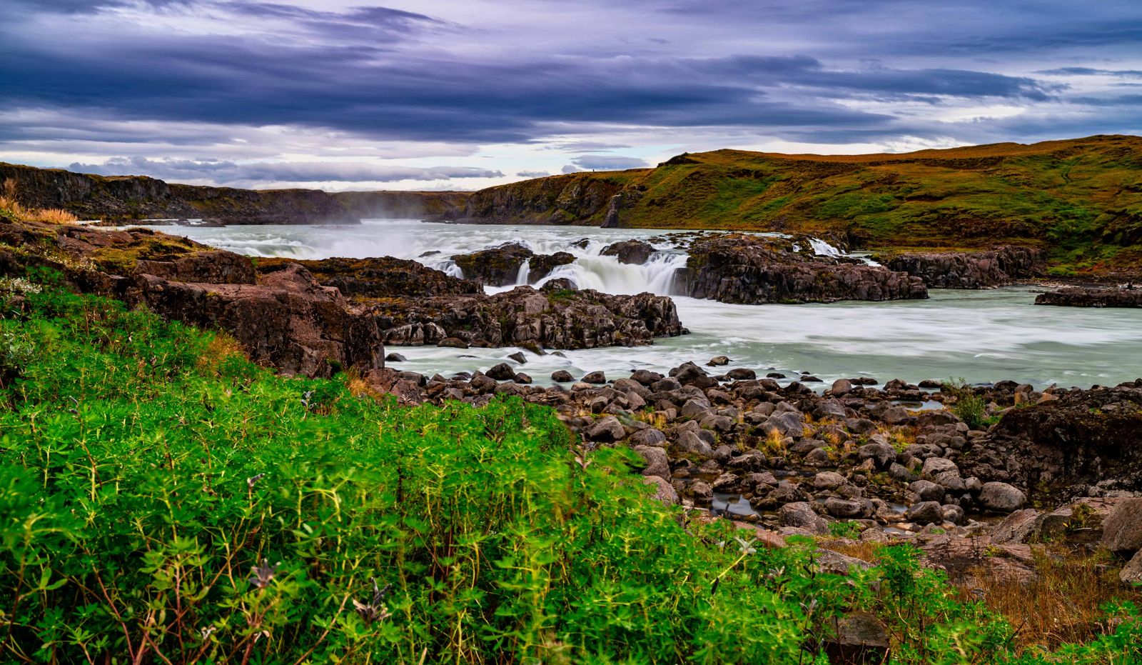
Urriðafoss is a low but very wide waterfall on the Þjórsá, Iceland's longest river, with the highest average flow of any waterfall in Iceland (about 360 m³ per second). It is about 75 km from Reykjavík (around 1 hour) just off the Ring Road, free to visit and open all year. A stop of 15–20 minutes is enough.
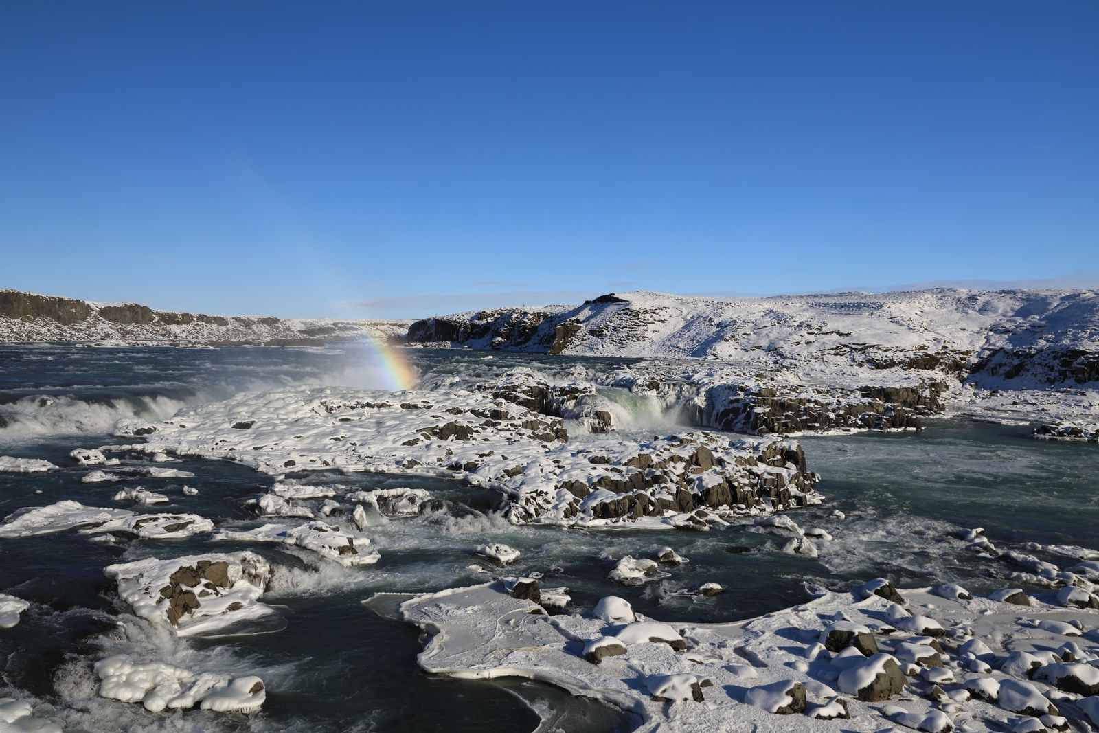
Urriðafoss is not tall, with a drop of only a few metres, but it carries the flow of the whole Þjórsá. The river spreads across a wide edge, split by small islands, and pours down in fast, powerful steps. Up close it feels more like a huge rapid than a single drop.
It sits at the edge of the Þjórsárhraun lava field, and a short signed road from the Ring Road leads to a viewing area. The river is known for its fish, and the name Urriðafoss is usually translated as trout waterfall.
The Þjórsá is glacial water from the highlands, yet salmon run up it every summer and gather below the falls on their way upstream. Farmers along the river have netted them for generations, and you may see locals fishing near the falls. That is why the name is sometimes given as salmon waterfall, although urriði is the Icelandic word for brown trout.
Landsvirkjun, the national power company, has proposed a hydropower station at Urriðafoss. Plans describe a station of about 125 MW with an underground powerhouse, and reports say the waterfall would probably lose most of its flow. The plan has met local opposition, and an earlier power plant was permitted here in 1927 but never built.
The Þjórsá and its tributaries are already harnessed by several power stations further up in the highlands. In Iceland's national Master Plan for energy projects, the Urriðafoss power station is in the 'on hold' category, so nothing has been decided. Opponents point out that the stretch around the falls is where most of the river's freshwater fish live, and local people have protested against the plan for years.
None on site. Fuel and cafés are available in nearby towns such as Selfoss or Hella.
Most visitors stop briefly at Urriðafoss while driving through South Iceland, staying overnight in Selfoss, Hella or further along the Ring Road.
Yes, as a quick stop: it is unusually wide and powerful for its modest height, and sits close to the Ring Road.
No, it is free to visit. A parking fee may apply.
About 75 km, around 1 hour by car.
It has the highest average flow, about 360 m³ per second. Gullfoss and Dettifoss are taller or more dramatic.
Urriði is Icelandic for brown trout, so trout waterfall. It is sometimes translated as salmon waterfall because of the salmon in the Þjórsá.
Take the signed turn-off onto Urriðafossvegur shortly before the Þjórsá bridge, east of Selfoss. The viewing area is under 1 km from Route 1.