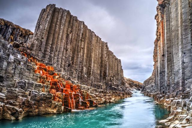
HAFRAHVAMMAGLJÚFUR IN SHORTHafrahvammagljúfur, also known as Dimmugljúfur ("the dark canyon"), is a gorge about 200 metres deep and 8 km long, cut by the glacial river Jökla in the highlands above Jökuldalur, East Iceland. It is about 100 km (around 2 hours) from Egilsstaðir. The road to the Kárahnjúkar dam is paved, but the last stretch to the trailhead is an F-road that needs a 4x4. It is free to visit, generally accessible only in summer, and worth a half day including the drive.
About Hafrahvammagljúfur
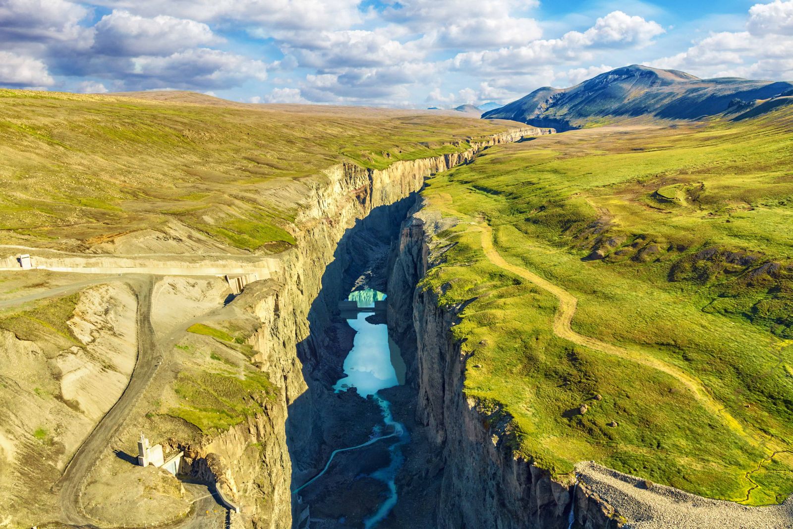
This is one of the most impressive canyons in Iceland. The walls drop around 200 metres to the river at the highest point, and the gorge runs for about 8 km north from Kárahnjúkar towards the Jökuldalur valley. It was cut by the Jökla (also called Jökulsá á Dal), a glacial river fed by Vatnajökull's Brúarjökull outlet. Two connected gorges make up the site: Dimmugljúfur, the narrow, dark upper part below the dam, and Hafrahvammagljúfur, which continues north from where the two meet.
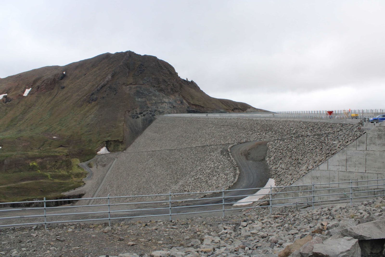
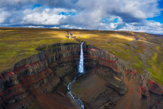
The Kárahnjúkavirkjun dam, built in the 2000s, changed the river's flow and, in doing so, created an unusual seasonal attraction: a waterfall called Hverfandi that appears in the canyon only when water is released from the reservoir, typically for a few weeks from late August to early October. Outside that window the riverbed here can be far quieter than the dramatic photos suggest, so it is worth setting expectations before making the drive.
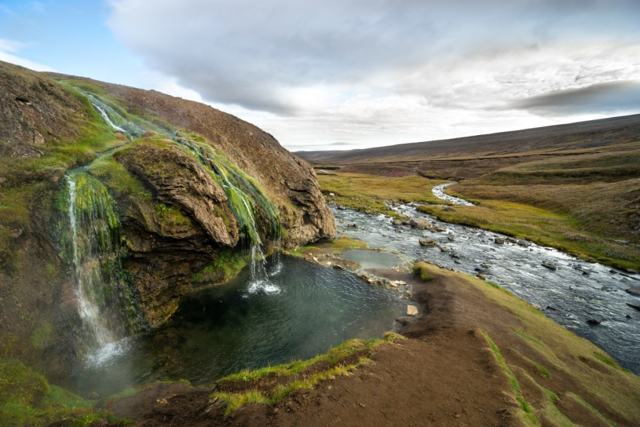
Few travellers come here. The canyon is a long way from the Ring Road, it is missing from many guidebooks, and most people driving through East Iceland do not have time for a detour into the highlands. If you do have the time and the right vehicle, it is one of the quietest big sights in the country, and the Laugavallalaug hot spring is close by.
Quick facts
DepthAbout 200 m
LengthAbout 8 km
GPS64.9791, -15.7516 (trailhead area)
RiverJökla (Jökulsá á Dal), fed by Brúarjökull
RegionEast Iceland highlands, near Kárahnjúkar
From EgilsstaðirAbout 100 km to Kárahnjúkar, then around 20 minutes on the F-road; allow 2 hours
RoadRoute 910 paved to the Kárahnjúkar dam; F910 and a steep rocky track beyond, 4x4 required
EntryFree
Seasonal featureHverfandi waterfall appears roughly late August to early October, when water is released from the dam
HikeAbout 2.7 km return to the viewpoints and Magnahellir, 45–60 minutes, about 160 m of descent and climb
How to get to Hafrahvammagljúfur
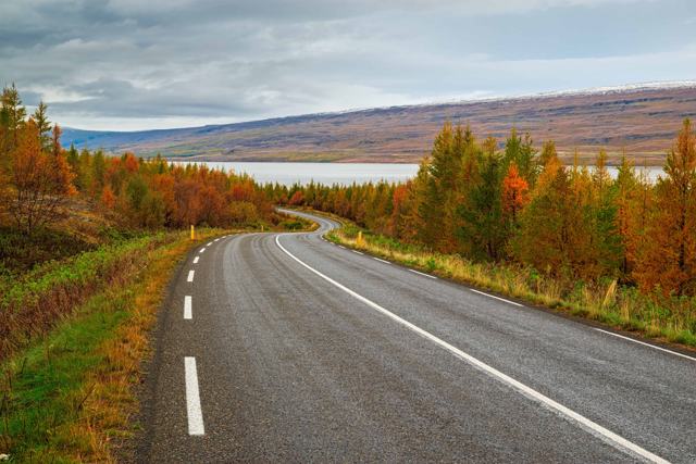
From Egilsstaðir to KárahnjúkarFrom Egilsstaðir, take Route 95 south, then Routes 931 and 933 along Lagarfljót into Fljótsdalur, and climb Route 910 past Laugarfell to the Kárahnjúkar dam. This road was built for the dam and is paved all the way, so any car can drive it in summer.
From the dam to the car park (4x4)Cross the dam and continue north on the gravel road, which becomes the F910, to the crossroads by Laugavellir. From there a steep, rocky track leads down to the car park by the canyon, about 20 minutes' driving from the dam. The track does not appear on every map, and low cars will hit the stones. At the car park there is an information sign and the start of the trail; the canyon rim is a few hundred metres' walk away.
Without a 4x4If your car is not allowed on F-roads, or the F-road is closed, park where Route 910 turns into the F910 and walk in from there. The walk takes around 2 hours. You also get a partial view into Dimmugljúfur from the Kárahnjúkar dam itself, which is reachable in a normal car.
On a guided tourSome East Iceland super-jeep or highland tours include Kárahnjúkar and Hafrahvammagljúfur as a stop.
This is a highland route. Beyond the dam the roads are rough gravel and are only open in summer; the F910 further west also has unbridged rivers. Do not take a 2WD car past the end of the paved road, and check road status on umferdin.is before you go.
Hiking Hafrahvammagljúfur canyon
The marked trails start at the car park. The path is well kept, with steps and viewing platforms in places, and most people are back at the car within an hour.
To the canyon viewpointFrom the car park the trail drops down an old track to the point where Hafrahvammagljúfur and Dimmugljúfur meet. A rocky outcrop faces straight into the mouth of the canyon and is the best viewpoint, with Dimmugljúfur to the south and Hafrahvammagljúfur running away to the north.
To Magnahellir caveFrom the viewpoint, follow the trail north. It is short but steep, and passes the Skessugjá ravine and the grassy hollow of Hellishvammur before dropping to Magnahellir, a cave named after Magni, a farmer who is said to have sheltered here with his sheep. The return trip from the car park is about 2.7 km, with around 160 m of descent and the same back up.
Along the rimA trail follows the edge of the canyon in both directions: south along Dimmugljúfur towards the dam, or north towards the far end of Hafrahvammagljúfur. Walk as far as you like and return the same way.
Into DimmugljúfurSince the dam was built, little water runs through the gorge for most of the summer, and the route into Dimmugljúfur from the viewpoint is easy to follow. Do not go down into the gorge in late summer and autumn, when the reservoir is full and water can spill over into the canyon.
The canyon edges are unfenced and the rock is loose. Keep back from the rim, especially in wind, and keep children close.
Best time to visit Hafrahvammagljúfur
SummerThe only realistic season for most visitors, when the road is open and conditions are manageable in a 4x4.
Late August to early OctoberThe best chance of seeing the seasonal Hverfandi waterfall, when water is periodically released from the Kárahnjúkar reservoir.
Outside a 4x4 and outside summer, this is not a realistic visit for most travellers.
Safety and practical tips
- Do not drive past the end of the paved road without a proper 4x4 vehicle.
- Check road conditions on umferdin.is before setting out; conditions change quickly in the highlands.
- Stay well back from unfenced canyon edges.
- Bring fuel, food and water; there is nothing along the way once you leave the Ring Road.
- Without a 4x4, park where Route 910 becomes the F910 and allow about 2 hours for the walk in.
- Wear hiking boots; the path to Magnahellir is steep and the ground is loose.
- Combine the trip with a soak at Laugavallalaug, a short drive from the Laugavellir crossroads.
Facilities and accessibility
None at the canyon itself. The nearest fuel and services are in Egilsstaðir.
Nearby places worth a stop
Where to stay near Hafrahvammagljúfur
Egilsstaðir is the practical base, with the widest choice of accommodation before heading into the highlands.
Hafrahvammagljúfur FAQ
Do I need a 4x4 to visit Hafrahvammagljúfur?
Yes, to reach the trailhead. The road to the Kárahnjúkar dam is paved, but the F910 and the track down to the car park need a 4x4. Without one you can walk in from the end of the paved road, which takes about 2 hours.
What is Dimmugljúfur?
It is the darker, narrower upper part of the same canyon system, just below the Kárahnjúkar dam. It joins Hafrahvammagljúfur at the main viewpoint. Many people use the two names for the whole canyon.
When can you see the Hverfandi waterfall here?
Only during periodic water releases from the Kárahnjúkar dam, typically from late August to early October.
How far is it from Egilsstaðir?
About 100 km to the Kárahnjúkar dam on paved roads, then around 20 minutes on the F-road. Allow about 2 hours each way.
How long is the hike at Hafrahvammagljúfur?
The marked trail from the car park to the viewpoints and Magnahellir cave is about 2.7 km return and takes 45 minutes to an hour. It is short but steep in places.
How deep is Hafrahvammagljúfur?
About 200 metres at its deepest, and the canyon is about 8 km long.
 Iceland Travel GuideLOCAL TRAVEL AGENCY IN ICELAND
My trip
Talk to a local