Iceland Travel GuideLOCAL TRAVEL AGENCY IN ICELAND
My trip
Talk to a local
Iceland Travel GuideLOCAL TRAVEL AGENCY IN ICELAND
My trip
Talk to a local
Almannagjá is the great rift wall of Þingvellir National Park on the Golden Circle, the edge of the North American plate and the place where Iceland’s parliament first met. It is about 50 km (45 minutes) from Reykjavík, free to walk, and open all year. Parking is charged at the park car parks. Allow 1–2 hours.
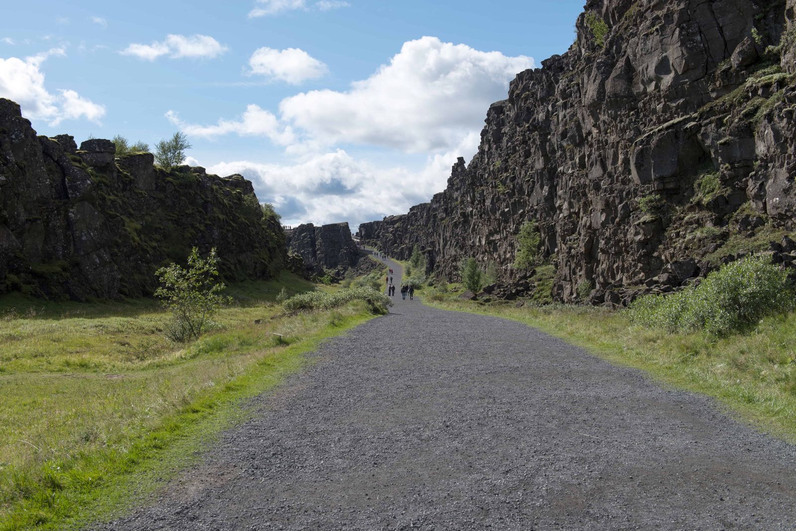
Almannagjá is a long, straight cliff and gorge running through Þingvellir. It marks the western edge of the rift valley, where the North American and Eurasian plates are slowly moving apart, by roughly 2 cm a year. You walk along the bottom with the rock wall on one side and the wide valley floor on the other.
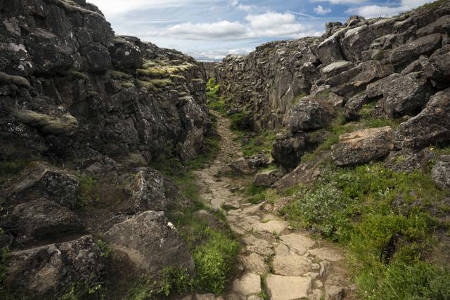
The wall is mossy, dark basalt, up to around 40 metres high in places. Sources give slightly different figures for its length, from about 7 to 8 km, because the fault line continues beyond the part most people walk. The section you visit is a few hundred metres.
It is also the natural setting for Iceland’s early history. The Alþingi, the national assembly, met in this area from 930, and the Law Rock, Lögberg, is usually placed by the base of the rift wall. Iceland later declared its republic here in 1944.
The Alþingi was founded around 930 and met every summer at Þingvellir until 1798. Chieftains and farmers travelled from all over Iceland to settle disputes and agree laws. The Lawspeaker recited a third of the law each year, traditionally from Lögberg, the Law Rock.
The assembly was more than a court. People came to represent their families and districts, to trade news and to argue their cases, and feuds between powerful clans were fought out here in words and sometimes with weapons. The decision to give up the old Norse religion and adopt Christianity was taken here around the year 1000.
Þingvellir was made a national park in 1930, on the 1,000th anniversary of the Alþingi, and it is now a UNESCO World Heritage Site for its cultural importance. The rift wall that gives the place its shape is the same one you walk beneath.
Route 36 is open all year but can be icy in winter. Check road conditions on umferdin.is and the weather on vedur.is before you drive.
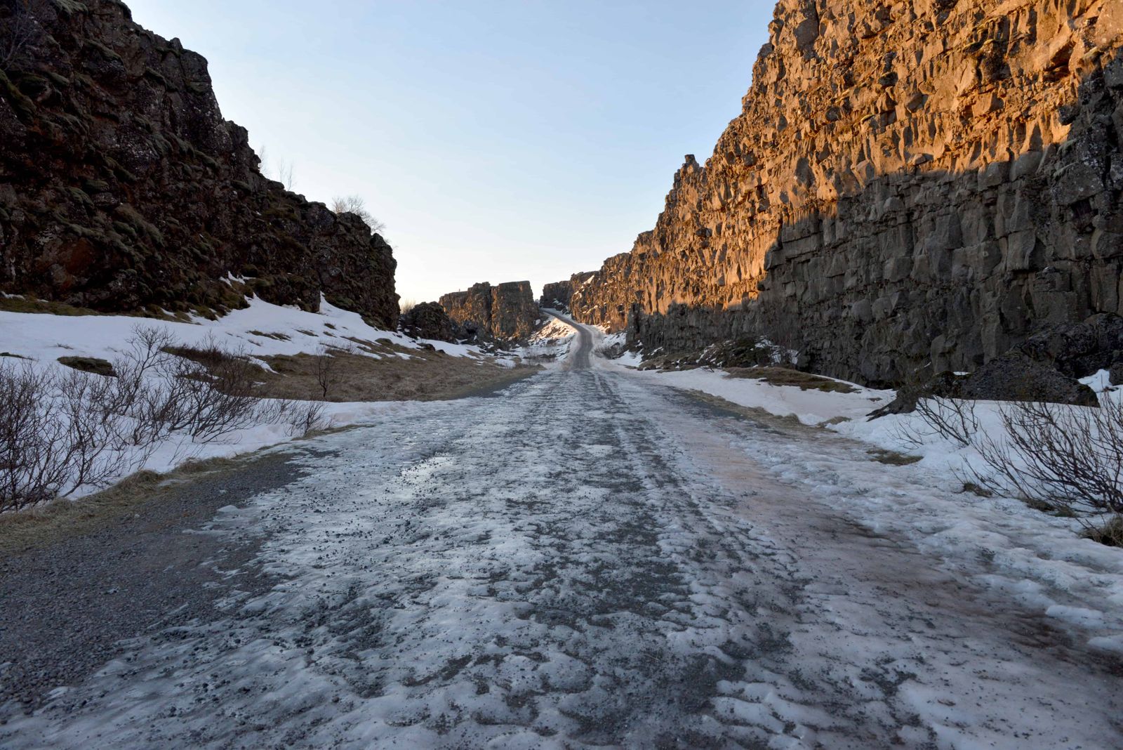
A wide path leads from the top of the gorge to the valley floor.
Stay on the paths. Moss is fragile and the ground beside the rift is uneven. Do not climb on the rock wall.
Almannagjá is the clearest place in Iceland to see what happens when two tectonic plates pull apart.
The Mid-Atlantic Ridge runs across Iceland, and at Þingvellir it comes to the surface. Almannagjá marks its western edge. As the North American plate moves west and the Eurasian plate moves east, the land between them stretches, sinks and cracks.
When the ground pulled away, the old rim could no longer carry its own weight. It broke off in earthquakes and dropped, splitting the rock in two. That is why you walk through a gorge with a high wall on one side and a lower, broken wall on the other. The width changes along the way, from a narrow passage to a broad, grassy floor.
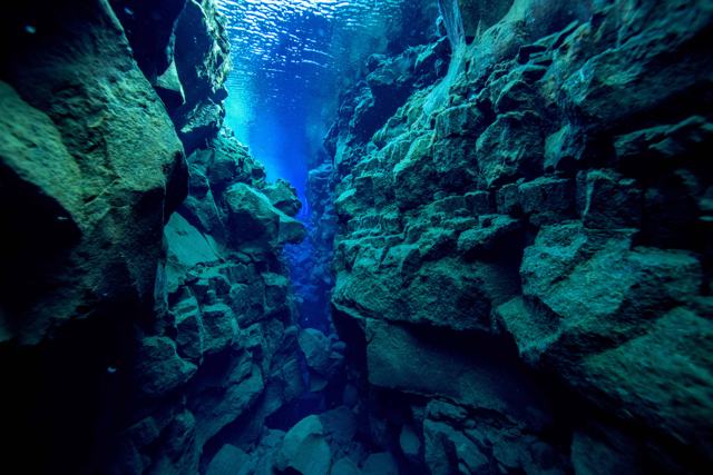
The same movement has opened many smaller fissures across the valley floor. Several are filled with very clear spring water. The best known is <a href="/locations/silfra-fissure/">Silfra</a>, where people snorkel and dive between the plates.
For many years the road to Þingvellir ran through the gorge itself: you drove down one wall and up the other. It is now a walking path only.
The Hakið visitor centre at the top of the gorge has an exhibition, toilets and a small shop or information desk. There is a café and toilets at Þingvellir near P5 and the church. The path down from Hakið is steep in places, so the lower car parks are easier if mobility is limited.
Þingvellir has no lodging inside the park, but there are hotels and guesthouses at Laugarvatn and around Selfoss, and many people simply base themselves in Reykjavík.
A large rift wall in Þingvellir National Park that marks the edge of the North American tectonic plate, where the plates are moving apart.
Yes, walking it is free. Parking at the Þingvellir car parks costs ISK 1,000 per car per day.
About 1–2 hours for the main path, including time at the viewpoint and the Law Rock.
You can walk along the rift valley between the plates, but you are not crossing a border. The rift wall marks the edge of the North American plate.
Yes, all year. Paths can be icy, so bring spikes and dress warmly.
About 7–8 km in total, depending on the source. The part visitors walk, from Hakið past the Law Rock towards Öxarárfoss, is much shorter.
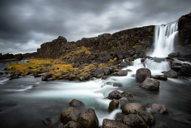
Yes. Öxarárfoss, a 13-metre waterfall, drops over the rift wall and is reached by a short side path.