Iceland Travel GuideLOCAL TRAVEL AGENCY IN ICELAND
My trip
Talk to a local
Iceland Travel GuideLOCAL TRAVEL AGENCY IN ICELAND
My trip
Talk to a local
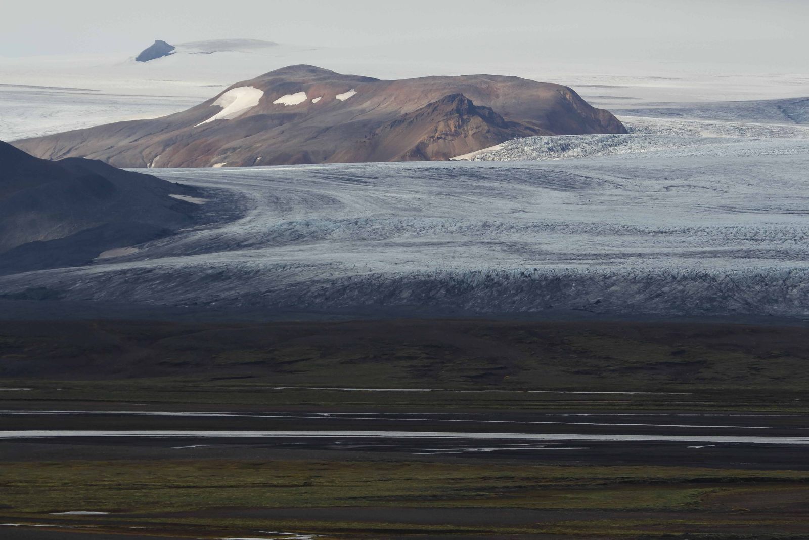
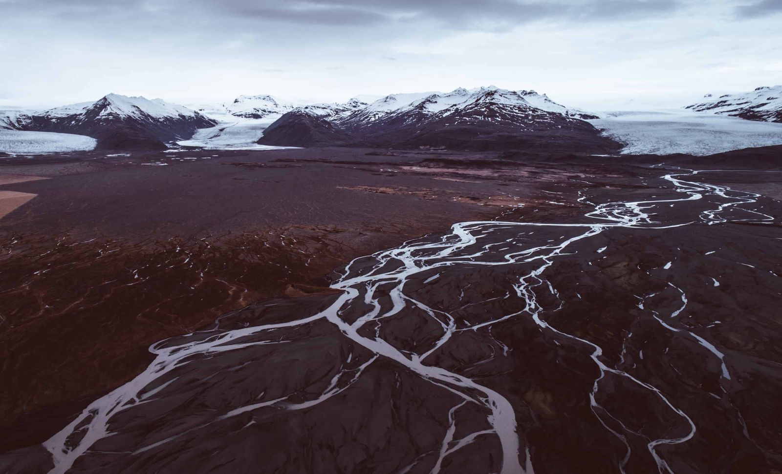
Hofsjökull is Iceland's third-largest glacier, an ice cap covering about 830 km² in the Central Highlands, with an active volcano and caldera hidden beneath the ice. It sits between the Kjölur and Sprengisandur highland routes, is only reached by 4x4 on F-roads open in summer, and is best seen from a distance rather than visited up close on foot without a guide.
Glaciers cover roughly a tenth of Iceland. Vatnajökull is the largest in the country and Langjökull, the "long glacier", comes second. Hofsjökull is the third, a round dome of ice in the very middle of the highlands, and the hardest of the three to reach.
Hofsjökull sits roughly in the middle of Iceland, between the country's two largest glaciers, Vatnajökull and Langjökull. Beneath its ice cap is a central volcano with a caldera, part of an active volcanic system, though it erupts far less often than Iceland's better-known volcanoes.
The volcano under Hofsjökull is the largest active central volcano in Iceland. It is a broad, shield-shaped volcano, the kind built up by fluid lava that travels far before it cools, with a caldera of roughly 7 by 11 km hidden under the ice. No eruption has been recorded here since Iceland was settled, and the volcano is thought to have been quiet for thousands of years. It was built up mainly during the Ice Age.
The glacier is also an important source of water: several of Iceland's major rivers begin here, most notably Þjórsá, the country's longest river. Blanda and the glacial rivers that feed Héraðsvötn run north from the ice cap, and meltwater from the south-west side ends up in Hvítá and Ölfusá. Most visitors see Hofsjökull from the Kjölur highland road (F35) that skirts its western side, or from viewpoints in the Kerlingarfjöll mountains nearby, rather than walking directly onto the ice, which needs a glacier guide and proper equipment.
Like the other Icelandic ice caps, Hofsjökull is shrinking. Older sources give its area as about 925 km²; today it is closer to 830 km², and measurements show it lost about 12% of its volume between 1989 and 2015.
Hofsjökull itself has no marked visitor trail or facilities; it is a highland landscape best appreciated from a road, viewpoint or organised tour rather than a place with a defined 'visit'.
Hofsjökull has a reputation as the toughest of Iceland's big glaciers to get to. There is no road to the edge of the ice, no visitor centre and no marked trail.
The highlands are no joke. Whichever side you approach from, prepare before you leave the lowlands.
Check the weather forecast on vedur.is and road conditions and openings on umferdin.is on the day you travel. Fill the fuel tank, since you cannot count on finding fuel in the highlands. Carry a first aid kit, food and water, and warm layered clothing with a waterproof shell. Do not cross a river unless you have a suitable 4x4, have checked the depth and know how to do it; if in doubt, wait or turn back. Leave your travel plan at safetravel.is, and remember that phone coverage is patchy.
None at the glacier itself. The nearest services are at highland huts and the Kerlingarfjöll area, or back down at Hveravellir or in the lowlands.
There are highland huts and a campsite at Hveravellir and in the Kerlingarfjöll area for those travelling through, though most visitors base themselves in the lowlands and visit the highlands on day trips.
It is possible with a certified glacier guide and proper equipment, though guided trips here are far less common than on Vatnajökull or Sólheimajökull.
A guided highland tour is the most practical option if you do not have a 4x4 or the road is closed to smaller vehicles.
Yes, there is an active central volcano with a caldera beneath the ice cap, part of Iceland's ongoing volcanic activity.
Mainly in summer, when the F35 Kjölur road and other highland routes near the glacier are open.
In the middle of the Icelandic highlands, between the Kjölur route to the west and Sprengisandur to the east, and between Langjökull and Vatnajökull.
About 830 km², which makes it the third-largest glacier in Iceland. Its highest point is about 1,782 metres.
Þjórsá, Iceland's longest river, along with Blanda and the glacial rivers that form Héraðsvötn in Skagafjörður.
It lies far from any town, the only roads nearby are summer-only highland routes, and getting to the ice itself means rough tracks and unbridged rivers.
Tours and trips that include Hofsjökull, booked directly with a local travel agency in Iceland.